

Adina Sommer
Antique and Contemporary Art
Winzerer Str. 154
80797 München
telephone
+49 89 304714
business hours:
by appointment
Email
![]()


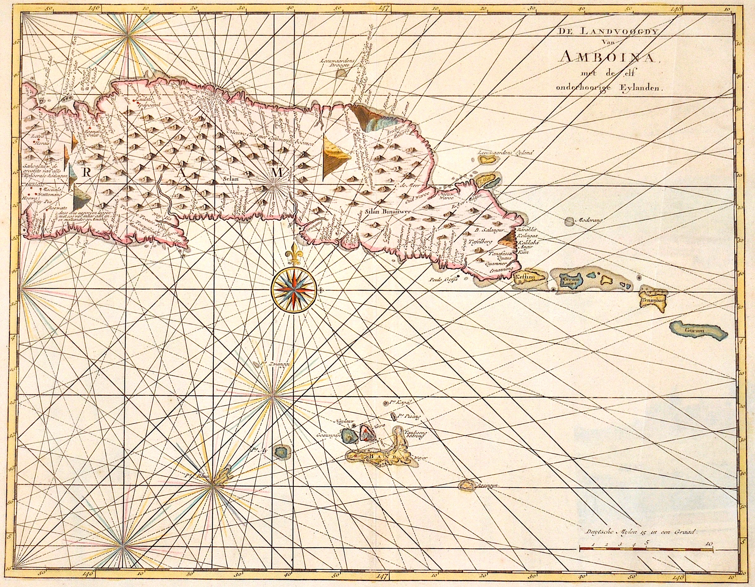
De Landvoogdy Van Amboina, met de elf onderhoorige Eylanden.

| Article ID | ASS1183 |
Title | De Landvoogdy Van Amboina, met de elf onderhoorige Eylanden. |
Description | Detailed map of the eastern part of Seram in Indonesia, part of the Molucces islands. Map of the southern part of Seram with the city of Lonthoir. Map shows the eastern part of Seram on the Molucces islands. |
| Year | ca. 1750 |
Artist | Bellin (1703-1772) |
Jacques-Nicolas Bellin (1703 Paris -1772 Versailles) was a French cartographer, engineer-geographer, marine hydrographer. As a contributor to the Encyclopédie, he wrote more than a thousand articles on maritime topics. As a cartographer, Bellin distinguished himself primarily in the field of sea cartography. From 1721 he worked for the Dépot des Cartes et Plans de la Marine, from 1741 until his death as an engineer-hydrograph of the Navy. In 1753 his atlas Neptune français, which covered all the coasts of France, was published, and in 1756 the hydrography françoise covering all seas of the earth. In 1764 the five-volume Petit Atlas maritime was published, which Bellin prepared on the orders of the Minister of the Navy, Choiseul. In addition, he wrote a number of geographical works and with Nouvelle méthode pour apprendre la geographie (1769) a geographic textbook for teaching. His maps illustrated, among other things, Bougainville's work Voyage autour du monde, published in 1771. As a co-author of the Encyclopédie edited by Diderot and d'Alembert, Bellin wrote more than a thousand articles in the field of shipping and navy. | |
Historical Description | The Maluku Islands are an archipelago within Banda Sea, Indonesia. Tectonically they are located on the Halmahera Plate within the Molucca Sea Collision Zone. Geographically they are located east of Sulawesi, west of New Guinea, and north and east of Timor. The islands were known as the Spice Islands due to the nutmeg, mace and cloves that were originally exclusively found there, the presence of which sparked colonial interest from Europe in the 16th century. The Maluku Islands formed a single province from Indonesian independence until 1999, when it was split into two provinces. A new province, North Maluku, incorporates the area between Morotai and Sula, with the arc of islands from Buru and Seram to Wetar remaining within the existing Maluku Province. |
| Place of Publication | Paris |
| Dimensions (cm) | 29,5 x 37,5 |
| Condition | Perfect condition |
| Coloring | colored |
| Technique | Copper print |