

Adina Sommer
Antique and Contemporary Art
Winzerer Str. 154
80797 München
telephone
+49 89 304714
business hours:
by appointment
Email
![]()


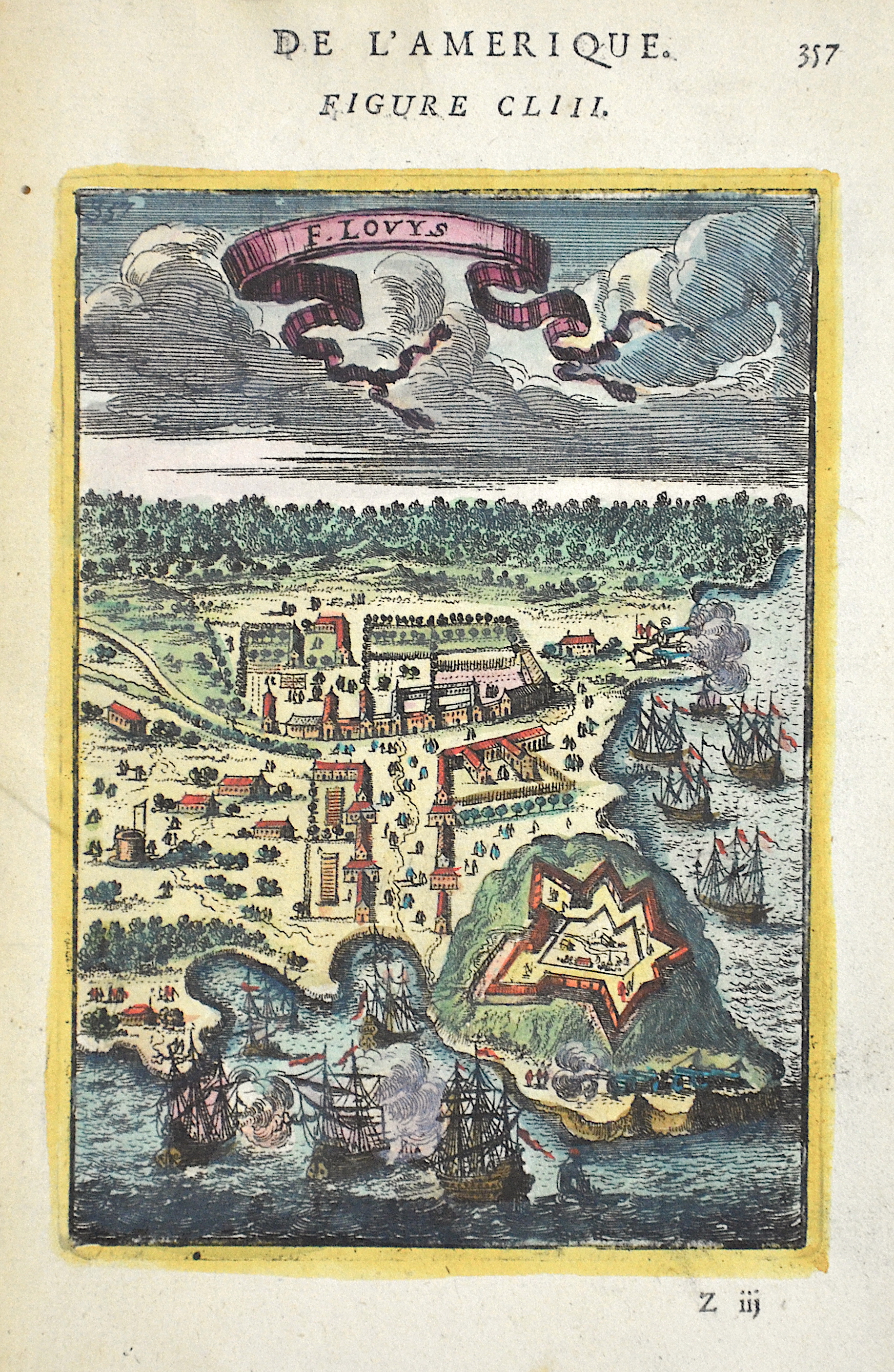
De L’Amerique. Figure CLIII. F. Lovys

| Article ID | AMS1347 |
Title | De L’Amerique. Figure CLIII. F. Lovys |
Description | Bird's eye view shows Fort Lovys and the city behind it in Brazil. |
| Year | ca. 1685 |
Artist | Mallet (1630-1706) |
Alain Manesson Mallet (1630- 1706 ) was a French cartographer and engineer. He started his career as a soldier in the army of Louis XIV, became a Sergeant-Major in the artillery and an Inspector of Fortifications. He also served under the King of Portugal, before returning to France, and his appointment to the court of Louis XIV. His military engineering and mathematical background led to his position teaching mathematics at court. His major publications were Description de L'Univers (1683) in 5 volumes, and Les Travaux de Mars ou l'Art de la Guerre (1684) in 3 volumes. His Description de L'Universe contains a wide variety of information, including star maps, maps of the ancient and modern world, and a synopsis of the customs, religion and government of the many nations included in his text. It has been suggested that his background as a teacher led to his being concerned with entertaining his readers. This concern manifested itself in the charming harbor scenes and rural landscapes that he included beneath his description of astronomical concepts and diagrams. Mallet himself drew most of the figures that were engraved for this book. | |
Historical Description | The oldest traces of human life were found in the Caverna da Pedra Pintada in the state of Piauí. The early inhabitants fundamentally changed the ecosystem of the Amazon basin by planting certain types of plants and improving the soil. Their settlements - for example on the huge river island of Marajó - were far larger than long thought. In the province of Mato Grosso there were numerous planned locations where fish farming and agriculture were practiced until around 1500. The cities, which were up to 60 hectares in size, were connected by a road network - although in most areas the canoe was the means of transportation - there were dams and artificial ponds. As in many places in America, the people of the Xingu are believed to have been victims of the epidemic, especially smallpox. The indigenous peoples in Brazil lived partly from hunting, fishing and gathering, as well as from the fragile ecosystem of adapted soil management. A large part of the local population died in the course of European colonization, mostly from imported diseases, but also as a result of forced labor or enslavement. The majority of the Indians living outside the rainforest, especially in the cities, were assimilated insofar as they survived violence and epidemics and mingled with European immigrants. Already in 1494 Portugal and Spain decided to divide South America in the Tordesillas Treaty. Because the line had been agreed in ignorance of the coastline of the New World, the (at that time still generally unknown) eastern tip of South America also belonged to Portugal. The prerequisite for a legitimate possession was the consequent catholization of the locals. The period from 1500 to 1530 was marked by bartering with the locals. In 1549, today's Salvador da Bahia (São Salvador da Bahía de Todos os Santos) was named the capital. From 1530, native Indians were brought to the coast from inland who had to do the work on the sugar cane plantations in the northeast. Many of them died because of hard work, persecution, and indigenous susceptibility to European diseases. The colonialists then tried to replace the lost labor with slaves from Africa. |
| Place of Publication | Paris |
| Dimensions (cm) | 17 x 10 cm |
| Condition | Perfect condition |
| Coloring | original colored |
| Technique | Copper print |