

Adina Sommer
Antique and Contemporary Art
Winzerer Str. 154
80797 München
telephone
+49 89 304714
business hours:
by appointment
Email
![]()


Das ganz Frankreich so vor zeiten Galia Narbonensis, Eugdonensis/Belgica und Celtica ist genent worden
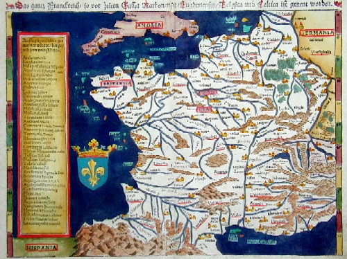
| Article ID | EUF702 |
Title | Das ganz Frankreich so vor zeiten Galia Narbonensis, Eugdonensis/Belgica und Celtica ist genent worden |
Map shows total France | |
| Year | ca. 1545 |
Artist | Ptolemy/Münster Sebastian |
| Dimensions (cm) | 26 x 34 |
| Condition | Very good |
| Coloring | original colored |
| Technique | Woodcut |
:
87.00 €
( A reproduction can be ordered individually on request. )