

Adina Sommer
Antique and Contemporary Art
Winzerer Str. 154
80797 München
telephone
+49 89 304714
business hours:
by appointment
Email
![]()


Das Fünffte Buch

| Article ID | DT1001 |
Title | Das Fünffte Buch |
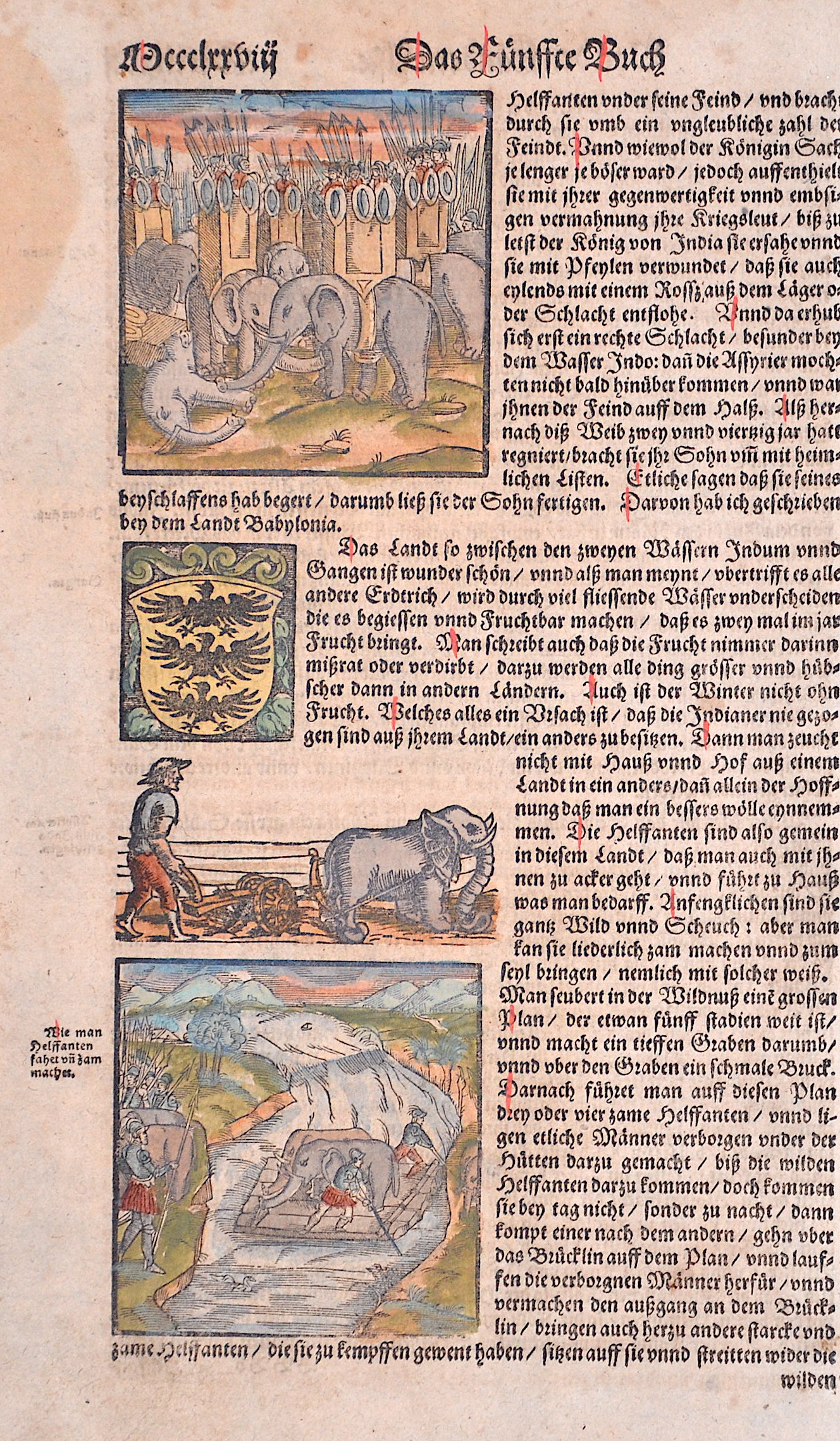
Description | Three illustrations of various scenes with Indian elephants and a coat of arms depiction. |
| Year | ca. 1550 |
Artist | Münster (1489-1552) |
Sebastian Münster (1489–1552) was a leading Renaissance cosmographer. His most famous work, the Cosmographia (1544), was a comprehensive description of the world with 24 maps, based on research dating back to 1528. Continuously revised, the 1550 edition already included many new maps. It was the first scientific yet accessible world description published in German, illustrated with numerous woodcuts by artists such as Hans Holbein the Younger. Between 1544 and 1650, the Cosmographia appeared in 46 editions (27 in German) and was translated into several languages. Münster’s work combined the knowledge of scholars, artists, and travelers and remained influential long after his death. | |
Historical Description | Elephants are the largest living land animals. They are a family from the order of proboscideans. There are three recent species: the African elephant, which inhabits the largely open landscapes of sub-Saharan Africa, the forest elephant, which is also native to Africa but is largely restricted to tropical rainforests, and the Asian elephant, which occurs in southern and south-eastern Asia and uses a variety of landscapes. The natural range of the Asian elephant used to extend from eastern to southeastern and southern Asia, and possibly all the way to the western part of the continent. Today, it is highly fragmented and is limited to the Indian subcontinent as well as to individual parts of the back of India, Sri Lanka and some of the Greater Sunda Islands or the southernmost part of China. The animals inhabit both more open landscapes and more densely wooded areas. The African elephant once colonized almost the entire African continent, but today it also occurs in highly fragmented habitats south of the Sahara. The northern limit of its distribution is in the south of Sudan. From here, the habitat extends across East and West Africa to South Africa. The way of life of today's elephants is comparatively well researched. The animals spend most of their time feeding, which can account for around two thirds to three quarters of their active phase. Sleep usually only lasts a few hours. Elephants are generally sociable animals that live in complex social communities. |
| Place of Publication | Basle |
| Dimensions (cm) | 27,5 x 16,5 cm |
| Condition | Stain at the outer margin |
| Coloring | colored |
| Technique | Woodcut |