

Adina Sommer
Antique and Contemporary Art
Winzerer Str. 154
80797 München
telephone
+49 89 304714
business hours:
by appointment
Email
![]()


Corsica
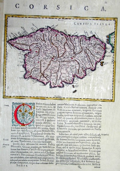
| Article ID | EUF697 |
Title | Corsica |
Map shows the Island of Corsica | |
| Year | ca. 1690 |
Artist | Coronelli |
| Place of Publication | Venice |
| Dimensions (cm) | 36 x 24 |
| Condition | Very good |
| Coloring | colored |
| Technique | Copper print |
:
55.50 €
( A reproduction can be ordered individually on request. )