

Adina Sommer
Antique and Contemporary Art
Winzerer Str. 154
80797 München
telephone
+49 89 304714
business hours:
by appointment
Email
![]()


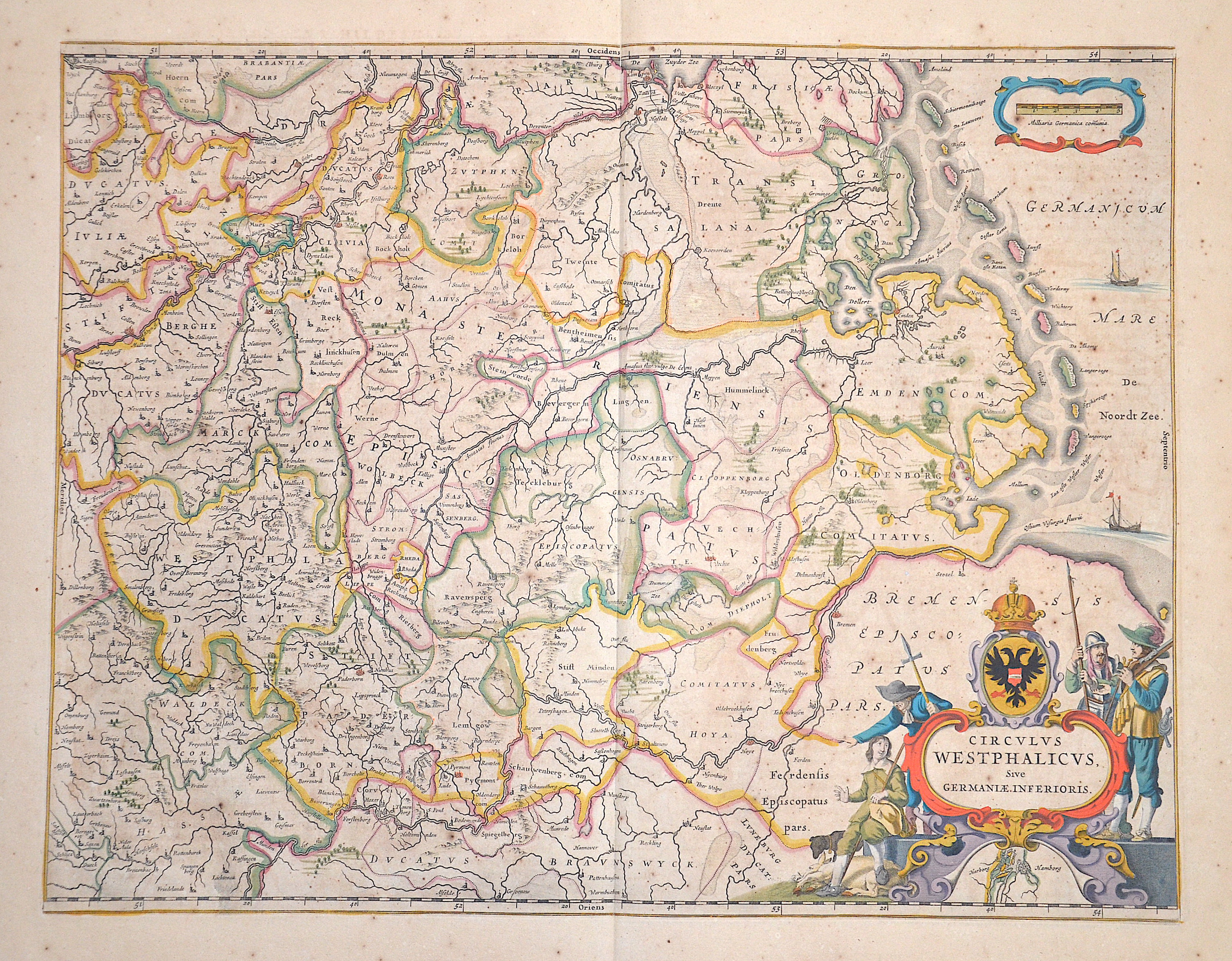
Circulus Westphalicus, Sive Germaniae Inferioris.

| Article ID | EUD4978 |
Title | Circulus Westphalicus, Sive Germaniae Inferioris. |
Description | Splendid old coloured map shows the Westphalian district with the area of the North Sea, the course of the Weser via Bremen, Hoya, Stolzenau (Lower Saxony), Corvey and Höxter (North Rhine-Westphalia). Furthermore, the course of the Ems with Emden, Rhede, Meppen,... and partly the course of the Rhine with Arnhem (NL), Kölln and Bonn. Right side with a title cartouche, a mileage indicator cartouche and a partial map with the Hanseatic city of Hamburg. |
| Year | ca. 1642 |
Artist | Blaeu (1571-1638) |
Joan Guilliemus Blaeu was the eldest son of Willem Janszoon Blaeu (1571-1638), and was probably born in Alkmaar in the province of Noord-Holland in the final years of the 16th century. He was brought up in Amsterdam, and studied law at the University of Leiden before going into partnership with his father in the 1630s. Although his father Willem had cartographic interests, having studied under the Danish astronomer Tycho Brahe and having manufactured globes and instruments, his primary business was as a printer. It was under the control of Joan that the Blaeu printing press achieved lasting fame by moving towards the printing of maps and expanding to become the largest printing press in Europe in the 17th century. By the 1660s the Theatrum Orbis Terrarum (or Atlas Maior as it had became known by this time) had expanded to between 9 and 12 volumes, depending on the language. With over 3,000 text pages and approximately 600 maps, it was the most expensive book money could buy in the later 17th century. The translation of the text from Latin into Dutch, English, German, French, and Spanish for several volumes created enormous work for those involved in typography and letterpress activities. It is estimated that over 80 men must have been employed full-time in the Blaeu printing house in Bloemgracht, not including engravers who worked elsewhere, with over 15 printing presses running simultaneously, and in 1667 a second press was acquired at Gravenstraat. At the same time as producing the Atlas Maior, Blaeu was also publishing town plans of Italy, maps for globes, and other volumes. At its peak the Blaeu press managed to produce over 1 million impressions from 1,000 copper plates within four years. | |
Historical Description | The town of Wesel lies at the mouth of the Lippe and the Wesel-Datteln Canal into the Rhine. The first verifiable settlement on today's Wesel urban area was established after the Migration Period in the area where the Lippe then flowed into the Rhine, the base of Lippeham, from where Emperor Charlemagne undertook several campaigns against the Saxons and Danes. The further development of this settlement is largely unknown, but it was probably flooded by the Rhine and Lippe and subsequently abandoned. The origin of today's town is thought to be a Frankish estate, which was located in the area of today's Kornmarkt. |
| Place of Publication | Amsterdam |
| Dimensions (cm) | 41 x 53 cm |
| Condition | Some minor restoration at upper centerfold |
| Coloring | original colored |
| Technique | Copper print |