

Adina Sommer
Antique and Contemporary Art
Winzerer Str. 154
80797 München
telephone
+49 89 304714
business hours:
by appointment
Email
![]()


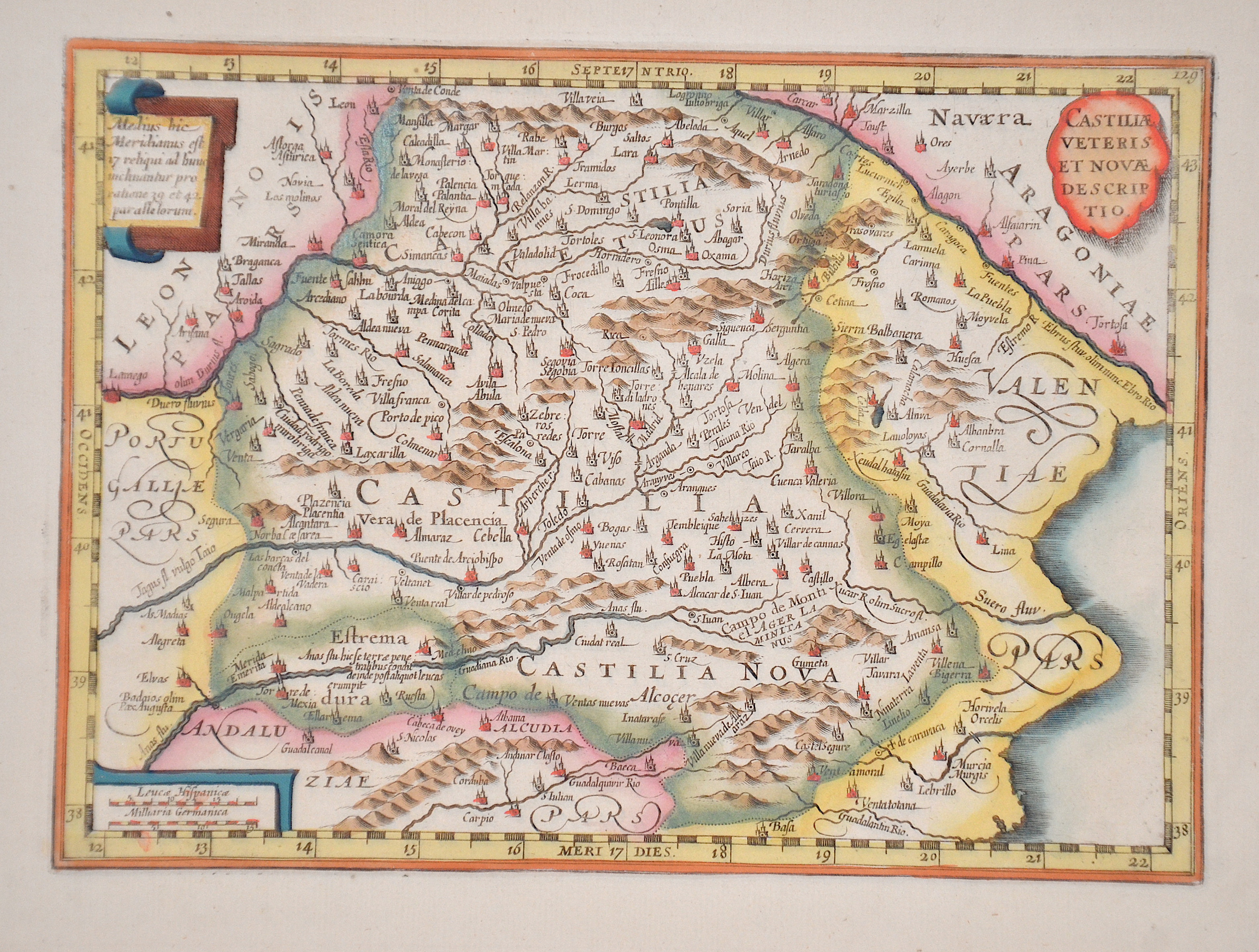
Castiliae veteris et novae descriptio

| Article ID | EUE1331 |
Title | Castiliae veteris et novae descriptio |
Description | Map shows the historical landscape of Castile in Spain with three cartouches. |
| Year | ca. 1630 |
Artist | Kaerius (1570-1630) |
Pieter van den Keere, or Petrus Kaerius (1570-1630). He was born in Ghent, and in 1584 moved with his family for religious reasons to London. From his time in England there is a map of Ireland from 1592, Hyberniae novissima descriptio. It was published by Hondius and served as a model for later editions of the Theatrum of Abraham Ortelius. Keere also contributed to John Norden's Speculum Britanniae of 1593. He also worked with Petrus Bertius, Cornelis Claesz, Petrus Plancius, the House of Visscher, and Lucas Janszoon Waghenaer. In 1595, there appeared a large wall map of Europe in 10 sheets, Nova totius Europae descriptio. From 1603, Keere began creating large urban panoramas, including Utrecht, Cologne, Amsterdam, and Paris. Around 1604, he was preparing the publication of the atlas Germania Inferior id est Provincuarum XVII. This first appeared in 1617, with a foreword by Petrus Montanus. | |
Historical Description | In the early 8th century, the Moors destroyed the Visigoth Empire and conquered the entire Iberian Peninsula. Their centuries of rule shaped the country. The Arabic heritage was reflected in both the architecture and the language. However, the Moors were unable to establish themselves permanently in the northern outskirts of the peninsula. From there the "Reconquest" (Reconquista) started. In this process, which spanned several centuries (722–1492) and was not continuous, the Muslim empires were gradually pushed back by the Christian empires until the fall of Granada in 1492, the last Moorish state structure on the peninsula also disappeared. In the 15th century, the kingdoms of Castile and Aragon were united. Aragon was an important maritime power in the Mediterranean at that time. The Spanish colonial empire extended around 1600 across large parts of South and Central America, the southern part of today's USA and the Philippines. As the English and French also intensified their colonial efforts, Spain gradually lost its supremacy. The liberation wars of the American states, particularly the Mexican and South American wars of independence in the early 19th century, brought independence to most of the colonies. In 1898, the last major properties were lost to the United States during the Spanish-American War, which meant the end of the colonial empire. The African colonies that followed later (Spanish-Morocco, Spanish-Sahara and Equatorial Guinea) finally became independent in the 20th century. |
| Place of Publication | Amsterdam |
| Dimensions (cm) | 18 x 25 cm |
| Condition | Perfect condition |
| Coloring | original colored |
| Technique | Copper print |