

Adina Sommer
Antique and Contemporary Art
Winzerer Str. 154
80797 München
telephone
+49 89 304714
business hours:
by appointment
Email
![]()


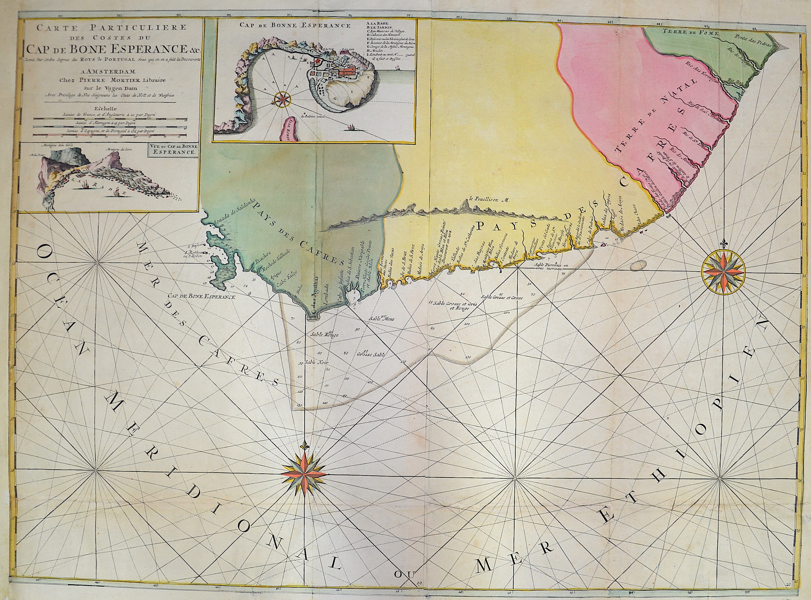
Carte particuliere des costes du Cap de Bonne Esperance

| Article ID | AF058 |
Title | Carte particuliere des costes du Cap de Bonne Esperance |
Description | Map shows South Africa and the Cap of good hope |
| Year | ca. 1700 |
Artist | Mortier (1661-1711) |
Pieter Mortier (1661–1711) was an 18th-century mapmaker and engraver from the Northern Netherlands. Mortier had a partnership with Johannes Covens I (1697-1774) and founded the map publishing company Covens & Mortier (1721-1866). Mortier, being French himself, had easy access to French cartographers such as De L'Isle, Sanson, Jaillot, de Fer and De Wit. Consequently, much of Mortier's business was built upon leveraging the sophisticated Dutch printing establishment to issue embellished high quality editions of previously contemporary French maps. In the greater context of global cartography, this was a significant advantage as most Dutch map publishes had, at this point, fallen into the miasma of reprinting their own outdated works. By contrast, the cartographers of France were producing the most accurate and up to date charts anywhere. Mortier's cartographic work culminated in the magnificent nautical atlas, Le Neptune Francois. Upon Pierre's death in 1711 this business was inherited by his widow. In 1721 his son Cornelius Mortier took over the day to day operation of the firm. Cornelius partnered with his brother-in-law Jean Covens to form one of history's great cartographic partnerships - Covens and Mortier - which continued to publish maps and atlases until about 1866. | |
Historical Description | Some of the world's oldest paleoanthropological fossils have been unearthed in South Africa. After these pre-humans, various species of the Homo genus such as Homo habilis, Homo naledi, Homo erectus and finally modern man, Homo sapiens, lived here. The beginning of modern historiography in South Africa is set on April 6, 1652, when the Dutchman Jan van Riebeeck built a supply station on the Cape of Good Hope on behalf of the Dutch East India Company (Dutch Vereenigde Oostindische Compagnie, VOC). Due to its strategically favorable location, it was supposed to be a rest stop for merchant ships traveling between Europe and Southeast Asia. During the 17th and 18th centuries, the settlement, which slowly but steadily expanded, was owned by the Netherlands. The settlers initially spread to the western Cape region, which at that time was a retreat for the Khoisan. Several hundred French Huguenots, after being persecuted in France from 1686, came into the country via the Netherlands from 1688 and brought the viticulture culture with them. The French-speaking names of wineries and fruit-growing farms in the western Cape can be traced back to them. After reaching the Bantu settlement border eastwards in 1770, they waged a series of wars - the border wars - against the Xhosa people. The Cape Dutch brought numerous slaves into the country from Indonesia, Madagascar and India. |
| Place of Publication | Amsterdam |
| Dimensions (cm) | 59 x 80 |
| Condition | Some folds partly restored, left margin replaced |
| Coloring | original colored |
| Technique | Copper print |