

Adina Sommer
Antique and Contemporary Art
Winzerer Str. 154
80797 München
telephone
+49 89 304714
business hours:
by appointment
Email
![]()


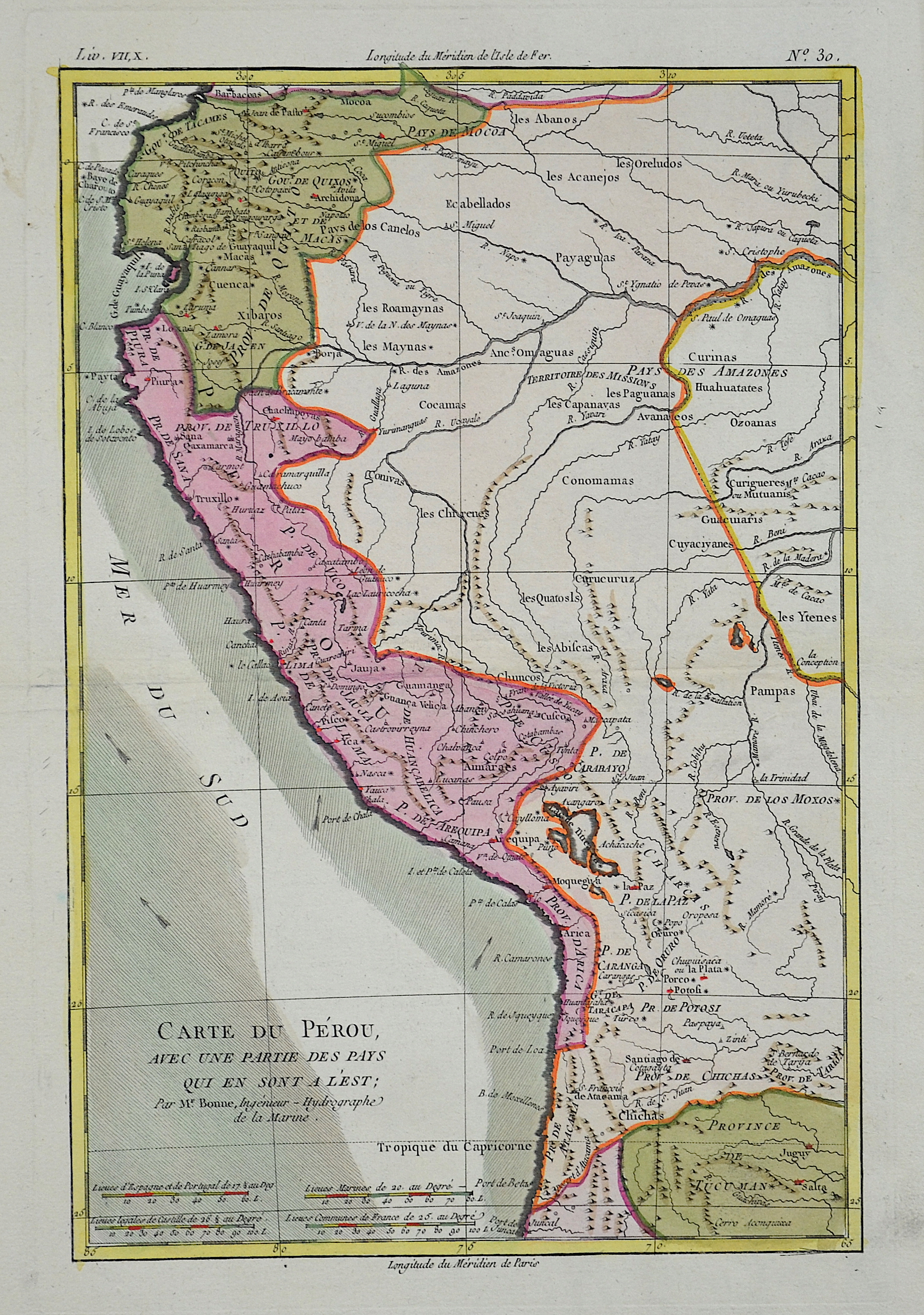
Carte du Perou avec un partie des pays qui en sont a l´est

| Article ID | AMS415 |
Title | Carte du Perou avec un partie des pays qui en sont a l´est |
Description | Map shows Peru and ist neighbour countries. |
| Year | ca. 1770 |
Artist | Bonne (1727-1795) |
Rigobert Bonne (1727–1795) was one of the most important cartographers of the late 18th century. In 1773 Bonne succeeded Jacques Nicolas Bellin as Royal Cartographer to France in the office of the Hydrographer at the Depôt de la Marine. Working in his official capacity, Bonne compiled some of the most detailed and accurate maps of the period. Bonne’s work represents an important step in the evolution of the cartographic ideology away from the decorative work of the 17th and early 18th century towards a more detail oriented and practical aesthetic. With regard to the rendering of terrain Bonne maps bear many stylistic similarities to those of his predecessor, Bellin. However, Bonne maps generally abandon such common 18th century decorative features such as hand coloring, elaborate decorative cartouches, and compass roses. While mostly focusing on coastal regions, the work of Bonne is highly regarded for its detail, historical importance, and overall aesthetic appeal. | |
Historical Description | In April 1532 Francisco Pizarro landed on the Peruvian coast. In November 1533 Pizarro reached the capital Cusco, which was handed over to him without any significant resistance. He appointed the younger brother Huáscars, Manco Cápac II as an Inca, who in 1536 dared a barely failed uprising. Pizarro had thus conquered the Inca Empire for the Spanish crown, and King Charles I, also known as the German-Roman Emperor Charles V, could say of himself: "The sun never sets in my empire." Pizarro founded today's capital in January 1535 Lima. The Spanish founded the Viceroyalty of Peru in 1542 with Lima as the capital, which, with the exception of Venezuela, included all Spanish possessions in South America. In 1572 the Spaniards took Vilcabamba, the last refuge of the Incas. Lima was developed by the Spaniards into a magnificent city and called the city of kings. While independence movements developed in most countries in South America from 1809, the situation in Peru remained relatively stable. The Bolivian dictator Andrés Santa Cruz invaded Lima in the Peruvian-Bolivian Confederation War in 1836 and united the two countries into the Peruvian-Bolivian Confederation. |
| Place of Publication | Paris |
| Dimensions (cm) | 32 x 21 |
| Condition | Very good |
| Coloring | colored |
| Technique | Copper print |