

Adina Sommer
Antique and Contemporary Art
Winzerer Str. 154
80797 München
telephone
+49 89 304714
business hours:
by appointment
Email
![]()


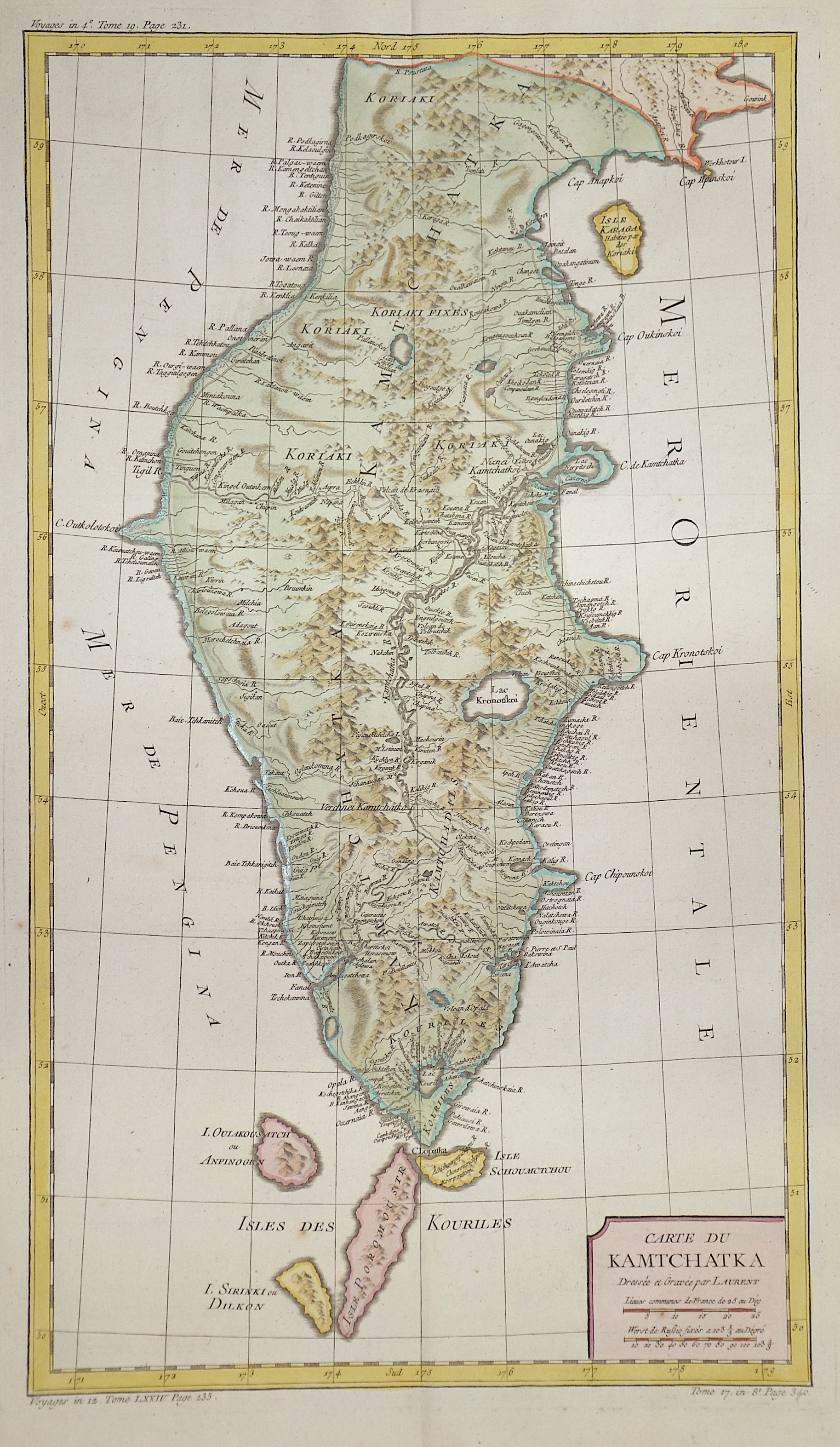
Carte du Kamtchatka…

| Article ID | ASC0609 |
Title | Carte du Kamtchatka… |
Description | Map shows the total peninsula of Kamtschatka. |
| Year | ca. 1750 |
Artist | Laurent |
Historical Description | The Kamchatka Peninsula was discovered by Cossacks on their forays into eastern Russia in 1697. Since there were mainly a lot of sables here, the area was annexed by Russia shortly after. The indigenous people living there, the Koryaks, Itelmen, Evens, Chukchi and Aleuts (Unangan), were bloodily subjugated by Russian Cossacks and almost exterminated. The Dane Vitus Bering, after whom the strait between Eastern Siberia and Alaska is named, led large expeditions to Kamchatka and north to the Bering Sea from 1725 to 1730 and from 1733 to 1743. Georg Wilhelm Steller, botanist and theologian, wrote extensive notes from the second expedition. |
| Dimensions (cm) | 52 x 30 |
| Condition | Very good |
| Coloring | original colored |
| Technique | Copper print |