

Adina Sommer
Antique and Contemporary Art
Winzerer Str. 154
80797 München
telephone
+49 89 304714
business hours:
by appointment
Email
![]()


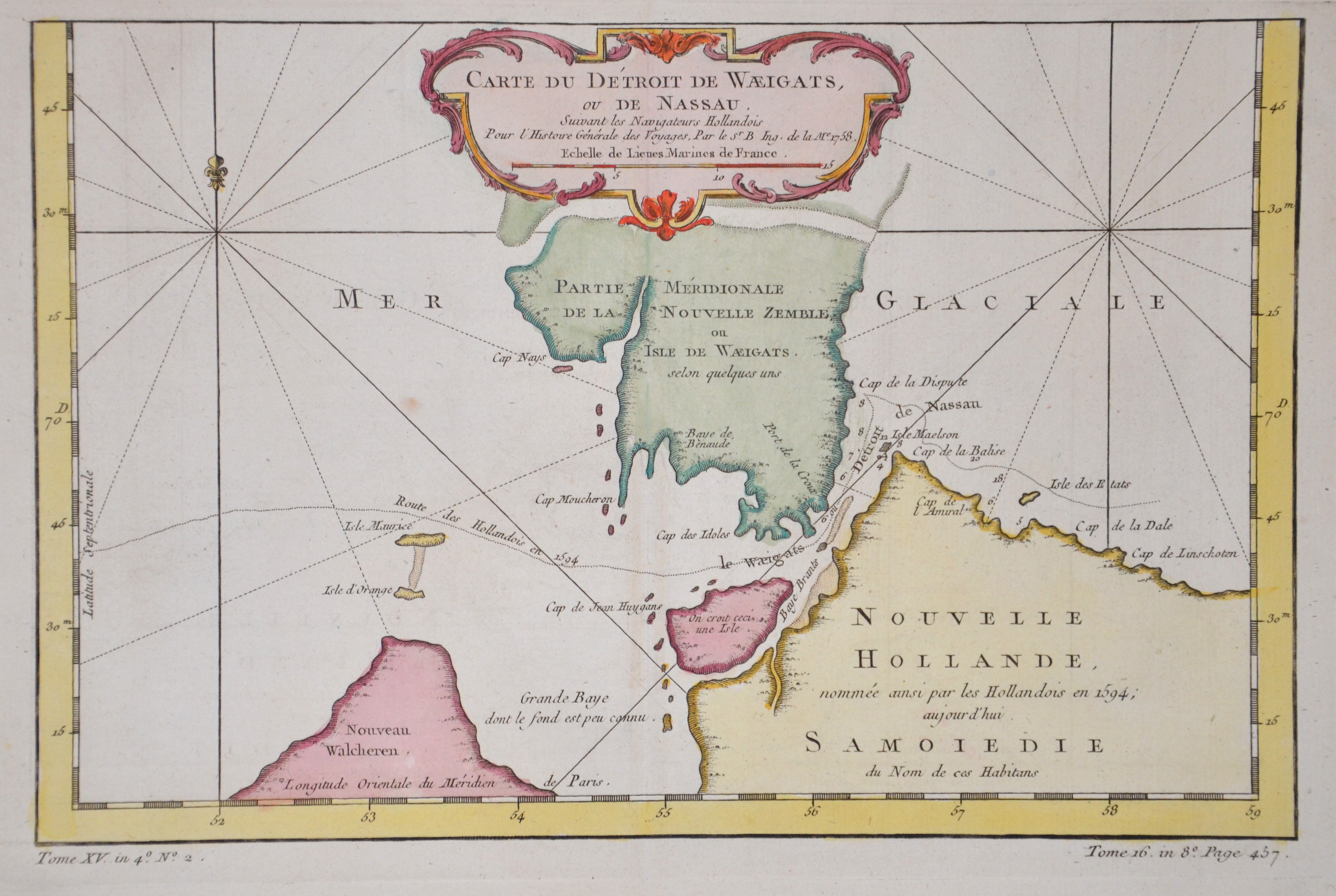
Carte du Détroit de Waeigats, ou de Nassau.

| Article ID | EUO3785 |
Title | Carte du Détroit de Waeigats, ou de Nassau. |
Description | Map shows the south part of Vaygach Island in the Arctic Sea, the Yugorsky Strait and partly Russia. Sailing in the Arctic ocean, In June 1594, Linschoten sailed from Texel in the expedition headed by Dutch cartographer Willem Barentsz. Three ships intended to enter the Kara Sea, hoping to find the Northeast Passage above Siberia. Nearing Williams Island the crew for the first time encountered a polar bear. After enticing it on board the bear then rampaged and had to be killed. Barentsz approached the west coast of Nova Zembla and heading north, before being forced to turn back in due to danger from large icebergs. The following year they sailed again in a new expedition of six ships, loaded with merchant wares that they hoped to trade with China. The party came across Samoyed ;wild men; but eventually had to turn back when discovering the Kara Sea to be frozen. Linschoten was one of the two crew members to publish journals of the Barentsz expedition. From : Maps for Prevost's L'Histoire Générale des Voyages - 1747-61 |
| Year | ca. 1758 |
Artist | Bellin (1703-1772) |
Jacques-Nicolas Bellin (1703 Paris -1772 Versailles) was a French cartographer, engineer-geographer, marine hydrographer. As a contributor to the Encyclopédie, he wrote more than a thousand articles on maritime topics. As a cartographer, Bellin distinguished himself primarily in the field of sea cartography. From 1721 he worked for the Dépot des Cartes et Plans de la Marine, from 1741 until his death as an engineer-hydrograph of the Navy. In 1753 his atlas Neptune français, which covered all the coasts of France, was published, and in 1756 the hydrography françoise covering all seas of the earth. In 1764 the five-volume Petit Atlas maritime was published, which Bellin prepared on the orders of the Minister of the Navy, Choiseul. In addition, he wrote a number of geographical works and with Nouvelle méthode pour apprendre la geographie (1769) a geographic textbook for teaching. His maps illustrated, among other things, Bougainville's work Voyage autour du monde, published in 1771. As a co-author of the Encyclopédie edited by Diderot and d'Alembert, Bellin wrote more than a thousand articles in the field of shipping and navy. | |
| Place of Publication | Paris |
| Dimensions (cm) | 19,5 x 30,5 |
| Condition | Perfect condition |
| Coloring | colored |
| Technique | Copper print |