

Adina Sommer
Antique and Contemporary Art
Winzerer Str. 154
80797 München
telephone
+49 89 304714
business hours:
by appointment
Email
![]()


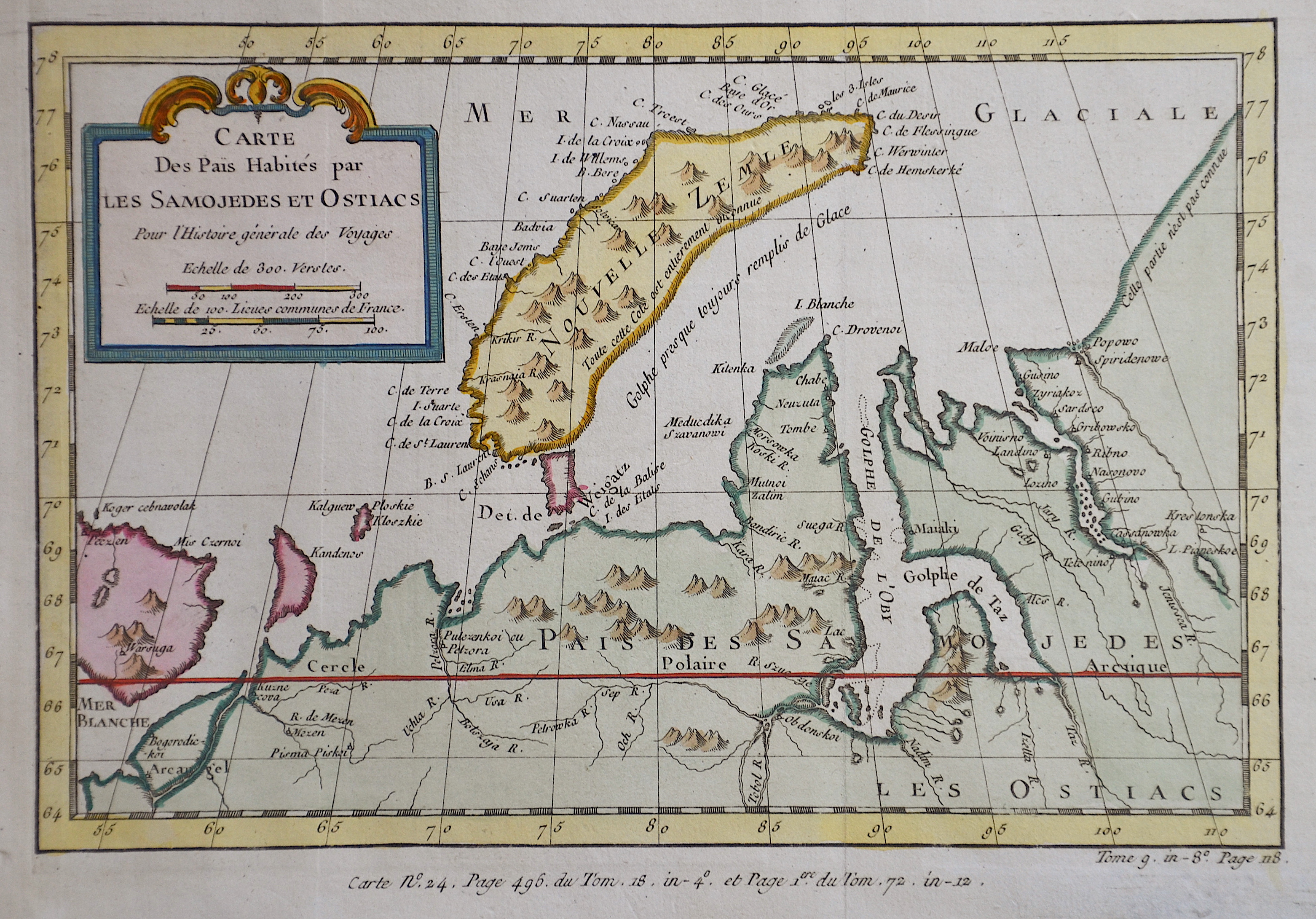
Carte Des Pais Habités par les Samojedes et Ostiacs

| Article ID | EUO3814 |
Title | Carte Des Pais Habités par les Samojedes et Ostiacs |
Description | Map shows the russian Nowaja Semlja (Nova Zembla) in the Arctic ocean, the peninsula Jamal and the Obbussen, with a decorative title cartouche. |
| Year | ca. 1758 |
Artist | Bellin (1703-1772) |
Jacques-Nicolas Bellin (1703 Paris -1772 Versailles) was a French cartographer, engineer-geographer, marine hydrographer. As a contributor to the Encyclopédie, he wrote more than a thousand articles on maritime topics. As a cartographer, Bellin distinguished himself primarily in the field of sea cartography. From 1721 he worked for the Dépot des Cartes et Plans de la Marine, from 1741 until his death as an engineer-hydrograph of the Navy. In 1753 his atlas Neptune français, which covered all the coasts of France, was published, and in 1756 the hydrography françoise covering all seas of the earth. In 1764 the five-volume Petit Atlas maritime was published, which Bellin prepared on the orders of the Minister of the Navy, Choiseul. In addition, he wrote a number of geographical works and with Nouvelle méthode pour apprendre la geographie (1769) a geographic textbook for teaching. His maps illustrated, among other things, Bougainville's work Voyage autour du monde, published in 1771. As a co-author of the Encyclopédie edited by Diderot and d'Alembert, Bellin wrote more than a thousand articles in the field of shipping and navy. | |
Historical Description | Novaya Zemlya also known as Nova Zembla is an archipelago in the Arctic Ocean in northern Russia and the extreme northeast of Europe, the easternmost point of Europe lying at Cape Flissingsky on the Northern island. West of Novaya Zemlya is the Barents Sea, and to the east is the Kara Sea. The Russians knew of Novaya Zemlya from the 11th century, when hunters from Novgorod visited the area. For Western Europeans, the search for the Northern Sea Route in the 16th century led to its exploration. The first visit from a Western European was by Hugh Willoughby in 1553. Dutch explorer Willem Barentsz reached the west coast of Novaya Zemlya in 1594, and in a subsequent expedition of 1596, he rounded the northern cape and wintered on the northeastern coast. Barentsz died during the expedition, and may have been buried on Severny Island. During a later voyage by Fyodor Litke in 1821–1824, the western coast was mapped. On Gerhards Mercator large world map from 1597 , it is alredy named as Nova Zemla. Henry Hudson was another explorer who passed through Novaya Zemlya while searching for the Northeast Passage. |
| Place of Publication | Paris |
| Dimensions (cm) | 17 x 24 cm |
| Condition | Perfect condition |
| Coloring | colored |
| Technique | Copper print |