

Adina Sommer
Antique and Contemporary Art
Winzerer Str. 154
80797 München
telephone
+49 89 304714
business hours:
by appointment
Email
![]()


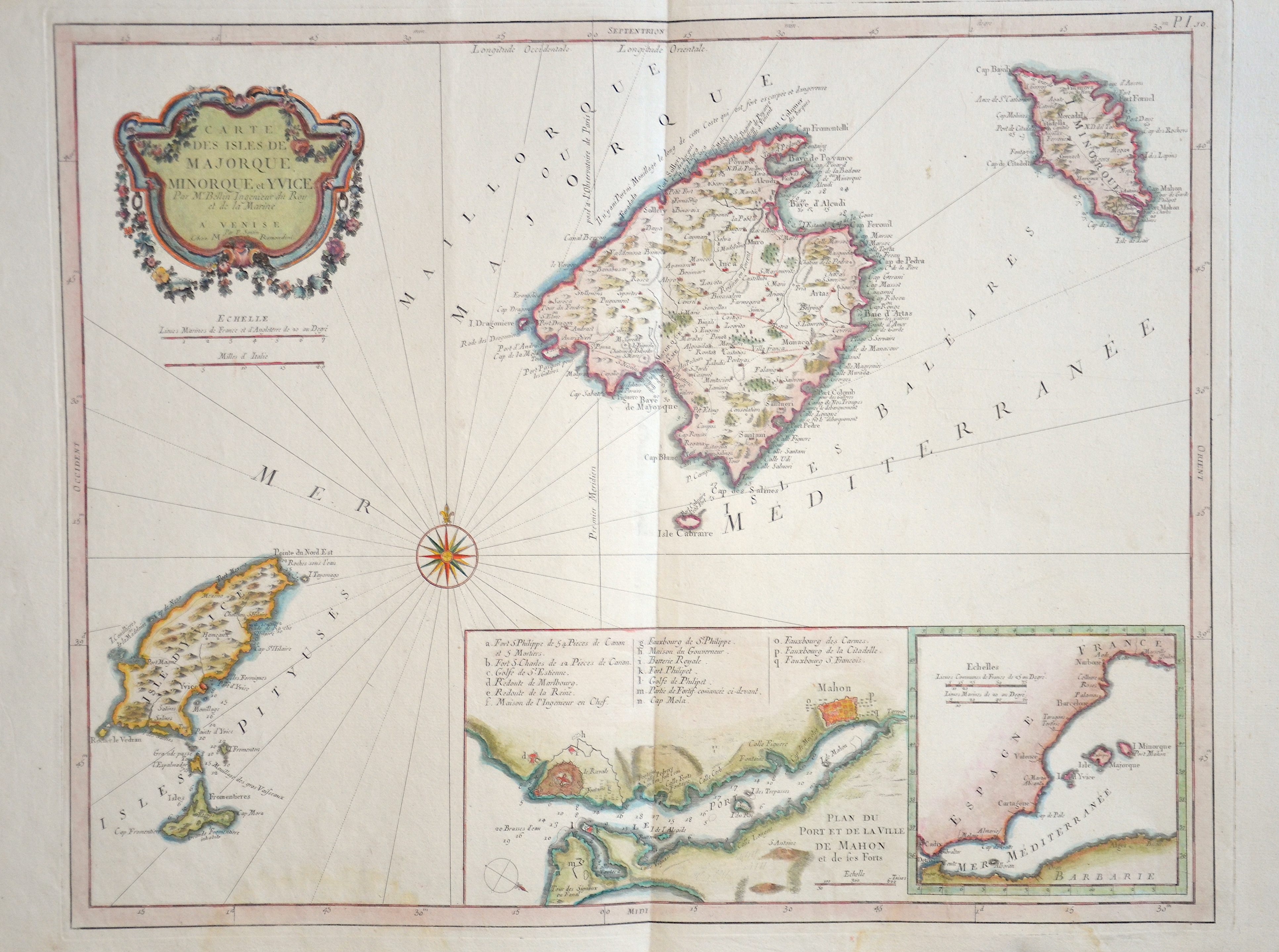
Carte des Isles de Majorque, Monorque, et Yvice

| Article ID | EUE4366 |
Title | Carte des Isles de Majorque, Monorque, et Yvice |
Description | Map shows the Spanish islands of Mallorca, Menorca, Ibiza and a title cartouche. Furthermore two partial maps with the capital Maó (Mahon) of the Balearic island of Menorca and the western Mediterranean. |
| Year | ca. 1780 |
Artist | Santini |
Francois (Francesco) Santini was an Italian cartographer and map publisher with his brother Paolo and based in Venice. He re-issued the works of Robert de Vaugondy, Homann’s Heirs and De L’Isle. At this time, cartography in Italy was commercialy very slow, so Santini, essentially a publisher rather than a map-maker modelled his work on two of the leading practitioners of cartography in Europe, the French map-makers Gilles and Didier Robert de Vaugondy. Their “Atlas Universel” was first published in 1758, and was much re-issued there after. The atlas was a commercial and cartographic success, with widespread influence on map-makers throughout Europe, most notably on Santini, who commissioned a new set of plates, published in 1776, being almost exact copies of the original French maps. | |
Historical Description | The indigenous population of the Balearic Islands probably immigrated from the Iberian Peninsula or today's southern France. In ancient times, the islands were called Balearides or Gymnesiae, which meant the islands of Mallorca (Balearis major) and Menorca (Balearis minor). At first they were dependent on the Phoenicians. Mallorca and Ibiza were conquered in 1229 and 1235 respectively by Jacob I of Aragon (Catalan Jaume I), Menorca by his descendant Alfonso III. The Balearic Islands, like Catalonia, now belonged to the Aragon Crown. At times, together with parts of Catalonia, they formed an independent state, the Kingdom of Mallorca, ruled by a branch of the Aragonese royal family. In 1708 Maó was conquered by the British. The Peace of Utrecht (1713), which ended the War of Spanish Succession, gave Menorca to the British Empire. This had to return the island to Spain in the Treaty of Versailles (1783), but remained British until 1802. The Spanish province of the Balearic Islands was founded in 1833. |
| Place of Publication | Venice |
| Dimensions (cm) | 44 x 55,5 cm |
| Condition | Perfect condition |
| Coloring | original colored |
| Technique | Copper print |