

Adina Sommer
Antique and Contemporary Art
Winzerer Str. 154
80797 München
telephone
+49 89 304714
business hours:
by appointment
Email
![]()


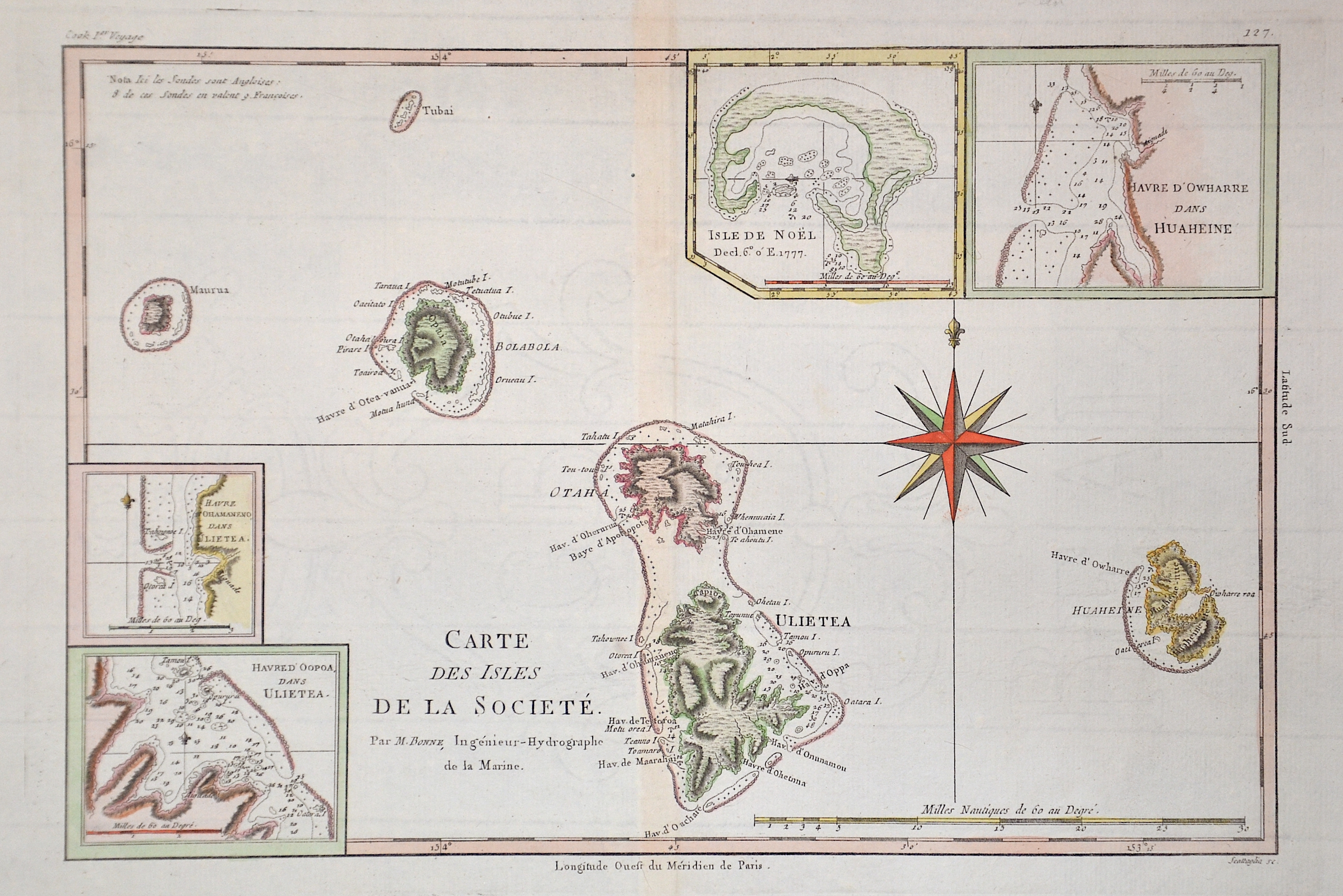
Carte des Isles de la Societe.

| Article ID | OZ0403 |
Title | Carte des Isles de la Societe. |
Description | Map depicts the islands of Raiatea and Tahaa, the Society Islands in French Polnesia. With 4 inst maps. The archipelago is suspected to have been named by Captain James Cook during his first voyage in 1769, supposedly in honour of the Royal Society, the sponsor of the first British scientific survey of the islands. However, Cook himself stated in his journal that he called the islands Society ;as they lay contiguous to one another. |
| Year | ca. 1780 |
Artist | Bonne (1727-1795) |
Rigobert Bonne (1727–1795) was one of the most important cartographers of the late 18th century. In 1773 Bonne succeeded Jacques Nicolas Bellin as Royal Cartographer to France in the office of the Hydrographer at the Depôt de la Marine. Working in his official capacity, Bonne compiled some of the most detailed and accurate maps of the period. Bonne’s work represents an important step in the evolution of the cartographic ideology away from the decorative work of the 17th and early 18th century towards a more detail oriented and practical aesthetic. With regard to the rendering of terrain Bonne maps bear many stylistic similarities to those of his predecessor, Bellin. However, Bonne maps generally abandon such common 18th century decorative features such as hand coloring, elaborate decorative cartouches, and compass roses. While mostly focusing on coastal regions, the work of Bonne is highly regarded for its detail, historical importance, and overall aesthetic appeal. | |
Historical Description | Records of the Society Islands begin when Ferdinand Magellan discovers the Tuamotu Archipelago in 1521. In June 1767, the archipelago is discovered and recorded by Samuel Wallis. The latter named the main island, today's Tahiti, after the client and sponsor of his circumnavigation. From then on, the island was called King George Island. In April 1768, Louis Antoine de Bougainville reached the Society Islands, unaware that he was encountering a group of islands that had already been discovered. The islands were reliably mapped in 1777 by James Cook, who named the archipelago "Society" because of the arrangement of the islands into a "society". Colonization by France began in 1843, when the Society Islands first became a French protectorate and then a French colony in 1880. |
| Place of Publication | Paris |
| Dimensions (cm) | 23 x 34 |
| Condition | Perfect condition |
| Coloring | colored |
| Technique | Copper print |