

Adina Sommer
Antique and Contemporary Art
Winzerer Str. 154
80797 München
telephone
+49 89 304714
business hours:
by appointment
Email
![]()


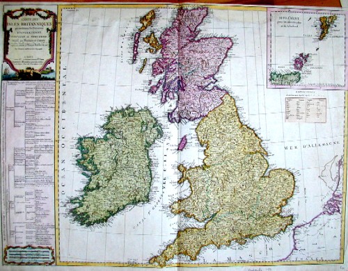
Carte des Isles Britaniques
| Article ID | EUG1043 |
Title | Carte des Isles Britaniques |
Map shows total Great Britain with seperate map showing Shetland and Orkney Islands. On left side pannel a description of the country. | |
| Year | ca. 1780 |
Artist | Vaugondy,de |
| Place of Publication | Paris |
| Dimensions (cm) | 54 x 71 |
| Condition | Missing part at upper margin perfectly replaced |
| Coloring | colored |
| Technique | Copper print |
:
51.00 €
( A reproduction can be ordered individually on request. )