

Adina Sommer
Antique and Contemporary Art
Winzerer Str. 154
80797 München
telephone
+49 89 304714
business hours:
by appointment
Email
![]()


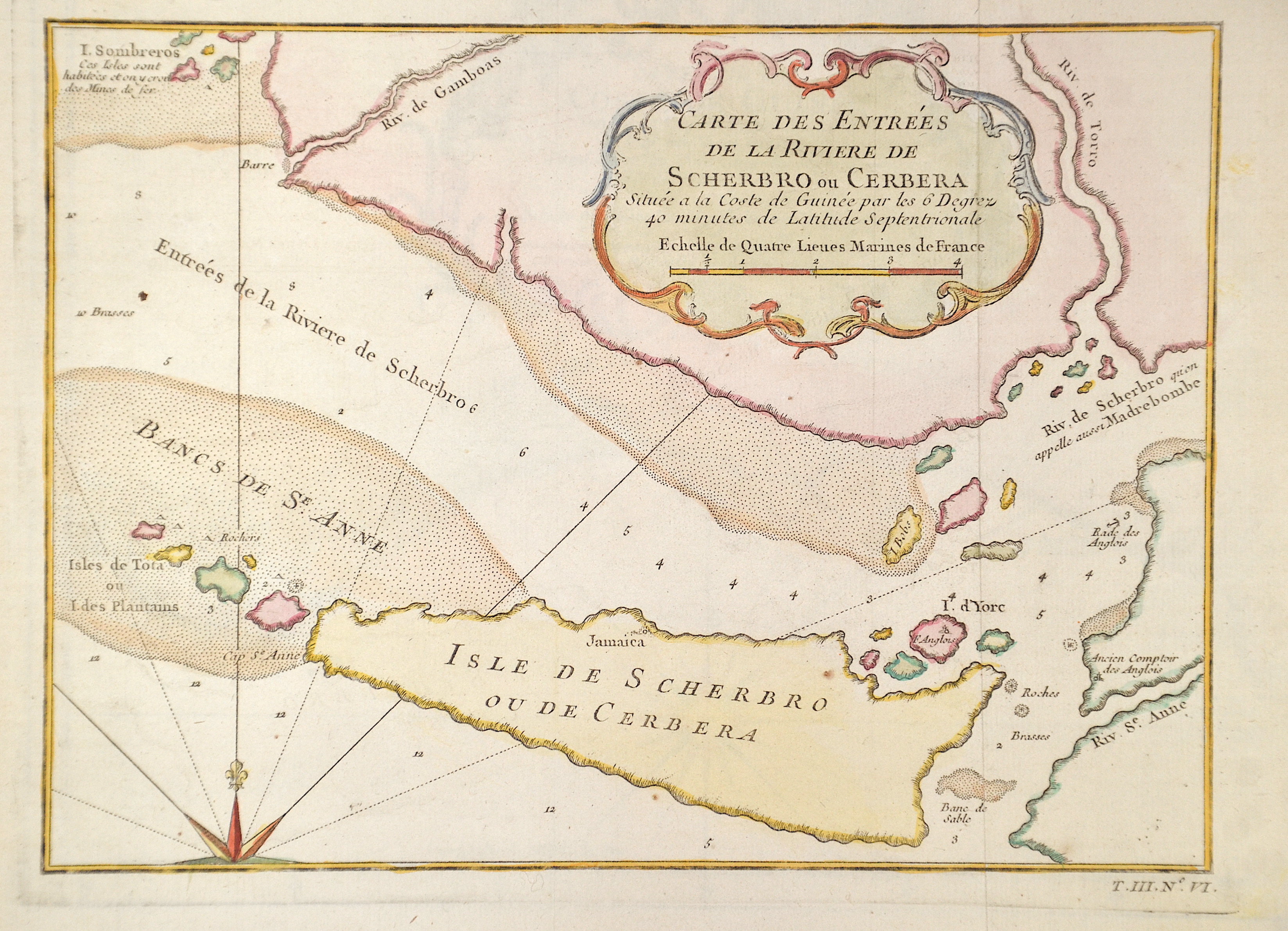
Carte des Entrées de la Riviere de Scherbro ou Cerbera

| Article ID | AF0527 |
Title | Carte des Entrées de la Riviere de Scherbro ou Cerbera |
Description | Map partly showing Sierra Leone with the offshore island "Isle de Scherbro ou de Cerbera" in Africa and a title cartouche. |
| Year | ca. 1764 |
Artist | Bellin (1703-1772) |
Jacques-Nicolas Bellin (1703 Paris -1772 Versailles) was a French cartographer, engineer-geographer, marine hydrographer. As a contributor to the Encyclopédie, he wrote more than a thousand articles on maritime topics. As a cartographer, Bellin distinguished himself primarily in the field of sea cartography. From 1721 he worked for the Dépot des Cartes et Plans de la Marine, from 1741 until his death as an engineer-hydrograph of the Navy. In 1753 his atlas Neptune français, which covered all the coasts of France, was published, and in 1756 the hydrography françoise covering all seas of the earth. In 1764 the five-volume Petit Atlas maritime was published, which Bellin prepared on the orders of the Minister of the Navy, Choiseul. In addition, he wrote a number of geographical works and with Nouvelle méthode pour apprendre la geographie (1769) a geographic textbook for teaching. His maps illustrated, among other things, Bougainville's work Voyage autour du monde, published in 1771. As a co-author of the Encyclopédie edited by Diderot and d'Alembert, Bellin wrote more than a thousand articles in the field of shipping and navy. | |
Historical Description | In 1440, the first European, the Portuguese navigator Gil Eanes, reached the coast of Sierra Leone. In 1462, the Portuguese Pedro da Cintra named the rugged mountain range on the coast Serra Lyoa, meaning "Lion Mountains," which gave rise to the name of the state, now spelled Serra Leoa in Portuguese and Sierra Leona in Spanish. With the arrival of the Portuguese in Sierra Leone and the conquest of parts of the American continent by the Europeans, there was a demand for labor that was met with slaves from West Africa. In 1562, it began with the first slave ship of the English trader John Hawkins. From then on, Englishmen dominated the slave trade on the West African coast, and from 1672 it was the British Royal African Company that established fortified bases on the islands of Bunce and Sherbro. Many slaves tried to take their fate into their own hands and fought for their freedom. Sengbe Pieh, won many abolitionists with his uprising on the ship Amistad. By the end of the 18th century, 5,000 to 7,000 former slaves were living in English towns, often in extreme poverty. Abolitionists then developed the idea of settling the former slaves in one place on the African continent. |
| Place of Publication | Paris |
| Dimensions (cm) | 18 x 25 cm |
| Condition | Perfect condition |
| Coloring | original colored |
| Technique | Copper print |