

Adina Sommer
Antique and Contemporary Art
Winzerer Str. 154
80797 München
telephone
+49 89 304714
business hours:
by appointment
Email
![]()


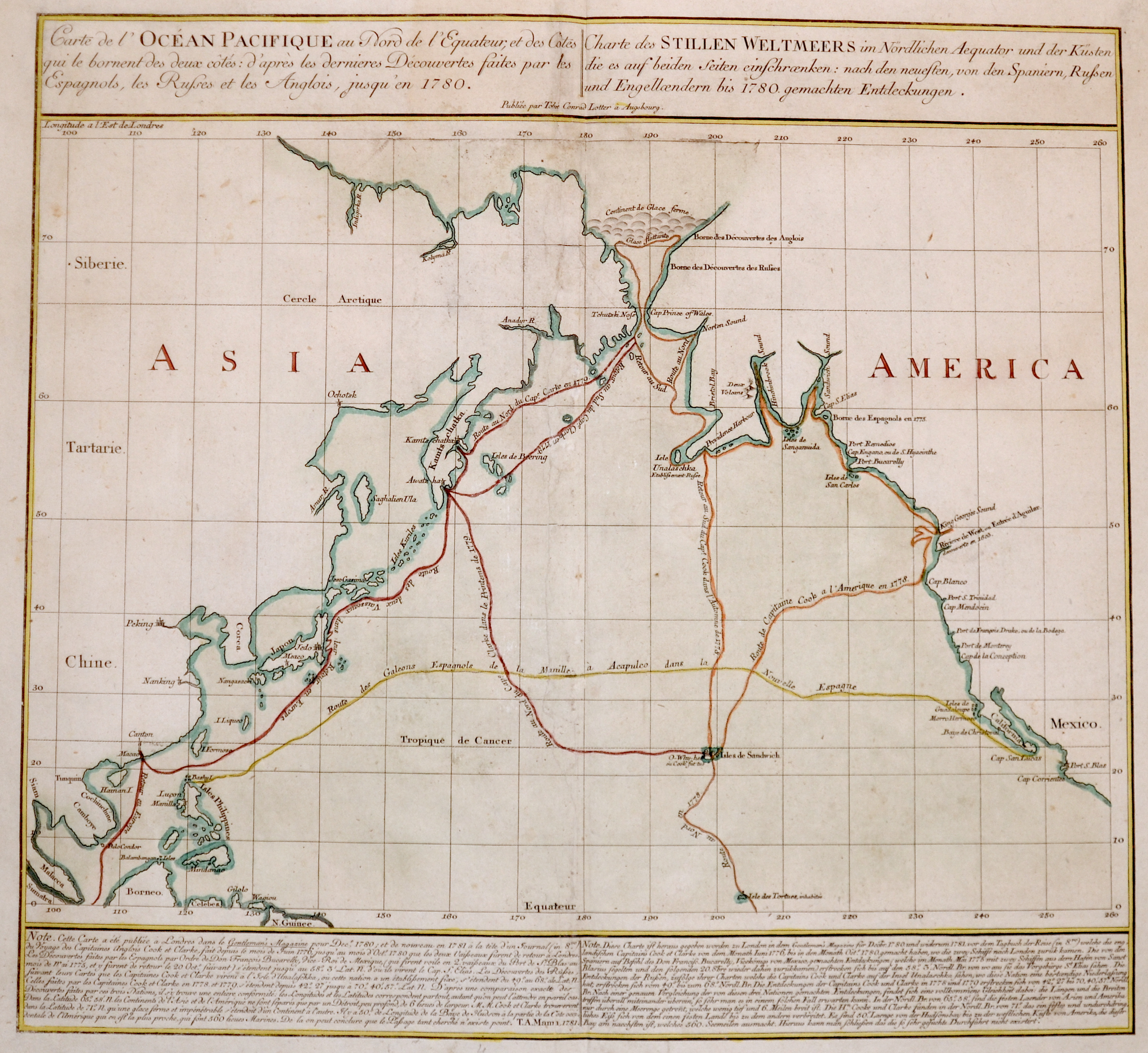
Carte de l’Océan Pacifique au Nord de l’Equateur, et des Costes / Charte des Stillen Weltmeers im Nördlichen Aequator und der Küsten

| Article ID | SE0310 |
Title | Carte de l’Océan Pacifique au Nord de l’Equateur, et des Costes / Charte des Stillen Weltmeers im Nördlichen Aequator und der Küsten |
Description | Map showing the Pacific ocean and the Berringstreet, with the west caost of Northamerica with Alasca and California and the eastcoast of Asia with Japan, Cambodia, Kamtschatka, the Phillippines and partly Southeast Asia. |
| Year | ca. 1781 |
Artist | Lotter (1717-1777) |
Tobias Conrad Lotter ( 1717- 1777) was a carthographer and publisher in Augsburg. He married the elder daughter of Matthäus Seutters and worked in the company of his father in la was map maker. He produced under the „ eye“ of M. Seutter his first „ Asia minor“ atlas between 1740 and 1744. The Asia minor altas of Lotter, Praecipua orbis terrarum imperia, regna et provincias, Germania potissimum tabelli 80 exactae delineatis sistens usui militiae ducum ac peregrinantium maxime accommodatus opera contains 63 maps, mosly Lotters work and other maps from Seutter where he put his name in the lower margin. | |
Historical Description | The Pacific Ocean is the largest and deepest of Earth's oceanic divisions. Though the peoples of Asia and Oceania have traveled the Pacific Ocean since prehistoric times, the eastern Pacific was first sighted by Europeans in the early 16th century when Spanish explorer Vasco Núñez de Balboa crossed the Isthmus of Panama in 1513 and discovered the great "southern sea" which he named Mar del Sur (in Spanish). In 1519, Portuguese explorer Ferdinand Magellan sailed the Pacific East to West on a Spanish expedition to the Spice Islands that would eventually result in the first world circumnavigation. Magellan called the ocean Pacífico (or "Pacific" meaning, "peaceful") because, after sailing through the stormy seas off Cape Horn, the expedition found calm waters. The ocean was often called the Sea of Magellan in his honor until the eighteenth century. |
| Place of Publication | Augsburg |
| Dimensions (cm) | 47,5 x 51,5 cm |
| Condition | Restoration at centerfold |
| Coloring | original colored |
| Technique | Copper print |