

Adina Sommer
Antique and Contemporary Art
Winzerer Str. 154
80797 München
telephone
+49 89 304714
business hours:
by appointment
Email
![]()


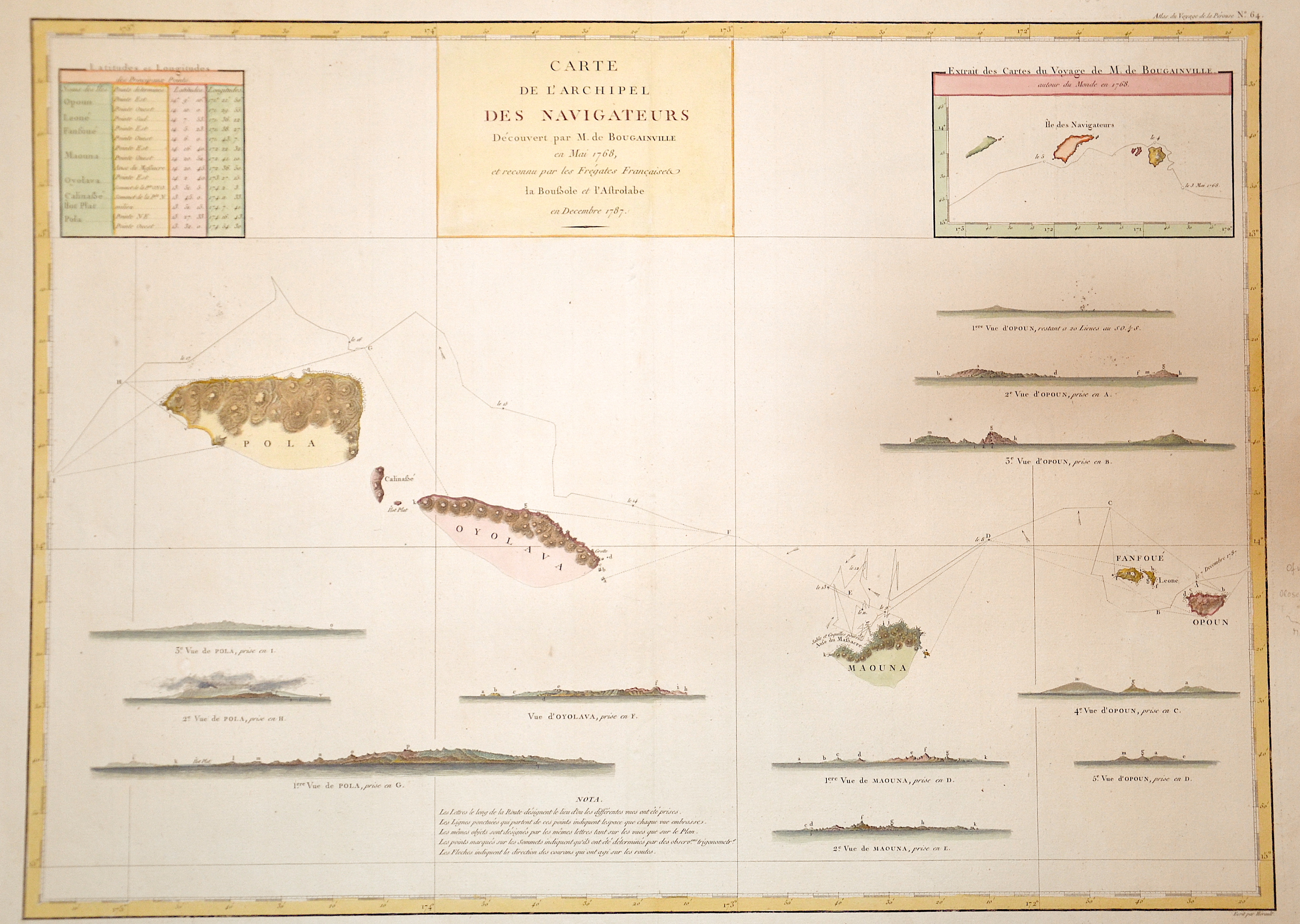
Carte de l´archipel des navigateurs…

| Article ID | OZ0287 |
Title | Carte de l´archipel des navigateurs… |
Description | Map shows the island Samoa with Pola, Oyolava, Maouna,(Tutuila) Ofu, Olosega and Tau, on inset map Iles des Navigateurs. |
| Year | dated 1787 |
Artist | Pérouse, la (1741-1788) |
Jean-François de Galaup de La Pérouse (1741 1788) was a French Naval officer and explorer whose expedition vanished in Oceania. La Pérouse crossed the Pacific Ocean in 100 days, arriving at Macau, where he sold the furs acquired in Alaska, dividing the profits among his men. Lapérouse sailed all the way south to the Spanish Las Californias in 1786. He stopped at the Presidio of San Francisco long enough to create an outline map of the Bay Area, Plan du Port du St. Francois, which was reproduced as Map 33 in L. Aubert's 1797 Atlas du Voyage de la Perouse. Laterhe arrived in Monterey Bay and at the Presidio of Monterey. In 1787 after a visit to Manila, he set out for the northeast Asian coasts. He saw the island of Quelpart, present-day Cheju in South Korea, which had been visited by Europeans only once before when a group of Dutchmen shipwrecked there in 1635. He visited the Asian mainland coasts of Korea. | |
Historical Description | The Independent State of Samoa, known as Western Samoa, is a Unitary Parliamentary Republic with eleven administrative divisions. The two main islands are Savai'i and Upolu with four smaller islands surrounding the landmasses. The capital city is Apia. The Lapita people discovered and settled the Samoan islands around 3,500 years ago. They developed a unique language and cultural identity. |
| Place of Publication | Paris |
| Dimensions (cm) | 49 x 68 |
| Condition | Very good |
| Coloring | original colored |
| Technique | Copper print |