

Adina Sommer
Antique and Contemporary Art
Winzerer Str. 154
80797 München
telephone
+49 89 304714
business hours:
by appointment
Email
![]()


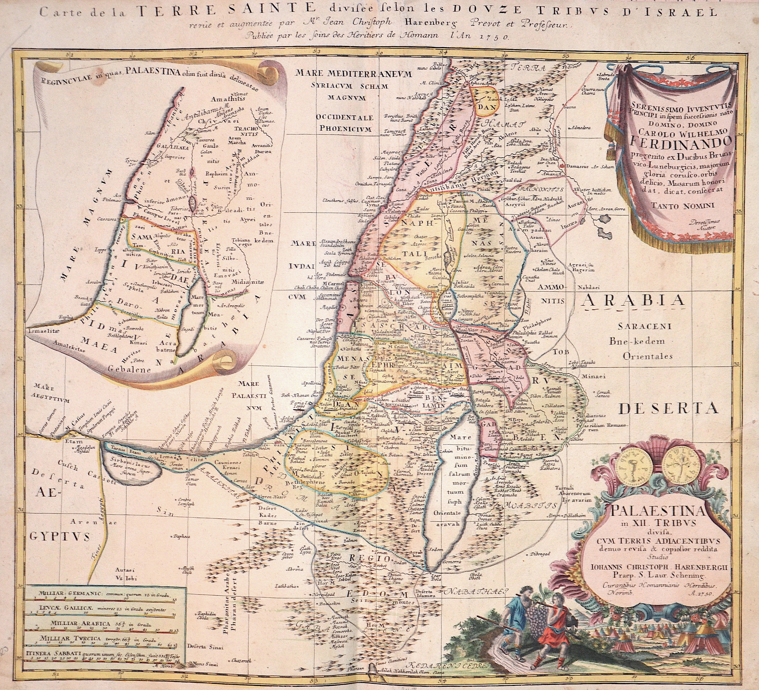
Carte de la Terre Sainte divesee se lon les douze tribus d´Israel

| Article ID | ASP320 |
Title | Carte de la Terre Sainte divesee se lon les douze tribus d´Israel |
Description | Map shows the Holy Land (Terra Sancta) with a partial map of Palestine, two splendid cartouches and a mileage scale. |
| Year | dated 1750 |
Artist | Homann Erben (1724-1780) |
Johann Babtiste Homann (1664-1724) was born in Oberkammlach, the Electorate of Bavaria. Although educated at a Jesuit school, and preparing for an ecclesiastical career, he eventually converted to Protestantism and from 1687 worked as a civil law notary in Nuremberg. He soon turned to engraving and cartography; in 1702 he founded his own publishing house. Homann acquired renown as a leading German cartographer, and in 1715 was appointed Imperial Geographer by Emperor Charles VI. Giving such privileges to individuals was an added right that the Holy Roman Emperor enjoyed. In the same year he was also named a member of the Prussian Academy of Sciences in Berlin. Of particular significance to cartography were the imperial printing privileges (Latin: privilegia impressoria). These protected for a time the authors in all scientific fields such as printers, copper engravers, map makers and publishers. They were also very important as a recommendation for potential customers. In 1716 Homann published his masterpiece Grosser Atlas ueber die ganze Welt (Grand Atlas of all the World). Numerous maps were drawn up in cooperation with the engraver Christoph Weigel the Elder, who also published Siebmachers Wappenbuch. Homann died in Nuremberg. He was succeeded by the Homann heirs company, which was in business until 1848. The company was known as Homann Erben, Homanniani Heredes, or Heritiers de Homann abroad. | |
Historical Description | One of the oldest cities in the world, Jerusalem was named as "Urusalima" on ancient Mesopotamian cuneiform tablets, probably meaning "City of Shalem". During its long history, Jerusalem has been destroyed at least twice. The part of Jerusalem called the City of David was settled in the 4th millennium BCEIn 1538, walls were built around Jerusalem under Suleiman the Magnificent. Today those walls define the Old City, which has been traditionally divided into four quarter. There is no evidence of a permanent settlement in the City of David area until the early Bronze Age . Many Jewish tombs from the Second Temple period have been rediscovered in Jerusalem. One example, discovered north of the Old City, contains human remains in an ossuary decorated with the Aramaic inscription "Simon the Temple Builder. In 1517, Jerusalem and environs fell to the Ottoman Turks, who generally remained in control until 1917 .Jerusalem enjoyed a prosperous period of renewal and peace under Suleiman the Magnificent – including the rebuilding of magnificent walls around the Old City. Throughout much of Ottoman rule, Jerusalem remained a provincial, if religiously important center, and did not straddle the main trade route between Damascus and Cairo. The English reference book Modern history or the present state of all nations, written in 1744, stated that "Jerusalem is still reckoned the capital city of Palestine, though much fallen from its ancient grandeaur". The Ottomans brought many innovations: modern postal systems run by the various consulates and regular stagecoach and carriage services were among the first signs of modernization in the city. In the mid 19th century, the Ottomans constructed the first paved road from Jaffa to Jerusalem, and by 1892 the railroad had reached the city. |
| Place of Publication | Nuremberg |
| Dimensions (cm) | 49 x 53 cm |
| Condition | Restoration at centerfold |
| Coloring | original colored |
| Technique | Copper print |