

Adina Sommer
Antique and Contemporary Art
Winzerer Str. 154
80797 München
telephone
+49 89 304714
business hours:
by appointment
Email
![]()


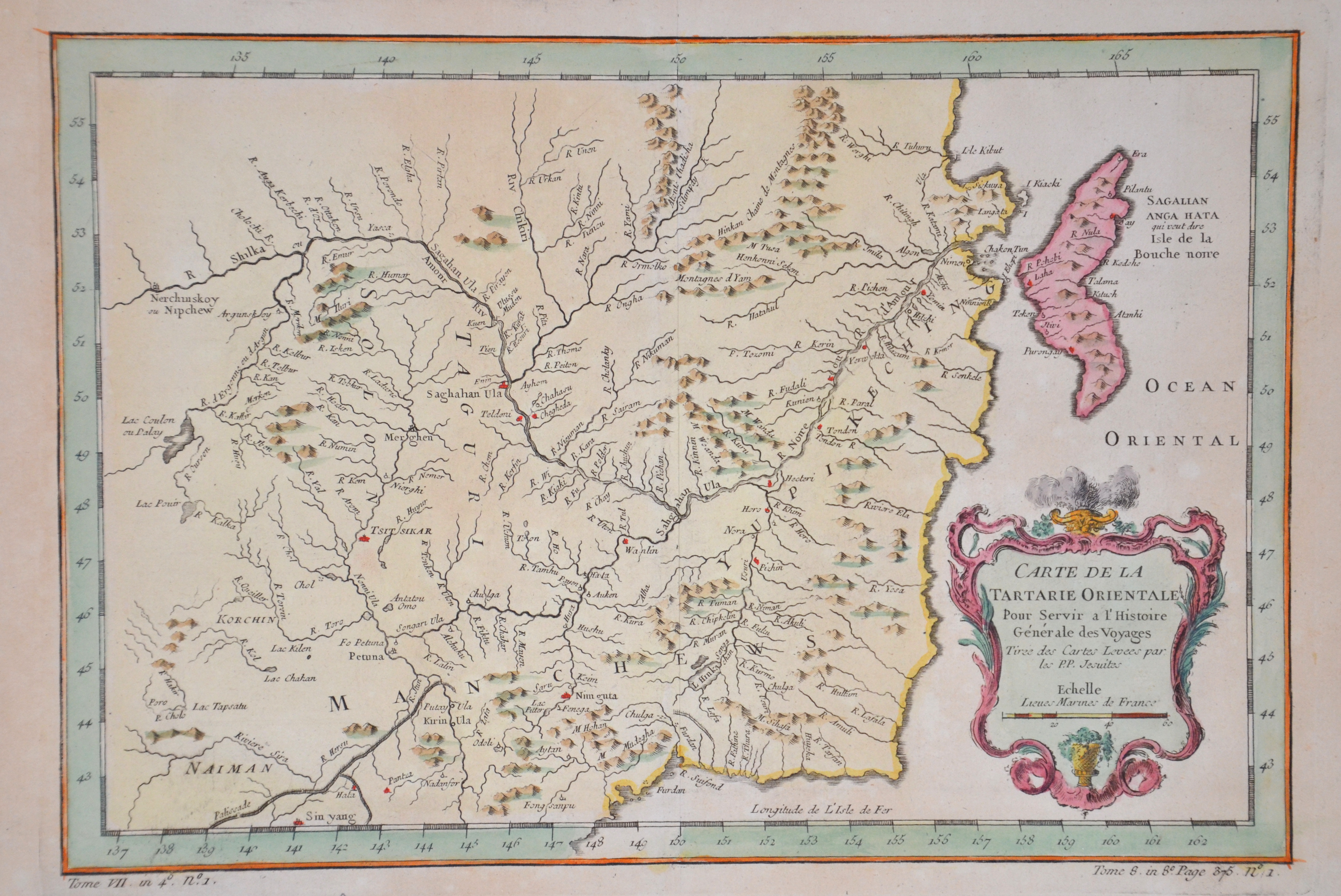
Carte de la Tartarie Orientale

| Article ID | ASC1153 |
Title | Carte de la Tartarie Orientale |
Description | Map shows the norteast part of China with the city of Shenyang and the river Amur ( Hailong Jiang ) going through Russia and China, the russina island Sachalin and a decorative title cartouche. From : Maps for Prevost's L'Histoire Générale des Voyages - 1747-61 |
| Year | ca. 1754 |
Artist | Bellin (1703-1772) |
Jacques-Nicolas Bellin (1703 Paris -1772 Versailles) was a French cartographer, engineer-geographer, marine hydrographer. As a contributor to the Encyclopédie, he wrote more than a thousand articles on maritime topics. As a cartographer, Bellin distinguished himself primarily in the field of sea cartography. From 1721 he worked for the Dépot des Cartes et Plans de la Marine, from 1741 until his death as an engineer-hydrograph of the Navy. In 1753 his atlas Neptune français, which covered all the coasts of France, was published, and in 1756 the hydrography françoise covering all seas of the earth. In 1764 the five-volume Petit Atlas maritime was published, which Bellin prepared on the orders of the Minister of the Navy, Choiseul. In addition, he wrote a number of geographical works and with Nouvelle méthode pour apprendre la geographie (1769) a geographic textbook for teaching. His maps illustrated, among other things, Bougainville's work Voyage autour du monde, published in 1771. As a co-author of the Encyclopédie edited by Diderot and d'Alembert, Bellin wrote more than a thousand articles in the field of shipping and navy. | |
Historical Description | By the 15th century, Beijing had essentially taken its current shape. The Ming city wall continued to serve until modern times, when it was pulled down and the 2nd Ring Road was built in its place. It is generally believed that Beijing was the largest city in the world for most of the 15th, 16th, 17th, and 18th centuries.The first known church was constructed by Catholics in 1652 at the former site of Matteo Ricci's chapel; the modern Nantang Cathedral was later built upon the same site. The capture of Beijing by Li Zicheng's peasant army in 1644 ended the dynasty, but he and his Shun court abandoned the city without a fight when the Manchu army of Prince Dorgon arrived 40 days later. The Forbidden City was the Chinese imperial palace from the Ming dynasty to the end of the Qing dynasty( the years 1420 to 1912). It is located in the center of Beijing, China, and now houses the Palace Museum. When Hongwu Emperor's son Zhu Di became the Yongle Emperor, he moved the capital from Nanjing to Beijing, and construction began in 1406 on what would become the Forbidden City. Construction lasted 14 years and required more than a million workers. It served as the home of emperors and their households as well as the ceremonial and political center of Chinese government for almost 500 years. The palace complex exemplifies traditional Chinese palatial architecture, and has influenced cultural and architectural developments in East Asia and elsewhere. Since 1925 the Forbidden City has been under the charge of the Palace Museum, whose extensive collection of artwork and artifacts were built upon the imperial collections of the Ming and Qing dynasties. |
| Place of Publication | Paris |
| Dimensions (cm) | 21 x 31 |
| Condition | Perfect condition |
| Coloring | colored |
| Technique | Copper print |