

Adina Sommer
Antique and Contemporary Art
Winzerer Str. 154
80797 München
telephone
+49 89 304714
business hours:
by appointment
Email
![]()


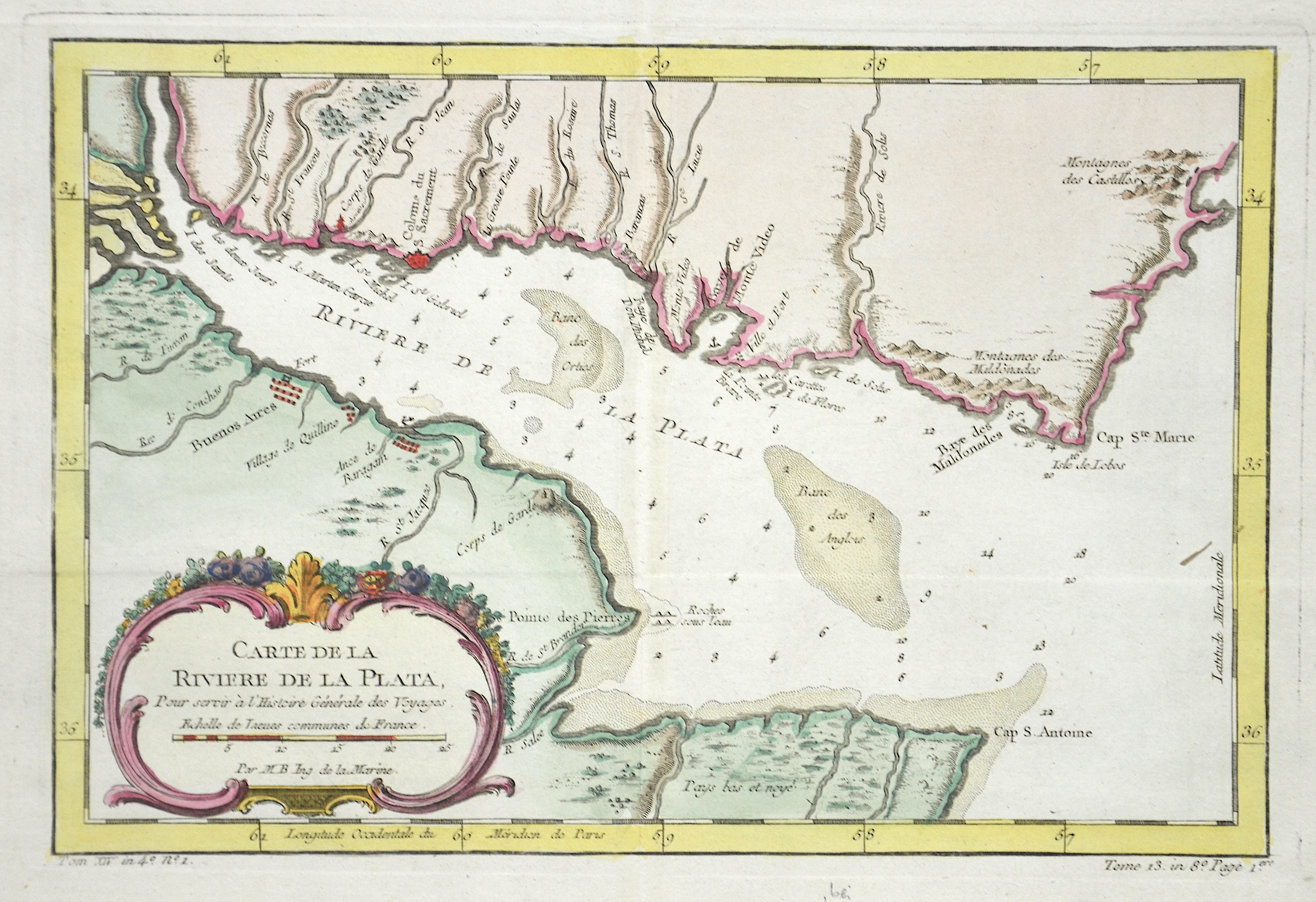
Carte de la Riviere de la Plata,…

| Article ID | AMS1073 |
Title | Carte de la Riviere de la Plata,… |
Description | Map shows the Rio Plata in Uruguay with the cities of Colonia del Sacramento, Montevideo to the bay of Maldonado and Argentinia with the cities Buenos Aires and Punta Piedras. |
| Year | ca. 1770 |
Artist | Bellin (1703-1772) |
Jacques-Nicolas Bellin (1703 Paris -1772 Versailles) was a French cartographer, engineer-geographer, marine hydrographer. As a contributor to the Encyclopédie, he wrote more than a thousand articles on maritime topics. As a cartographer, Bellin distinguished himself primarily in the field of sea cartography. From 1721 he worked for the Dépot des Cartes et Plans de la Marine, from 1741 until his death as an engineer-hydrograph of the Navy. In 1753 his atlas Neptune français, which covered all the coasts of France, was published, and in 1756 the hydrography françoise covering all seas of the earth. In 1764 the five-volume Petit Atlas maritime was published, which Bellin prepared on the orders of the Minister of the Navy, Choiseul. In addition, he wrote a number of geographical works and with Nouvelle méthode pour apprendre la geographie (1769) a geographic textbook for teaching. His maps illustrated, among other things, Bougainville's work Voyage autour du monde, published in 1771. As a co-author of the Encyclopédie edited by Diderot and d'Alembert, Bellin wrote more than a thousand articles in the field of shipping and navy. | |
Historical Description | After the arrival of European settlers, the horses and cattle abandoned by the Spaniards developed into large herds on the wide grasslands of the pampas, which formed the basis for the country's economic wealth. Uruguay is one of the most stable, democratic and prosperous countries in Latin America today. It is believed that what is now Uruguay has been around since around 7000 BC. Was settled by people who lived nomadically in small groups. The first people to emerge as such were the Charrúas.The Spanish explored the country around 1516. The first permanent settlement in what is now Uruguay was founded in 1624 by the Spanish in Soriano (on the Río Negro). The next few years were a constant battle against the Portuguese, who also claimed the area. Montevideo was founded in 1726. The early 19th century was mainly characterized by fighting against the Argentines and Brazilians who wanted to annex the country. In addition, the last charrúas were killed during this time. During the 19th century, Uruguay had limited male suffrage. After the country became independent, a period of civil war began between the Colorados under José Fructuoso Rivera and the Blancos under Manuel Oribe. When the Blanco government of Uruguay, which was allied with Paraguay, was overthrown by the Colorados with the help of Brazil, Paraguay's President Francisco Solano López declared war on Brazil. The result was the "Triple Alliance War" (Guerra de la Triple Alianza), which ended five years later in Paraguay's defeat. At the same time as these developments, there was a large flow of immigrants, mainly from Europe, who settled in Uruguay. The agricultural sector was modernized and, with the help of European capital, the infrastructure, especially the transport and service sectors, was improved. |
| Place of Publication | Paris |
| Dimensions (cm) | 18,5 x 28,5 cm |
| Condition | Perfect condition |
| Coloring | original colored |
| Technique | Copper print |