

Adina Sommer
Antique and Contemporary Art
Winzerer Str. 154
80797 München
telephone
+49 89 304714
business hours:
by appointment
Email
![]()


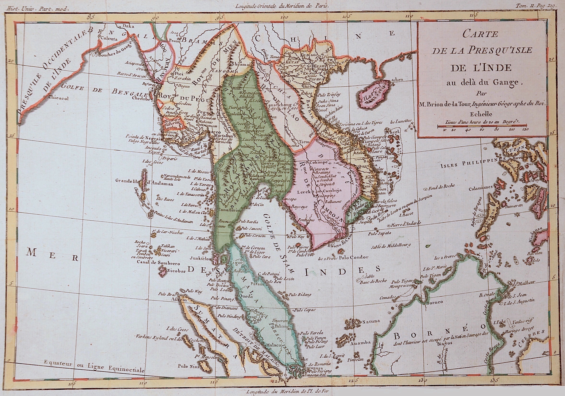
Carte de la presque isle de l´Inde au de la du Gange

| Article ID | ASS0478 |
Title | Carte de la presque isle de l´Inde au de la du Gange |
Description | Map shows total Thailand with Birma, Kambodcha, laos, Tonking, Vietnam , the island Hainan, partly Philippines nd Malaisia |
| Year | ca. 1766 |
Artist | Brion de la Tour (1743-1803) |
Louis Brion de la Tour was a french cartographer and demographer. With his knowledgebacame the famous « Ingénieur Géographe du Roi ».He issued together with Louis Charles Desnos (1750-1790) several atlases and globes. | |
Historical Description | The Thai may not immigrated to what is now Thailand until the 11th century. They established several kingdoms that were united in the centuries that followed. However, until the 19th century there was no national state of Thailand, but the many local principalities (Müang) remained and were only obliged to pay tribute to the rulers in the center. These networks of Müang dependent on a ruler are called mandalas. Their area of influence had no fixed borders, but could expand and contract again over time. During the colonial era, Thailand managed to maintain its independence and it developed into a modern central state. |
| Place of Publication | Paris |
| Dimensions (cm) | 23,5 x 34,5 |
| Condition | Very good |
| Coloring | colored |
| Technique | Copper print |