

Adina Sommer
Antique and Contemporary Art
Winzerer Str. 154
80797 München
telephone
+49 89 304714
business hours:
by appointment
Email
![]()


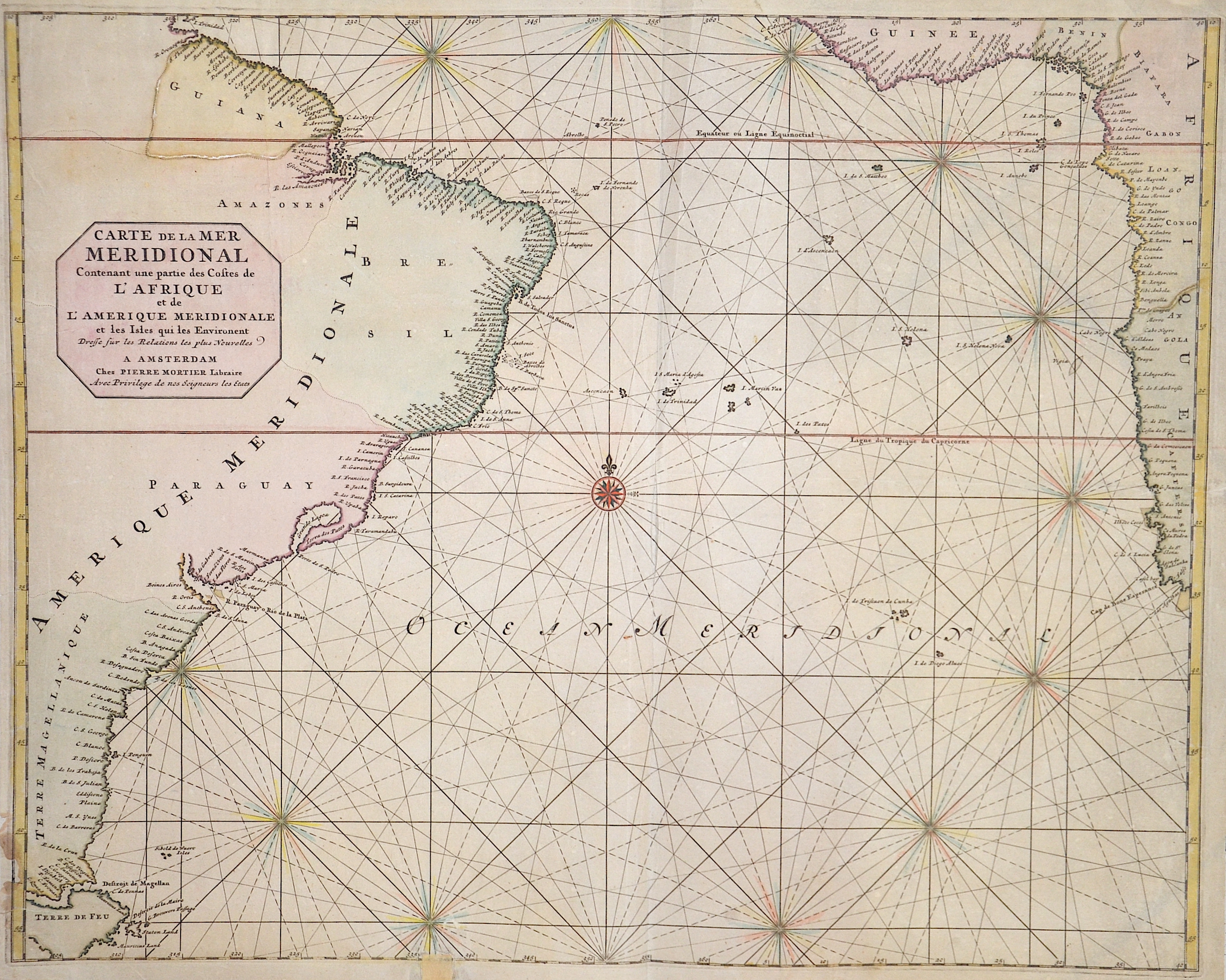
Carte de la mer Meridional Contenant un partie des Costes de l´Afrique et de L´Amerique meridionale..

| Article ID | SE0296 |
Title | Carte de la mer Meridional Contenant un partie des Costes de l´Afrique et de L´Amerique meridionale.. |
Description | Map shows the Atlantic with the coast of South America and the caost of the southern part of Africa. |
| Year | ca. 1705 |
Artist | Mortier (1661-1711) |
Pieter Mortier (1661–1711) was an 18th-century mapmaker and engraver from the Northern Netherlands. Mortier had a partnership with Johannes Covens I (1697-1774) and founded the map publishing company Covens & Mortier (1721-1866). Mortier, being French himself, had easy access to French cartographers such as De L'Isle, Sanson, Jaillot, de Fer and De Wit. Consequently, much of Mortier's business was built upon leveraging the sophisticated Dutch printing establishment to issue embellished high quality editions of previously contemporary French maps. In the greater context of global cartography, this was a significant advantage as most Dutch map publishes had, at this point, fallen into the miasma of reprinting their own outdated works. By contrast, the cartographers of France were producing the most accurate and up to date charts anywhere. Mortier's cartographic work culminated in the magnificent nautical atlas, Le Neptune Francois. Upon Pierre's death in 1711 this business was inherited by his widow. In 1721 his son Cornelius Mortier took over the day to day operation of the firm. Cornelius partnered with his brother-in-law Jean Covens to form one of history's great cartographic partnerships - Covens and Mortier - which continued to publish maps and atlases until about 1866. | |
Historical Description | For a long time in human history, the Atlantic was the great body of water that separated the "Old World" from the "New World." Covering an area of about 106 million square kilometers, the Atlantic Ocean makes up roughly one-fifth of the Earth's surface. Due to its vast size, the Atlantic is commonly divided into the North Atlantic and the South Atlantic. In the 17th century, the Atlantic Ocean was a central stage for global trade, colonialism, and naval power politics among the European powers. European countries such as Spain, Portugal, England, France, and the Netherlands used the Atlantic for their colonial ventures. The Americas, West Africa, and the Caribbean were interconnected through the Atlantic—economically, politically, and militarily. The transatlantic triangular trade flourished: European goods were brought to Africa, exchanged for enslaved people, who were then shipped to the Americas. From there, raw materials such as sugar, tobacco, or cotton were transported back to Europe. Thus, the Atlantic was also a major zone of intensive slave trade. The Atlantic routes were dangerous: in addition to natural hazards, there were also pirates and conflicts between rival colonial powers. By around 1680, the Atlantic had become the backbone of the emerging global economic system—shaped by colonialism, the slave trade, and naval power. It connected continents, but also spread violence, exploitation, and power struggles. After Christopher Columbus's first crossing in 1492, regular ocean crossings did not begin until the 19th century. People in Europe wanted to leave behind the poor living conditions of the time and start a new life in the rapidly developing Americas. This led to large waves of emigration.The first transatlantic steamship set sail from Bremerhaven on July 2, 1847. |
| Place of Publication | Amsterdam |
| Dimensions (cm) | 47,5 x 60 |
| Condition | Minor restorations along the orig. outline colours |
| Coloring | original colored |
| Technique | Copper print |