

Adina Sommer
Antique and Contemporary Art
Winzerer Str. 154
80797 München
telephone
+49 89 304714
business hours:
by appointment
Email
![]()


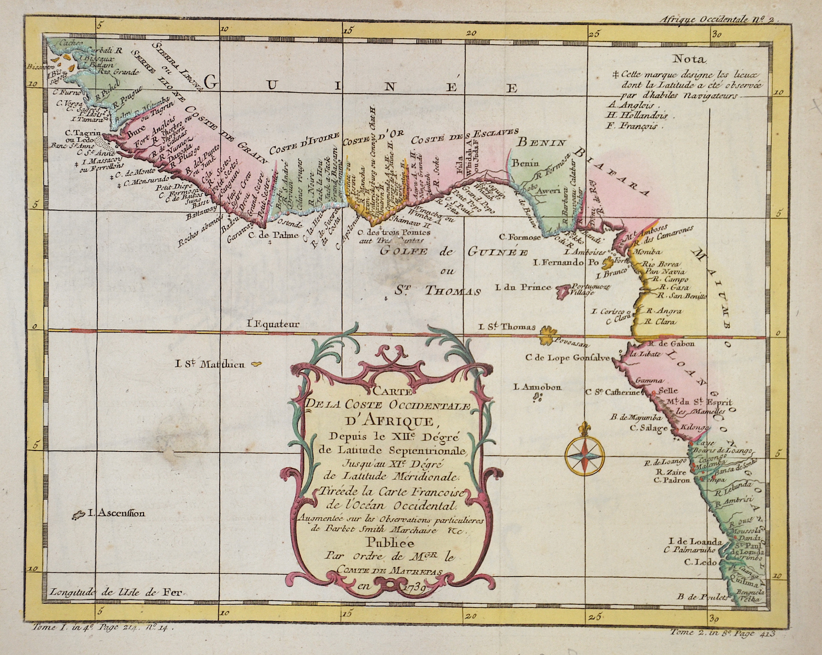
Carte De la Coste Occidentale D’Afrique

| Article ID | AF0536 |
Title | Carte De la Coste Occidentale D’Afrique |
Description | Map shows the Gulf of Guinea with the countries Guinea, Sierra Leone, Liberia, Ivory Coast, Ghana, Togo, Benin and Nigeria in Africa. |
| Year | c. 1739 |
Artist | Maurepas, Comte de (1701-1781) |
Jean-Frédéric Phélypeaux, comte de Maurepas ( 1701 – 1781) was a French statesman and Count of Maurepas. Skilled in military and naval strategy, Maurepas enabled the French navy to regain previously lost prestige and France was once again recognized as a maritime power. One way that he improved the French reputation was by focusing on the defense of France's sprawling empire in the New World, especially in the 1730s and 1740s | |
Historical Description | Guinea: The land that is now Guinea belonged to a series of African empires until France colonized it in the 1890s, and made it part of French West Africa. Guinea declared its independence from France on 2 October 1958. The country is named after the Guinea region. Guinea is a traditional name for the region of Africa that lies along the Gulf of Guinea. It stretches north through the forested tropical regions and ends at the Sahel. The English term Guinea comes directly from the Portuguese word Guiné, which emerged in the mid-15th century to refer to the lands inhabited by the Guineus, a generic term for the black African peoples south of the Senegal River, in contrast to the "tawny" Zenaga Berbers above it, whom they called Azenegues or Moors. |
| Place of Publication | Paris |
| Dimensions (cm) | 20 x 25,5 cm |
| Condition | Small missing part replaced |
| Coloring | colored |
| Technique | Copper print |