

Adina Sommer
Antique and Contemporary Art
Winzerer Str. 154
80797 München
telephone
+49 89 304714
business hours:
by appointment
Email
![]()


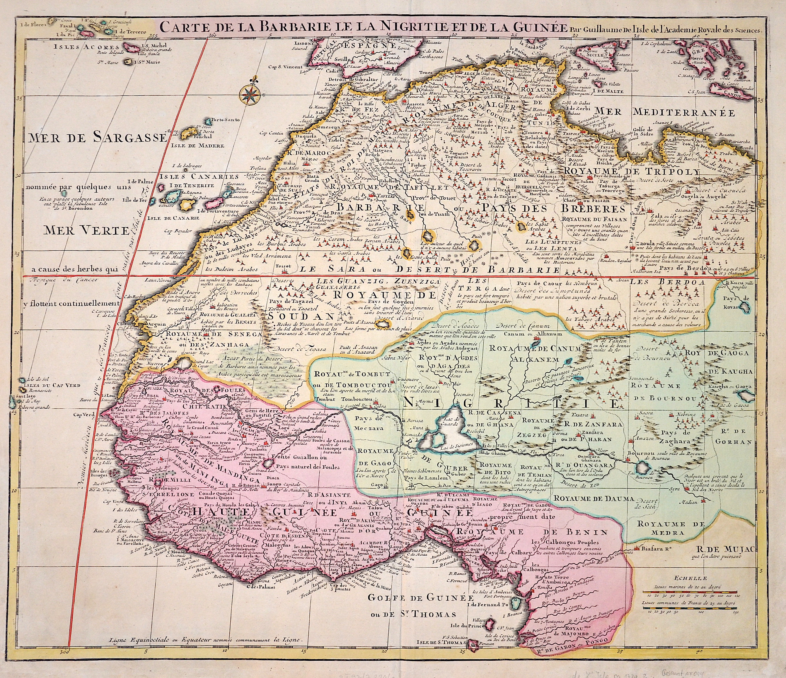
Carte de la Barbarie le la Nigritie et de la Guinée

| Article ID | AF094 |
Title | Carte de la Barbarie le la Nigritie et de la Guinée |
Description | Map shows the western coast of Africa. |
| Year | ca. 1720 |
Artist | L´Isle, de /Covens & Mortier (1675-1726) |
Guillaume De L’Isle (1675–1726) was a renowned French cartographer famous for his accurate maps of Europe, the Americas, and Africa. He joined the French Académie Royale des Sciences, signing his maps as “Géographe de l’Académie,” and later became Premier Géographe du Roi in 1718, teaching geography to the Dauphin. De L’Isle mostly worked from his office, relying on a strong network of traveler reports and scientific updates, ensuring his maps were precise and honest. He openly noted uncertain information, such as a disputed river in Louisiana. In 1700, he won a legal case against Jean-Baptiste Nolin for plagiarism. Unlike the Sanson workshop, which often published outdated maps, De L’Isle focused on up-to-date, scientifically grounded cartography. | |
Historical Description | Before the arrival of the Europeans, there were important empires in West Africa, such as Ghana, Mali and Songhai. Beginning in the 15th century, the British, Brandenburgers, Danes, French, Dutch, Portuguese and Swedes built forts and factories along the coast, primarily to handle the lucrative slave trade with North America. West Africa long had the reputation of being the "white man's grave." In the 18th century, 25% to 75% of newly arrived Europeans died within the first year of arrival from tropical diseases such as malaria, yellow fever, and sleeping sickness. In the late 19th and early 20th centuries, colonial divisions were cemented. By 1900, West Africa included the extensive colonial territories of British, German, and French West Africa.A wave of independence occurred around 1960, during which numerous West African states became sovereign.The greater region covers much of the African continent, incorporating parts of the Sahara in the north and extending from the coastal regions of the Atlantic to the highlands of Adamaua and Mount Cameroon in the south. In general, West Africa includes the western part of the Greater Sahel and Sudan and the tropical rainforests of the Upper Guinea Threshold. |
| Place of Publication | Paris |
| Dimensions (cm) | 50 x 48 cm |
| Condition | Left and right lower corners replaced |
| Coloring | original colored |
| Technique | Copper print |