

Adina Sommer
Antique and Contemporary Art
Winzerer Str. 154
80797 München
telephone
+49 89 304714
business hours:
by appointment
Email
![]()


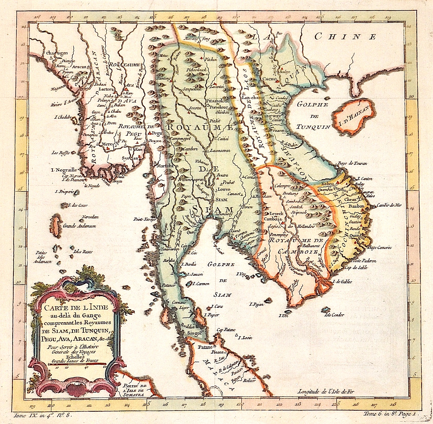
Carte de l Inde au-de la du Gange comprenant les Royaume de Siam, de Tunquin, Pegu, Ava, Aracan….

| Article ID | ASI0474 |
Title | Carte de l Inde au-de la du Gange comprenant les Royaume de Siam, de Tunquin, Pegu, Ava, Aracan…. |
Description | Map shows Thailand, Cambotscha, Vietnam, the island Hainan, Laos and partly Birma |
| Year | ca. 1710 |
Artist | Fer, de (1646-1720) |
Nicolas de Fer ( 1646 - 1720 in Paris) was a French cartographer and geographer. He also was an engraver and publisher. De Fer was the youngest of three sons of Antoine de Fer, who was also a cartographer. When he was 12, he became the apprentice of Parisian engraver Louis Spirinx, and made his first map, of the Canal du Midi, at the age of 23. After the death of his father in June 1673, de Fer was so successful at improving the firm that, in 1690, he became the official geographer to Louis, Dauphin of France. With support from the Spanish and French Royal Families, de Fer also became official geographer for Philip V and Louis XIV, the kings of Spain and France, respectively. Because of this, his maps became Bourbon propaganda, endorsing French King Louis XIV. His business flourished, producing town plans, atlases, wall maps, and more than 600 sheet maps.He made maps of places in Europe and North America, including New Spain, places fortified by Vauban, the Low Countries, and the War of the Spanish Succession. In 1698, de Fer published a map of North America, which included a depiction of beavers building dams near Niagara Falls. Seventeen years later, Herman Moll published an identical map as his own, known as the -Beaver map-. De Fer became the official geographer for His Catholic Majesty in 1720.Two of his sons-in-law, Guillaume Danet and Jaques-François Bénard, continued the company after de Fer's death on 25 October of that year until around 1760. | |
Historical Description | The Thai may not immigrated to what is now Thailand until the 11th century. They established several kingdoms that were united in the centuries that followed. However, until the 19th century there was no national state of Thailand, but the many local principalities (Müang) remained and were only obliged to pay tribute to the rulers in the center. These networks of Müang dependent on a ruler are called mandalas. Their area of influence had no fixed borders, but could expand and contract again over time. During the colonial era, Thailand managed to maintain its independence and it developed into a modern central state. |
| Dimensions (cm) | 27,5 x 28 |
| Condition | Very good |
| Coloring | original colored |
| Technique | Copper print |