

Adina Sommer
Antique and Contemporary Art
Winzerer Str. 154
80797 München
telephone
+49 89 304714
business hours:
by appointment
Email
![]()


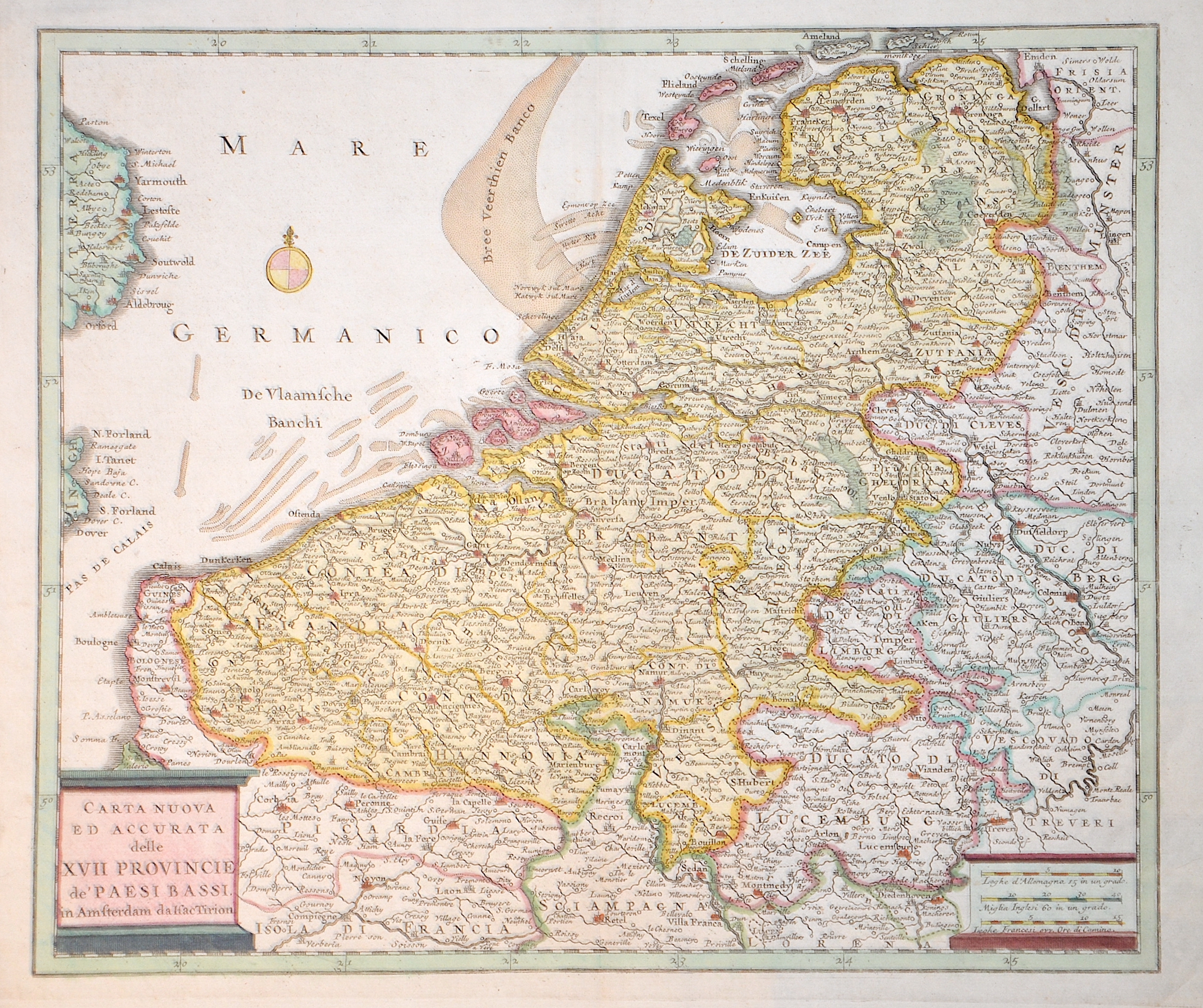
Carta Nuova ed accurata delle XVII Provincie de Paesi Bassi

| Article ID | EUB2250 |
Title | Carta Nuova ed accurata delle XVII Provincie de Paesi Bassi |
Description | Map shows the whole of Belgium, the Netherlands and Luxembourg. Part of England is also shown in the west with the towns of Dover, Aldeborgh and Yarmouth. There is also a title cartouche, a milepost cartouche and a compass rose. The map is based on an earlier map by Isaac Tirion. |
| Year | ca. 1740 |
Artist | Albrizzi (1698-1777) |
The Italian Giovanni Battista (Giovambattista) Albrizzi took inspiration for his best-known atlas - the Nieuwe En Beknopte Handatlas...by Isaak Tirion from the dutch and french mapmakers, translated them into Italian and published it in Venice. Albrizzi was also responsible for publishing an edition of Guillaume De L'Isle's atlas named: Atlante Novissimo. | |
Historical Description | As the province of Belgica - a name introduced by Caesar - what is now Belgium experienced many rulers. From the High Middle Ages to the early modern period, the cities of Flanders with their cloth industries represented one of the two centers of the European economy. Politically, the individual territories came under the House of Burgundy, which was inherited by the Habsburgs in 1477. In 1579 the Catholic Union of Arras and the Calvinist-Protestant Union of Utrecht were formed. The provinces of the Union of Utrecht broke away from Spain in 1581 and founded the Republic of the Seven United Provinces, whose independence was recognized in the Peace of Westphalia of 1648 after the end of the Eighty Years War. The provinces of the Union of Arras, Flanders and Brabant were administered as the Spanish Netherlands by a Spanish governor. After the extinction of the Spanish Habsburgs (1700) and the resulting War of the Spanish Succession, the Austrian Netherlands came under the rule of the Austrian Habsburgs in 1714. As a result of the absolutist-centralistic efforts of the Austrian ruler Joseph II, the Brabant Revolution came in 1789 and the short-lived United Belgian States. Revolutionary France annexed the Austrian Netherlands between 1792 and 1794, followed by incorporation into the French Republic in 1795. At the Congress of Vienna (1815) the provinces were awarded to the Netherlands. After the Belgian Revolution, the country gained independence in 1830. |
| Place of Publication | Venice |
| Dimensions (cm) | 28 x 33 cm |
| Condition | Perfect condition |
| Coloring | colored |
| Technique | Copper print |