

Adina Sommer
Antique and Contemporary Art
Winzerer Str. 154
80797 München
telephone
+49 89 304714
business hours:
by appointment
Email
![]()


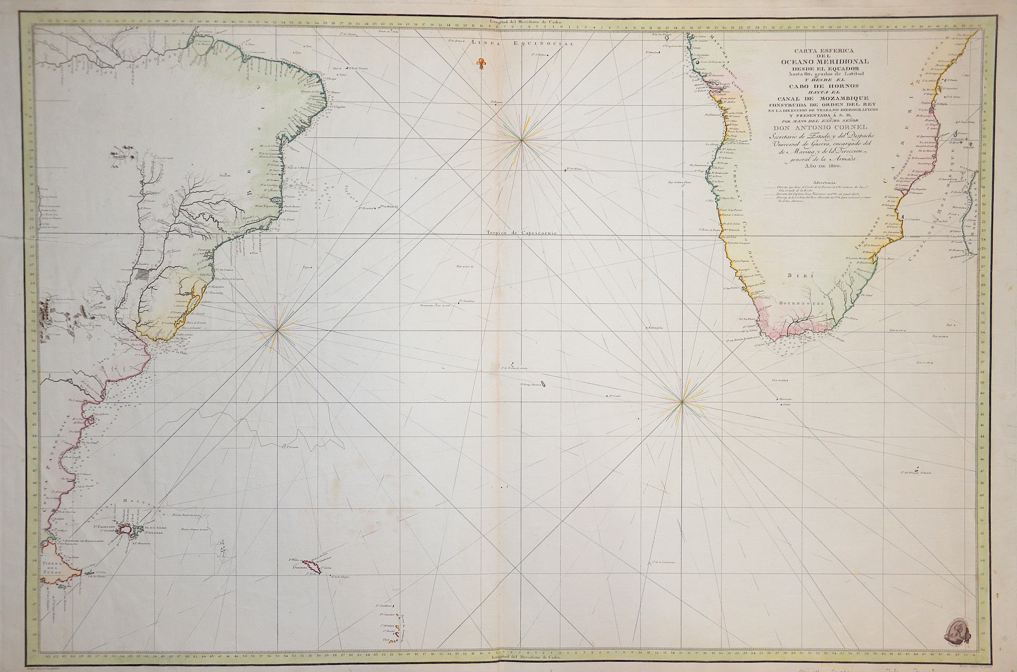
Carta Esferica del Oceeano Meridional desde el Eyuador…Cabo de Hornos… Canal de Mozambique…

| Article ID | SE0301 |
Title | Carta Esferica del Oceeano Meridional desde el Eyuador…Cabo de Hornos… Canal de Mozambique… |
Description | Decorative an rare map of the Atlantic ocean with the coast South Africa and the west coast of South America ( Brasil, Patagonia, Fireland and Falkland islands). The map is apparently quite rare on the market, with no examples being offered. |
| Year | ca. 1800 |
Artist | Bauza (1764-1834) |
Felipe Bauzá y Cañas (1764 in Palma de Mallorca – 1834 in London) was a Spanish naval officer, hydrographer and cartographer. He was the main cartographer of the Malaspina Expedition to the Americas, Oceania and Australasia between 1789 and 1794, and Bauza Island in New Zealand is named after him. At the end of that expedition he travelled across South America by land and created a map of the Andes. In 1797 he started working at the Hydrography Office in Madrid, of which he became director in 1815. He was highly esteemed as a cartographer, both by the Spanish government and by foreign authorities. He was honoured with the Russian Cross of St Vladimir in 1816 and was elected a Foreign Member of the Royal Society of London in 1819. The British Library holds a collection of his maps as the Bauzá Collection. | |
Historical Description | For a long time in human history, the Atlantic was the great body of water that separated the "Old World" from the "New World." Covering an area of about 106 million square kilometers, the Atlantic Ocean makes up roughly one-fifth of the Earth's surface. Due to its vast size, the Atlantic is commonly divided into the North Atlantic and the South Atlantic. In the 17th century, the Atlantic Ocean was a central stage for global trade, colonialism, and naval power politics among the European powers. European countries such as Spain, Portugal, England, France, and the Netherlands used the Atlantic for their colonial ventures. The Americas, West Africa, and the Caribbean were interconnected through the Atlantic—economically, politically, and militarily. The transatlantic triangular trade flourished: European goods were brought to Africa, exchanged for enslaved people, who were then shipped to the Americas. From there, raw materials such as sugar, tobacco, or cotton were transported back to Europe. Thus, the Atlantic was also a major zone of intensive slave trade. The Atlantic routes were dangerous: in addition to natural hazards, there were also pirates and conflicts between rival colonial powers. By around 1680, the Atlantic had become the backbone of the emerging global economic system—shaped by colonialism, the slave trade, and naval power. It connected continents, but also spread violence, exploitation, and power struggles. After Christopher Columbus's first crossing in 1492, regular ocean crossings did not begin until the 19th century. People in Europe wanted to leave behind the poor living conditions of the time and start a new life in the rapidly developing Americas. This led to large waves of emigration.The first transatlantic steamship set sail from Bremerhaven on July 2, 1847. |
| Place of Publication | Madrid |
| Dimensions (cm) | 58,5 x 87,5 |
| Condition | Tear on the left side perfectly restored |
| Coloring | original colored |
| Technique | Copper print |