

Adina Sommer
Antique and Contemporary Art
Winzerer Str. 154
80797 München
telephone
+49 89 304714
business hours:
by appointment
Email
![]()


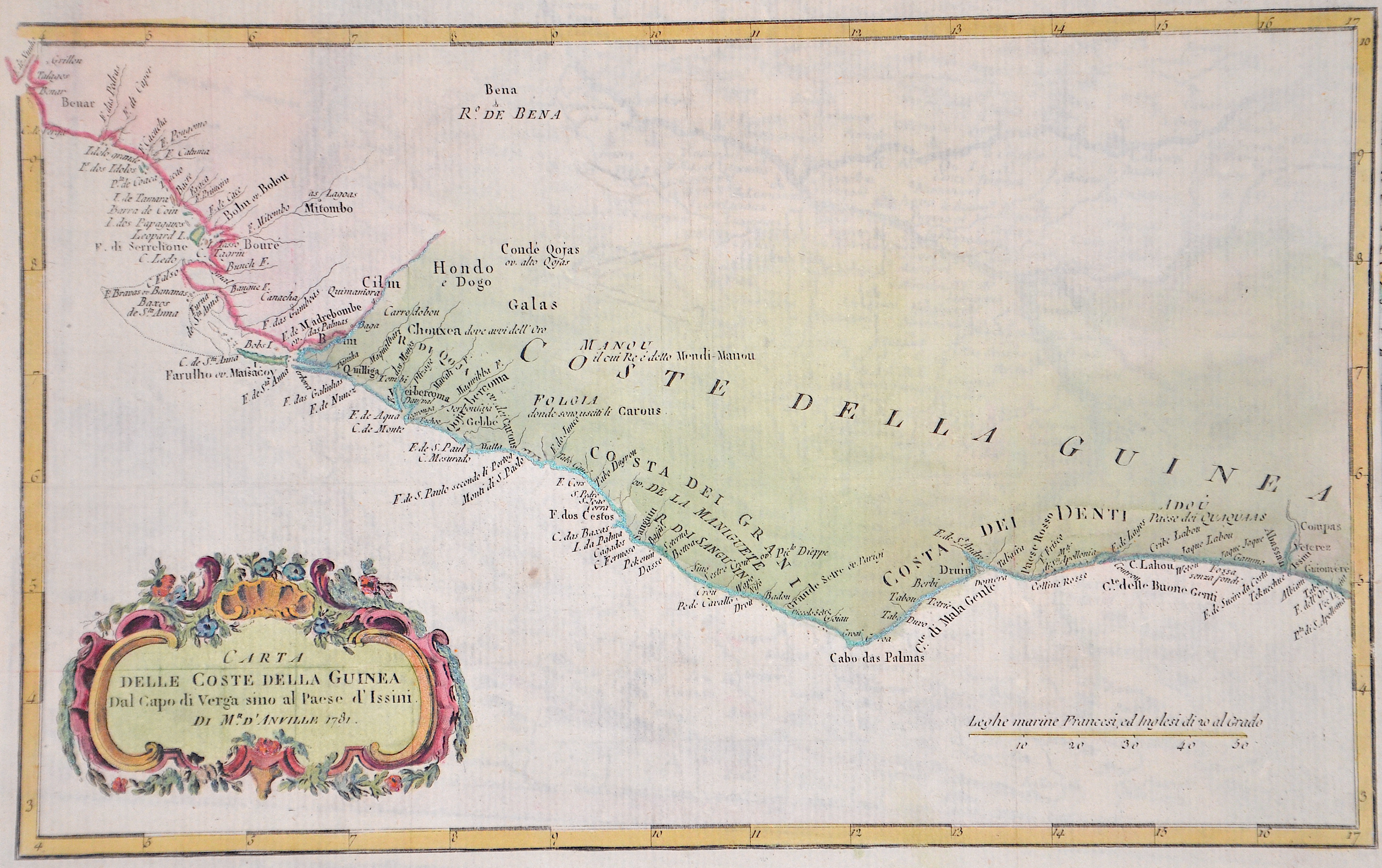
Carta Delle Coste Della Guinea…

| Article ID | AF0194 |
Title | Carta Delle Coste Della Guinea… |
Description | Map shows the coast of the Gulf of Guinea with Sierra Leone, Liberia, Ivory Coast and Ghana. |
| Year | dated 1781 |
Artist | Anville´d (1697-1782) |
Jean Baptiste Bourguignon d'Anville (1697 -1782), was a French geographer and the reformer of old and new cartography. Bourguignon d'Anville devoted himself early to geographical studies, already in the age of 21 became a royal geographer.With this appointment he later rose as a private secretary of Louis, Duke of Orléans. He published 211 maps and became a member of the Académie des sciences in 1773. His valuable map collection, consisting of 10,500 numbers, was purchased for the Royal Library of Paris, now the Bibliothèque Nationale de France. Jean Baptiste Bourguignon d'Anville, was a geographer and cartographer who greatly improved the standards of map making. Particularly valuable are his maps of ancient geography, which are characterized by careful, accurate work and are largely based on original research. He left unknown areas of continents blank and noted dubious information as such; compared to the elaborate maps of his predecessors, his maps seemed empty. His first serious map, that of ancient Greece, was published when he was fifteen years old. At the age of twenty-two he was appointed one of the king's geographers and began to attract the attention of the first authorities. D'Anville's studies included everything geographical in the world's literature as far as he could find it: To this end, he searched not only ancient and modern historians, travelers, and storytellers of every kind, but also poets, orators, and philosophers. One of his favorite themes was to reform geography by putting an end to blind copying of older maps, by testing the generally accepted positions of places by a rigorous examination of all descriptive authority, and by excluding from cartography any name that was inadequately supported. | |
Historical Description | Guinea: The land that is now Guinea belonged to a series of African empires until France colonized it in the 1890s, and made it part of French West Africa. Guinea declared its independence from France on 2 October 1958. The country is named after the Guinea region. Guinea is a traditional name for the region of Africa that lies along the Gulf of Guinea. It stretches north through the forested tropical regions and ends at the Sahel. The English term Guinea comes directly from the Portuguese word Guiné, which emerged in the mid-15th century to refer to the lands inhabited by the Guineus, a generic term for the black African peoples south of the Senegal River, in contrast to the "tawny" Zenaga Berbers above it, whom they called Azenegues or Moors. |
| Place of Publication | Paris |
| Dimensions (cm) | 20,5 x 33 cm |
| Condition | Perfect condition |
| Coloring | original colored |
| Technique | Copper print |