

Adina Sommer
Antique and Contemporary Art
Winzerer Str. 154
80797 München
telephone
+49 89 304714
business hours:
by appointment
Email
![]()


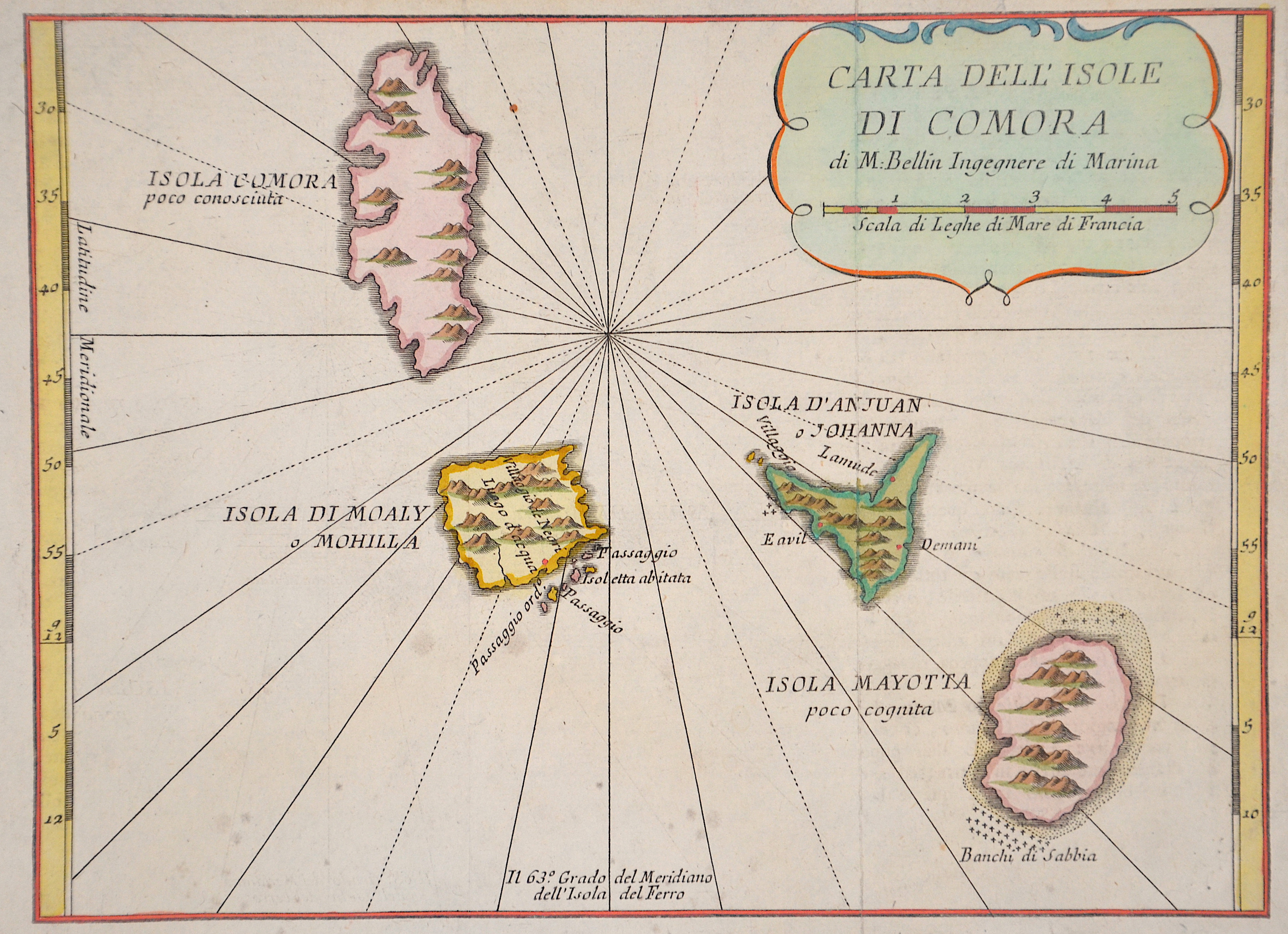
Carta dell isole di Comora

| Article ID | AF0211 |
Title | Carta dell isole di Comora |
Description | Map shows the islands of Comoro in the indian ocean |
| Year | ca. 1763 |
Artist | Bellin (1703-1772) |
Jacques-Nicolas Bellin (1703 Paris -1772 Versailles) was a French cartographer, engineer-geographer, marine hydrographer. As a contributor to the Encyclopédie, he wrote more than a thousand articles on maritime topics. As a cartographer, Bellin distinguished himself primarily in the field of sea cartography. From 1721 he worked for the Dépot des Cartes et Plans de la Marine, from 1741 until his death as an engineer-hydrograph of the Navy. In 1753 his atlas Neptune français, which covered all the coasts of France, was published, and in 1756 the hydrography françoise covering all seas of the earth. In 1764 the five-volume Petit Atlas maritime was published, which Bellin prepared on the orders of the Minister of the Navy, Choiseul. In addition, he wrote a number of geographical works and with Nouvelle méthode pour apprendre la geographie (1769) a geographic textbook for teaching. His maps illustrated, among other things, Bougainville's work Voyage autour du monde, published in 1771. As a co-author of the Encyclopédie edited by Diderot and d'Alembert, Bellin wrote more than a thousand articles in the field of shipping and navy. | |
Historical Description | It is believed that Austronesian immigrants who came by sea from Indonesia in the 1st millennium AD and landed on Madagascar also settled in the Comoros. In addition, Bantu came from East Africa (especially Mozambique). Arabs and Persians also visited the islands; From the 15th century onwards they settled more and more on the four main islands, introduced Islam, founded sultanates mainly in the coastal area and pushed the old population into the interior of the islands. In the 16th century, the Comoros was a regional trading center exporting rice, spices, ambergris and slaves to East African and Middle Eastern port cities. The first European visitors were Portuguese, who landed on Grande Comore in 1505. The Comoros first appeared on a Portuguese map in 1527. For a long time, however, the Europeans were unable to exert a formative influence. The branches founded by the Portuguese, Dutch and French in the 16th century were soon closed. Arab-Islamic influence remained dominant until the middle of the 19th century. The Shirazi sultans appropriated larger estates, which they had managed by local workers, but often also by slaves imported from East Africa. |
| Place of Publication | Paris |
| Dimensions (cm) | 17 x 23 |
| Condition | Very good |
| Coloring | colored |
| Technique | Copper print |