

Adina Sommer
Antique and Contemporary Art
Winzerer Str. 154
80797 München
telephone
+49 89 304714
business hours:
by appointment
Email
![]()


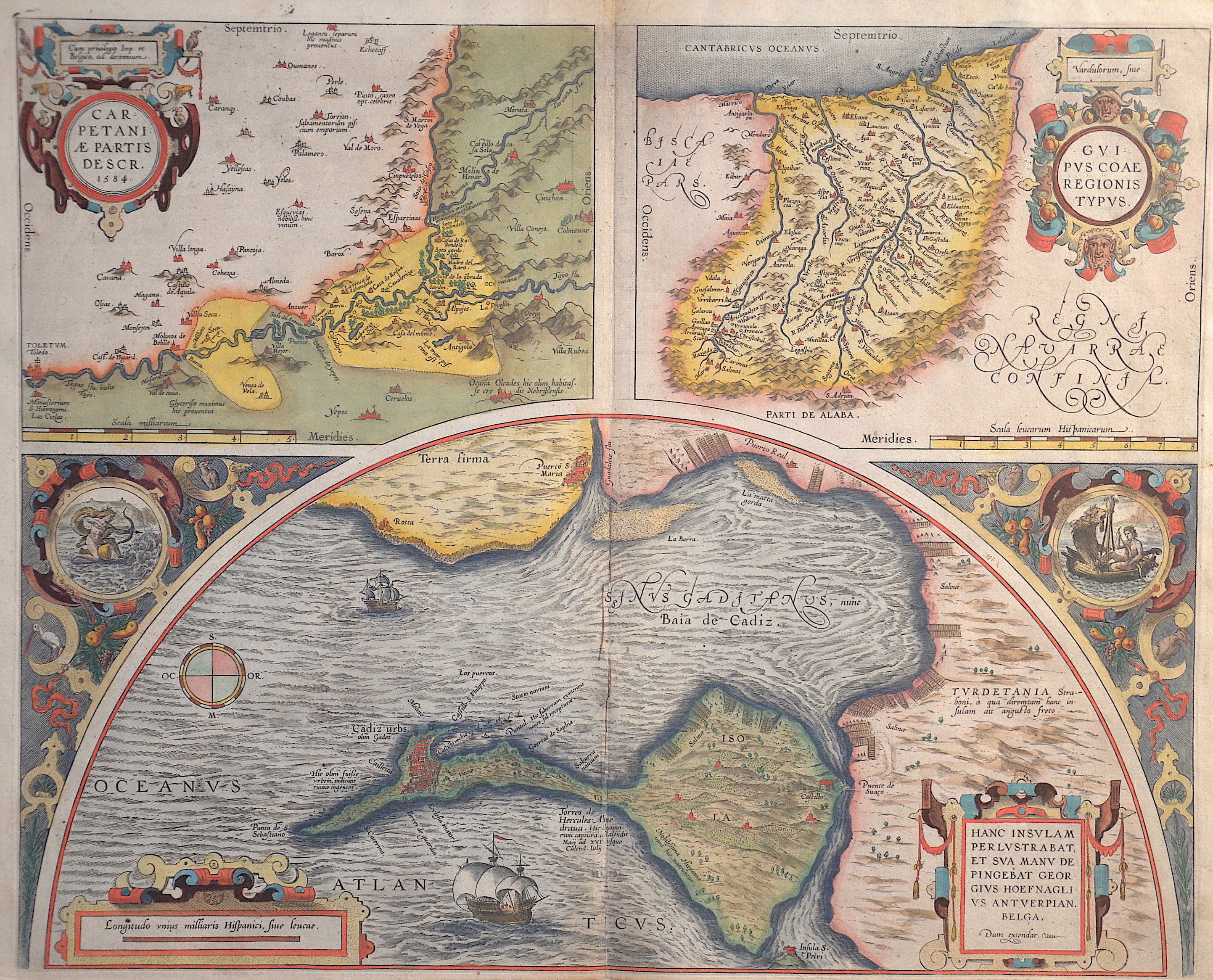
Carpetaniae partis descr. 1584. / Guipuscoae Regionis Typus. / Hanc insulam Perlustrabat, et sua manu de pingebat Georgius Hoefnaglius Antverpian.

| Article ID | EUE3475 |
Title | Carpetaniae partis descr. 1584. / Guipuscoae Regionis Typus. / Hanc insulam Perlustrabat, et sua manu de pingebat Georgius Hoefnaglius Antverpian. |
Description | Decorative map with three inset maps of Toledo, the province Gipuzoka and the capital city of Donostia- San- Sebastian and Cadiz. |
| Year | dated 1584 |
Artist | Ortelius (1527-1598) |
Abraham Ortelius (1527–1598) was a Flemish cartographer and publisher from Antwerp. Originally a map colorist, he became a major figure in cartography through his Theatrum Orbis Terrarum (1570), considered the first modern atlas—a uniform collection of reliable maps in book form. Influenced by Gerardus Mercator, Ortelius published several maps before compiling the Theatrum, which clearly showed America as a separate continent. The work was published in 42 editions and 7 languages by 1612. Unlike many of his peers, Ortelius cited his sources, and his atlas became a milestone in mapmaking and geographic knowledge. | |
Historical Description | Gibraltar is a British Overseas Territory located on the southern end of the Iberian Peninsula. In 1704, during the War of the Spanish Succession, a combined Anglo-Dutch fleet, representing the Grand Alliance, captured the town of Gibraltar on behalf of the Archduke Charles of Austria in his campaign to become King of Spain. The occupation of the town by Alliance forces caused the exodus of the population to the surrounding area of the Campo de Gibraltar.As the Alliance's campaign faltered, the 1713 Treaty of Utrecht was negotiated and ceded control of Gibraltar to Britain to secure Britain's withdrawal from the war. Unsuccessful attempts by Spanish monarchs to regain Gibraltar were made with the siege of 1727 and again with the Great Siege of Gibraltar (1779 to 1783), during the American War of Independence. Gibraltar became a key base for the Royal Navy and played an important role prior to the Battle of Trafalgar. |
| Place of Publication | Antwerp |
| Dimensions (cm) | 39 x 48,5 cm |
| Condition | Perfect condition |
| Coloring | original colored |
| Technique | Copper print |