

Adina Sommer
Antique and Contemporary Art
Winzerer Str. 154
80797 München
telephone
+49 89 304714
business hours:
by appointment
Email
![]()


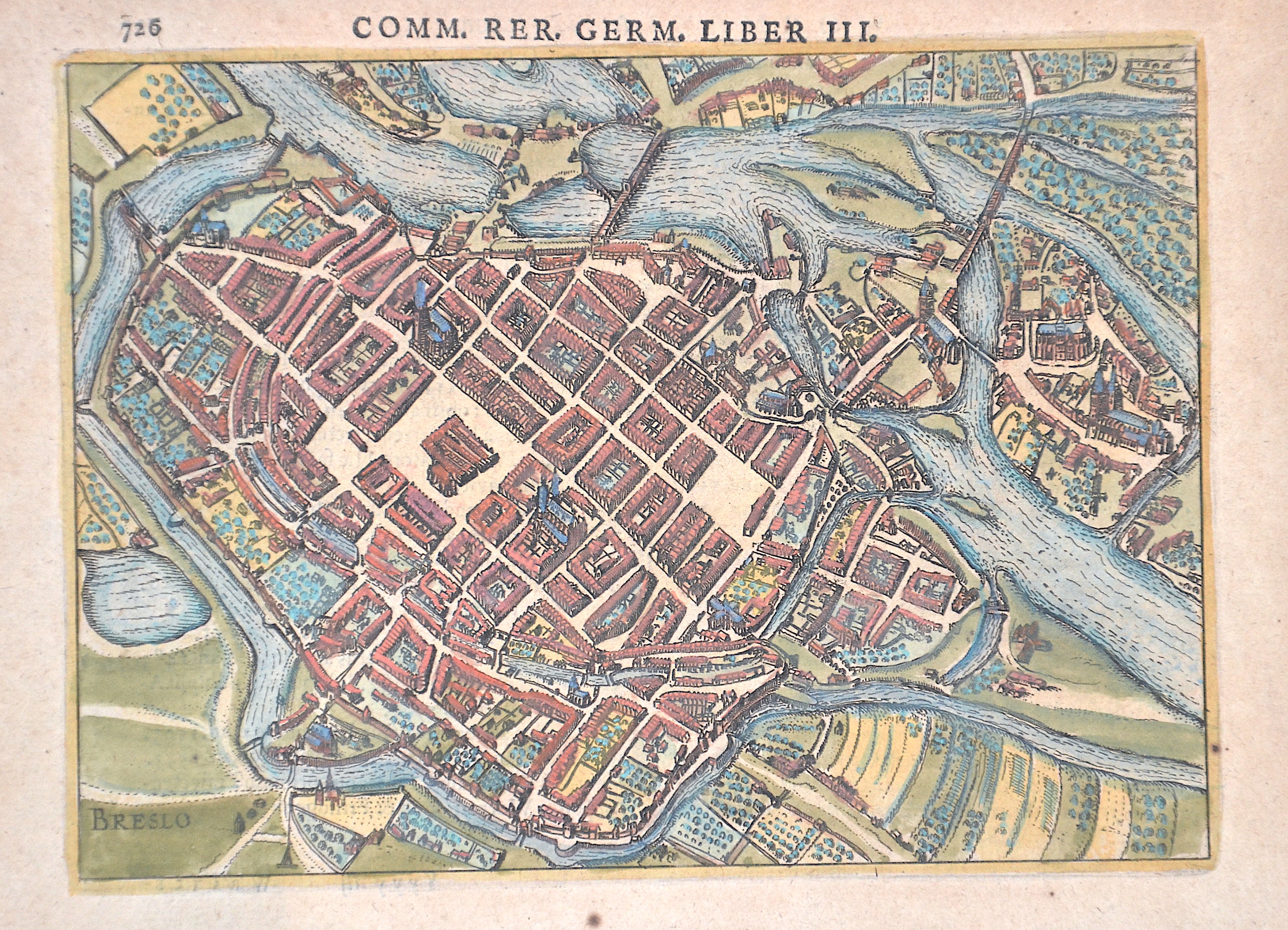
Breslo /Comm. Rer. Germ. Liber III. 726

| Article ID | EUP5504 |
Title | Breslo /Comm. Rer. Germ. Liber III. 726 |
Description | Decorative and detailed city map of Wrocław in Poland. |
| Year | ca. 1620 |
Artist | Bertius (1565-1629) |
Petrus Bertius (1565 -1629) was a Flemish theologian, historian, geographer and cartographer, He grew up in Beveren (Flanders). In 1593 he was appointed mathematics professor and librarian of the University of Leyden. His main cartographic work includes a miniature world atlas of 1600, a pocket atlas of the German Empire of 1616 with 26 engraved maps and 101 city views, a version of the Geographia of Ptolemy with 28 maps by Mercator and 14 maps from the Parergon of Ortelius of 1618, but he is known today as a cartographer with his edition of the Geographia of Ptolemy (based on Mercator's edition of 1578) and for his atlas. | |
Historical Description | Breslau, located on the Oder River in present-day Poland, has a history spanning over a thousand years. As early as the 10th century, a Slavic settlement was established, later becoming part of the Piast dynasty’s Poland. In the 13th century, Breslau was granted city rights under Magdeburg law and developed into an important trade and cultural center in Silesia. The city was a member of the Hanseatic League, which boosted its economic growth. Breslau later came under Habsburg rule and, for periods, Prussian control, remaining an important center for trade, education, and culture. In the 19th and 20th centuries, Breslau was part of the German Empire, undergoing industrialization and modernization. The city was heavily destroyed during World War II. After the war, Breslau became part of Poland and was renamed Wrocław. Most of the German population was expelled and replaced by Poles from the eastern territories. Today, Wrocław is a modern, vibrant city, known for its historic old town, bridges, universities, and cultural events. |
| Place of Publication | Amsterdam |
| Dimensions (cm) | 14 x 18,5 cm |
| Condition | Some browning |
| Coloring | original colored |
| Technique | Copper print |