

Adina Sommer
Antique and Contemporary Art
Winzerer Str. 154
80797 München
telephone
+49 89 304714
business hours:
by appointment
Email
![]()


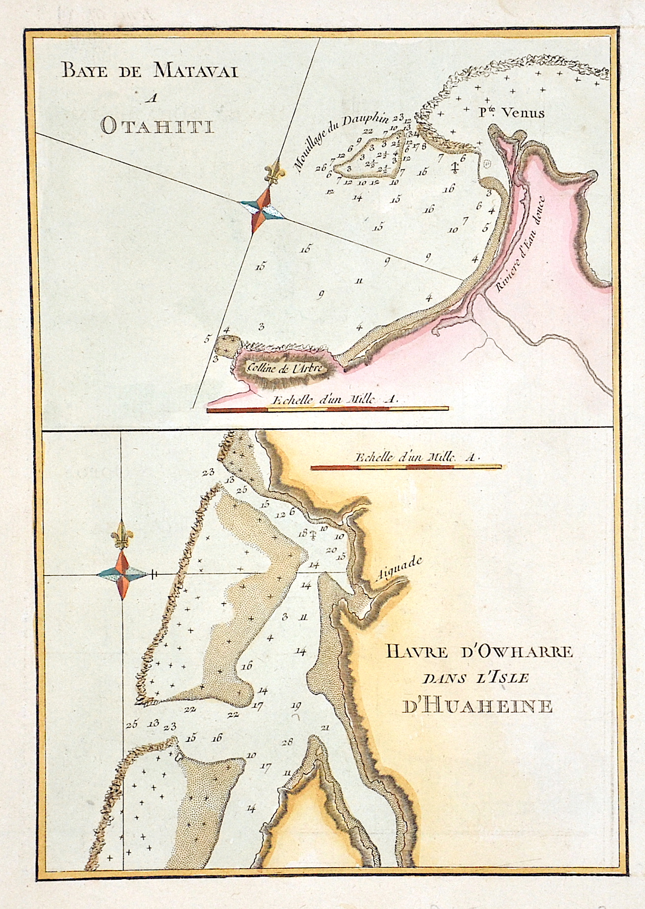
Baye de Matavai a Otahiti / Havre d’Owharre dans L’isle d’Huaheine

| Article ID | OZ0470 |
Title | Baye de Matavai a Otahiti / Havre d’Owharre dans L’isle d’Huaheine |
Description | Map shows Matavai Bay on Tahiti and a bay of Huahine. The islands are located in the southern Pacific and belong to the Society Islands. |
| Year | ca. 1800 |
Artist | Bénard (1734-) |
Historical Description | Records of the Society Islands begin when Ferdinand Magellan discovers the Tuamotu Archipelago in 1521. In June 1767, the archipelago is discovered and recorded by Samuel Wallis. The latter named the main island, today's Tahiti, after the client and sponsor of his circumnavigation. From then on, the island was called King George Island. In April 1768, Louis Antoine de Bougainville reached the Society Islands, unaware that he was encountering a group of islands that had already been discovered. The islands were reliably mapped in 1777 by James Cook, who named the archipelago "Society" because of the arrangement of the islands into a "society". Colonization by France began in 1843, when the Society Islands first became a French protectorate and then a French colony in 1880. |
| Dimensions (cm) | 21,5 x 15 cm |
| Condition | Perfect condition |
| Coloring | colored |
| Technique | Copper print |