

Adina Sommer
Antique and Contemporary Art
Winzerer Str. 154
80797 München
telephone
+49 89 304714
business hours:
by appointment
Email
![]()


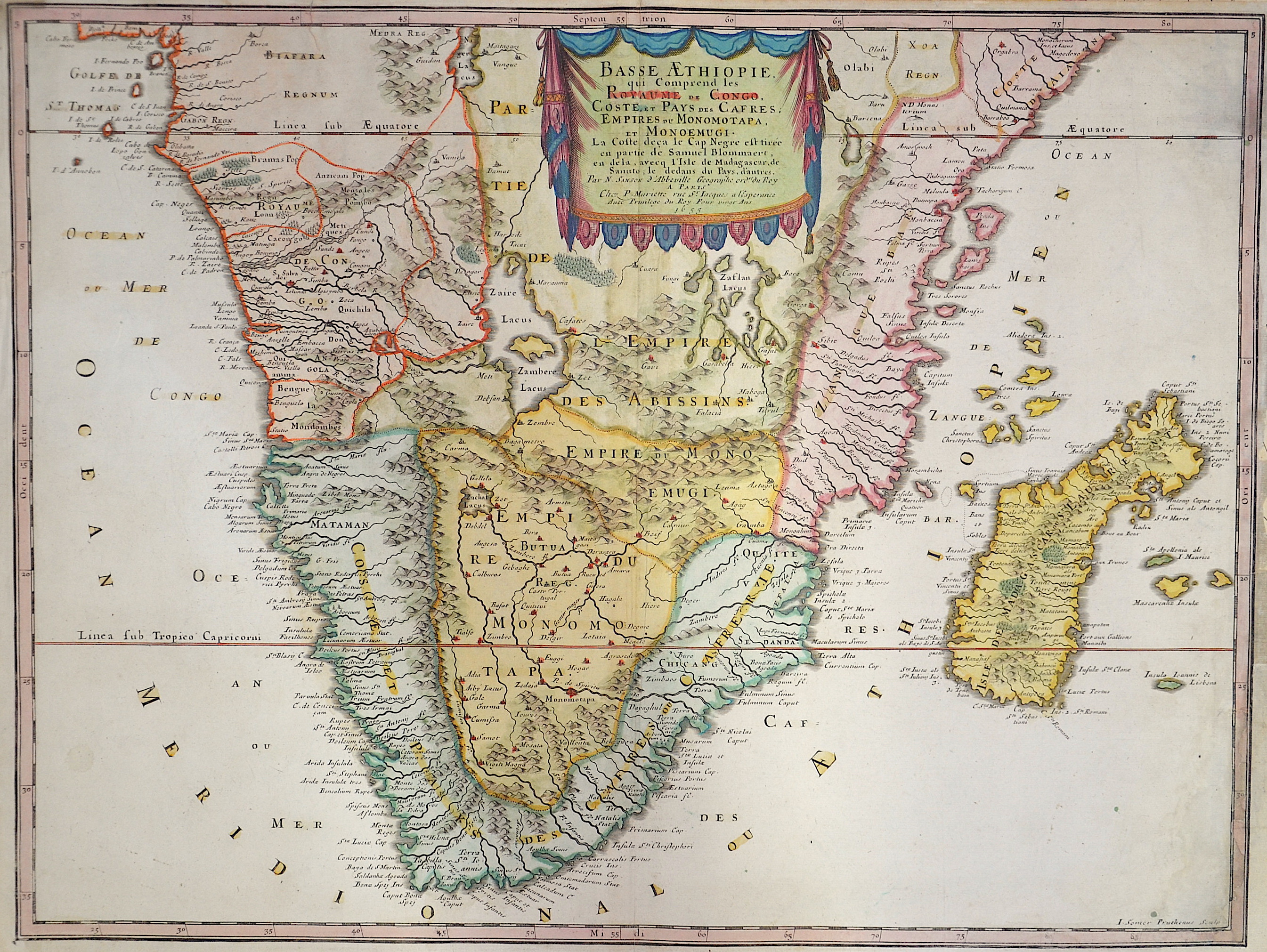
Basse Aethopie qui comprend les Royaume de Congo, Coste, et Pays des Cafres, Empires du Monomotapa, et Monoemugi…

| Article ID | AF0314 |
Title | Basse Aethopie qui comprend les Royaume de Congo, Coste, et Pays des Cafres, Empires du Monomotapa, et Monoemugi… |
Description | Map shows the southern part of Africa with the island of Madagascar |
| Year | dated 1655 |
Artist | Sanson (1600-1667) |
Nicolas Sanson (1600–1667) was a French cartographer, termed by some the creator of French geography, in which he's been called the father of French cartography. Active from 1627, Sanson issued his first map of importance, the ""Postes de France"", which was published by Melchior Tavernier in 1632. After publishing several general atlases himself he became the associate of Pierre Mariette, a publisher of prints. In 1647 Sanson accused the Jesuit Philippe Labbe of plagiarizing him in his Pharus Galliae Antiquae; in 1648 he lost his eldest son Nicolas, killed during the Fronde. Among the friends of his later years was the great Condé. He died in Paris on 7 July 1667. Two younger sons, Adrien (d. 1708) and Guillaume (d. 1703), succeeded him as geographers to the king. In 1692 Hubert Jaillot collected Sanson's maps in an Atlas nouveau. See also the 18th century editions of some of Sanson's works on Delamarche under the titles of Atlas de géographie ancienne and Atlas britannique; and the Catalogue des cartes et livres de géographie de Sanson (1702). | |
Historical Description | Some of the world's oldest paleoanthropological fossils have been unearthed in South Africa. After these pre-humans, various species of the Homo genus such as Homo habilis, Homo naledi, Homo erectus and finally modern man, Homo sapiens, lived here. The beginning of modern historiography in South Africa is set on April 6, 1652, when the Dutchman Jan van Riebeeck built a supply station on the Cape of Good Hope on behalf of the Dutch East India Company (Dutch Vereenigde Oostindische Compagnie, VOC). Due to its strategically favorable location, it was supposed to be a rest stop for merchant ships traveling between Europe and Southeast Asia. During the 17th and 18th centuries, the settlement, which slowly but steadily expanded, was owned by the Netherlands. The settlers initially spread to the western Cape region, which at that time was a retreat for the Khoisan. Several hundred French Huguenots, after being persecuted in France from 1686, came into the country via the Netherlands from 1688 and brought the viticulture culture with them. The French-speaking names of wineries and fruit-growing farms in the western Cape can be traced back to them. After reaching the Bantu settlement border eastwards in 1770, they waged a series of wars - the border wars - against the Xhosa people. The Cape Dutch brought numerous slaves into the country from Indonesia, Madagascar and India. |
| Place of Publication | Paris |
| Dimensions (cm) | 42 x 56 |
| Condition | Lower right corner perfectly restored |
| Coloring | original colored |
| Technique | Copper print |