

Adina Sommer
Antique and Contemporary Art
Winzerer Str. 154
80797 München
telephone
+49 89 304714
business hours:
by appointment
Email
![]()


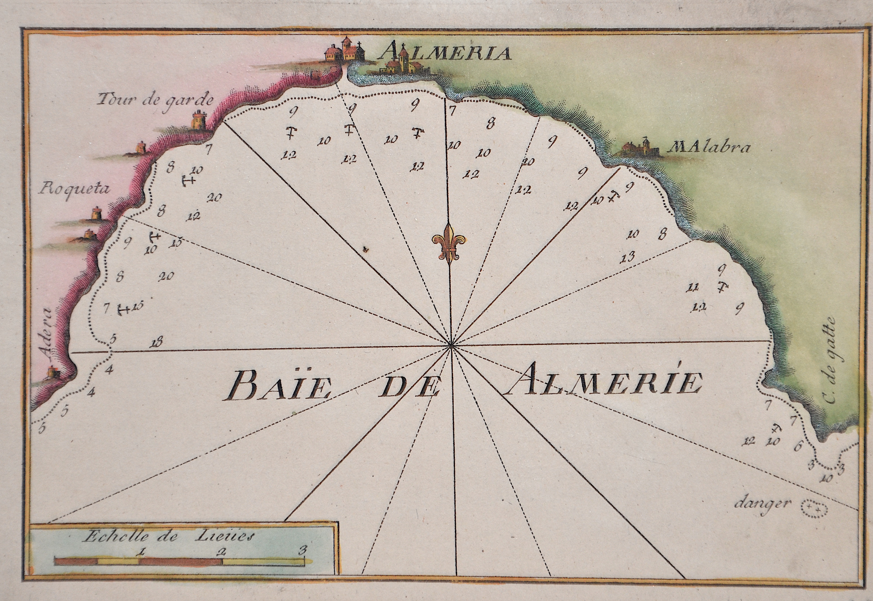
Baie de Almerie

| Article ID | EUE4209 |
Title | Baie de Almerie |
Description | Mao shows the bay of Costa Almeira and the city of Almeira ina Andalusia, Spain. |
| Year | ca. 1730 |
Artist | Roux (1725-1793) |
Joseph Roux (1725–1793), from Marseille, came from a family of hydrographers and marine cartographers. He ran a workshop-boutique at the Vieux-Port of Marseille, which he had taken over from his father. His main focus was the creation of nautical charts and plans of harbors, bays, and coastlines — particularly in the Mediterranean region.bIn 1764, for example, he published a series of twelve large sheets under the title Carte de la Mer Méditerranée en douze feuilles ("Map of the Mediterranean Sea in twelve sheets"). He produced chart sheets with depth soundings (for navigation), anchorages, coastlines, and more — for example: maps like “Isle de Sicile. Mer Méditerranée” from around 1760. Around that time, nautical cartography was entering a phase in which detailed harbor and coastal plans were becoming increasingly important for trade, naval operations, and navigation. Although Roux’s maps were rooted in Marseille, they gained broader significance due to his status as Hydrographe du Roi (Hydrographer to the King) and the widespread distribution of his works. | |
Historical Description | In prehistoric and prehistoric times, Iberians, Celts and Basques settled on the Iberian peninsula named after the former. In the 11th century BC The Phoenicians settled on the south coast; the most famous of their colonies was Cadiz. The name Spain is derived from the Roman name Hispania (from Phoenician ishapan "land of the rock hyrax". In the early 8th century, the Moors destroyed the Visigoth Empire and conquered the entire Iberian Peninsula. Their centuries of rule shaped the country. The Arabic heritage was reflected in both the architecture and the language. However, the Moors were unable to establish themselves permanently in the northern outskirts of the peninsula. From there the "Reconquest" (Reconquista) started. In this process, which spanned several centuries (722–1492) and was not continuous, the Muslim empires were gradually pushed back by the Christian empires until the fall of Granada in 1492, the last Moorish state structure on the peninsula also disappeared. In the 15th century, the kingdoms of Castile and Aragon were united. Aragon was an important maritime power in the Mediterranean at that time. The Spanish colonial empire extended around 1600 across large parts of South and Central America, the southern part of today's USA and the Philippines. As the English and French also intensified their colonial efforts, Spain gradually lost its supremacy. The liberation wars of the American states, particularly the Mexican and South American wars of independence in the early 19th century, brought independence to most of the colonies. In 1898, the last major properties were lost to the United States during the Spanish-American War, which meant the end of the colonial empire. The African colonies that followed later (Spanish-Morocco, Spanish-Sahara and Equatorial Guinea) finally became independent in the 20th century. |
| Place of Publication | Paris |
| Dimensions (cm) | 13 x 19 cm |
| Condition | Perfect condition |
| Coloring | colored |
| Technique | Copper print |