

Adina Sommer
Antique and Contemporary Art
Winzerer Str. 154
80797 München
telephone
+49 89 304714
business hours:
by appointment
Email
![]()


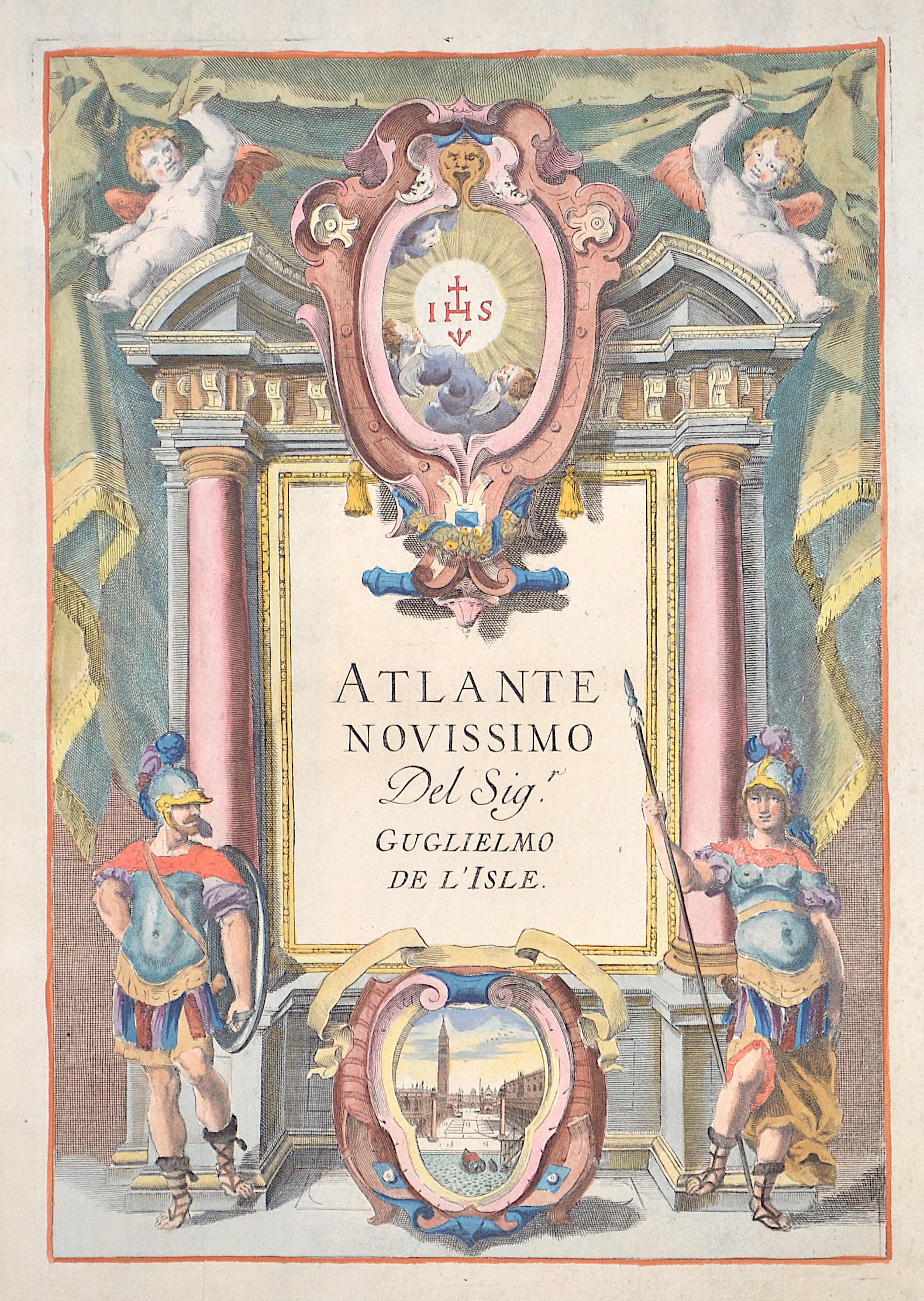
Atlante novissimo del Sig.

| Article ID | T0101 |
Title | Atlante novissimo del Sig. |
Description | Titlepage showing male and female soldiers ans a view of St Mark's Square and the canals of Venice. |
| Year | ca. 1750 |
Artist | L´Isle, de/ Albizzi G. (1675-1726) |
Guillaume De L’Isle (1675–1726) was a renowned French cartographer famous for his accurate maps of Europe, the Americas, and Africa. He joined the French Académie Royale des Sciences, signing his maps as “Géographe de l’Académie,” and later became Premier Géographe du Roi in 1718, teaching geography to the Dauphin. De L’Isle mostly worked from his office, relying on a strong network of traveler reports and scientific updates, ensuring his maps were precise and honest. He openly noted uncertain information, such as a disputed river in Louisiana. In 1700, he won a legal case against Jean-Baptiste Nolin for plagiarism. Unlike the Sanson workshop, which often published outdated maps, De L’Isle focused on up-to-date, scientifically grounded cartography. | |
Historical Description | The title page is one of the most important parts of an atlas or book. It appears at the beginning of the book and describes the actual title and the context or subject of the book or atlas. The title page often shows the title of the work, the person or institution responsible for its intellectual content, and the imprint, which includes the name and address of the publisher as well as the date of publication. Further information about the publication is often printed on the back of the title page.The first printed books or incunabula had no title pages: the text simply began on the first page, and the book was often identified by its opening words – the incipit. Maps were usually published in atlases, and atlases were books with titles. Even here, title pages were individual works of art. A publisher emphasized the importance of a book by introducing it with a spectacular entrée.Usually, the images on an atlas title page referred to the subject matter: measuring instruments, mythological, astronomical, religious, scientific, and allegorical references and facts were combined in a composition that represented the pride of scientific and intellectual progress. An atlas title page is often no more than an outstanding artistic and expressive cartouche. |
| Place of Publication | Venice |
| Dimensions (cm) | 29 x 20 cm |
| Condition | Perfect condition |
| Coloring | original colored |
| Technique | Copper print |