

Adina Sommer
Antique and Contemporary Art
Winzerer Str. 154
80797 München
telephone
+49 89 304714
business hours:
by appointment
Email
![]()


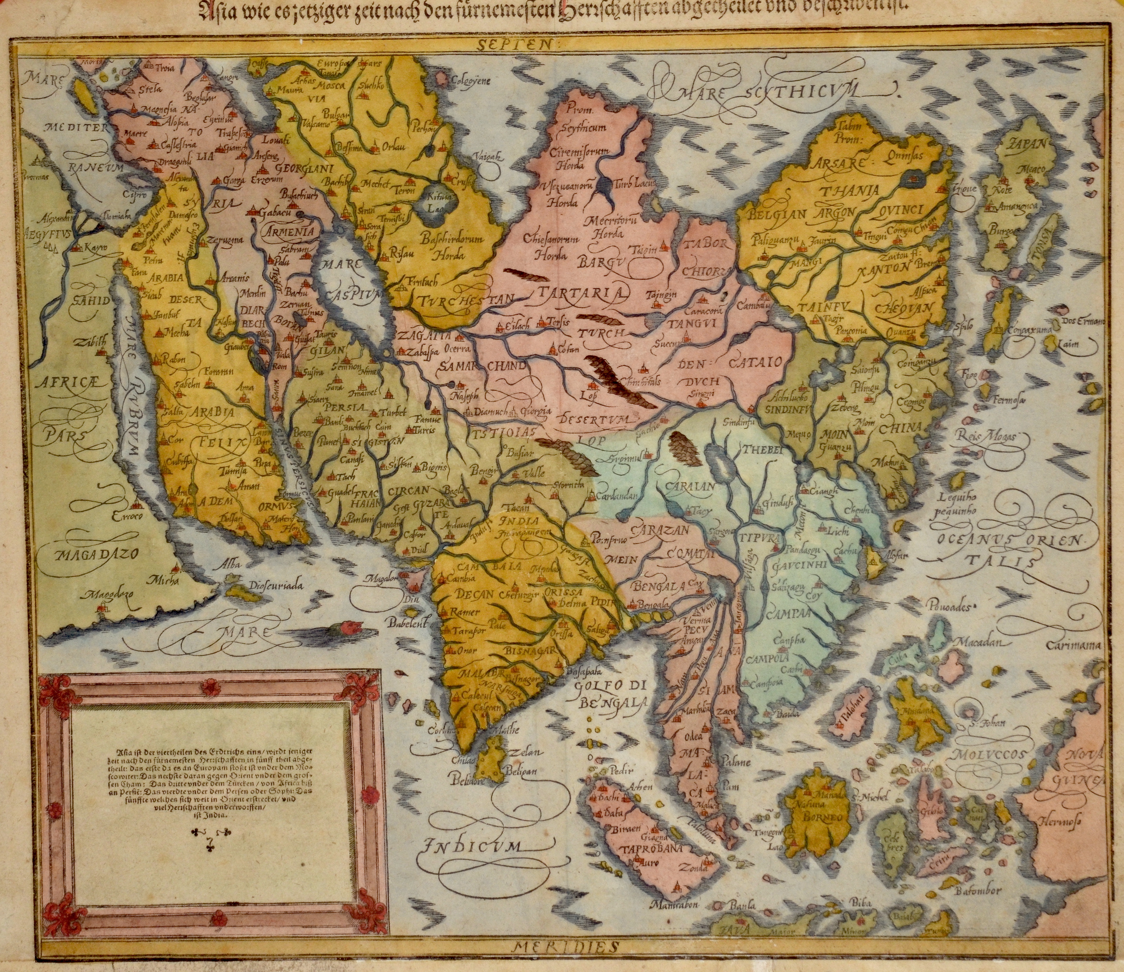
Asia wie es jetziger Zeit nach den fürnemsten Herrschaften beschriben ist

| Article ID | ASX038 |
Title | Asia wie es jetziger Zeit nach den fürnemsten Herrschaften beschriben ist |
Description | Map of total Asia, Southeast Asia and Japan. On reverse text and ornamental decoration. Asia is Earth's largest and most populous continent, located primarily in the Eastern and Northern Hemispheres. |
| Year | ca. 1588 |
Artist | Münster (1489-1552) |
Sebastian Münster (1489–1552) was a leading Renaissance cosmographer. His most famous work, the Cosmographia (1544), was a comprehensive description of the world with 24 maps, based on research dating back to 1528. Continuously revised, the 1550 edition already included many new maps. It was the first scientific yet accessible world description published in German, illustrated with numerous woodcuts by artists such as Hans Holbein the Younger. Between 1544 and 1650, the Cosmographia appeared in 46 editions (27 in German) and was translated into several languages. Münster’s work combined the knowledge of scholars, artists, and travelers and remained influential long after his death. | |
Historical Description | Asia is Earth's largest and most populous continent, located primarily in the Eastern and Northern Hemispheres. The history of Asia can be seen as the distinct histories of several peripheral coastal regions: East Asia, South Asia, Southeast Asia and the Middle East, linked by the interior mass of the Central Asian steppes. The coastal periphery was home to some of the world's earliest known civilizations, each of them developing around fertile river valleys. The civilizations in Mesopotamia, the Indus Valley and the Yellow River shared many similarities. These civilizations may well have exchanged technologies and ideas such as mathematics and the wheel. Other innovations, such as writing, seem to have been developed individually in each area. Cities, states and empires developed in these lowlands. The central steppe region had long been inhabited by horse-mounted nomads who could reach all areas of Asia from the steppes. The earliest postulated expansion out of the steppe is that of the Indo-Europeans, who spread their languages into the Middle East, South Asia, and the borders of China, where the Tocharians resided. The northernmost part of Asia, including much of Siberia, was largely inaccessible to the steppe nomads, owing to the dense forests, climate and tundra. These areas remained very sparsely populated. The center and the peripheries were mostly kept separated by mountains and deserts. The Caucasus and Himalaya mountains and the Karakum and Gobi deserts formed barriers that the steppe horsemen could cross only with difficulty. While the urban city dwellers were more advanced technologically and socially, in many cases they could do little in a military aspect to defend against the mounted hordes of the steppe. However, the lowlands did not have enough open grasslands to support a large horsebound force; for this and other reasons, the nomads who conquered states in China, India, and the Middle East often found themselves adapting to the local, more affluent societies. |
| Place of Publication | Basle |
| Dimensions (cm) | 32 x 36 |
| Condition | Lower margin enlarged |
| Coloring | original colored |
| Technique | Woodcut |