

Adina Sommer
Antique and Contemporary Art
Winzerer Str. 154
80797 München
telephone
+49 89 304714
business hours:
by appointment
Email
![]()


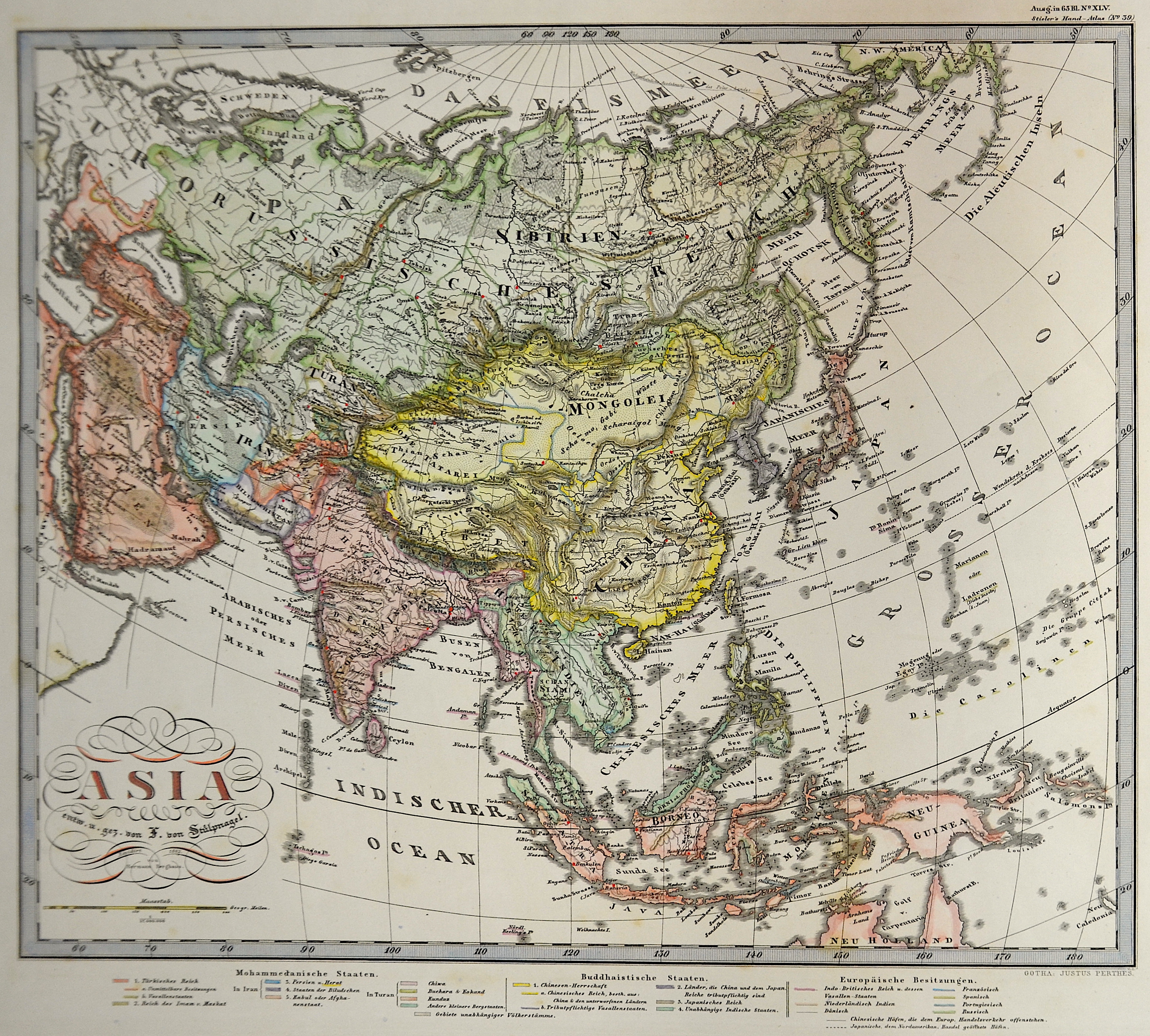
Asia entw. u. gez. von L. von Stülpnagel.

| Article ID | ASX1112 |
Title | Asia entw. u. gez. von L. von Stülpnagel. |
Description | Decorative map of total Asia with an index of description. |
| Year | dated 1862 |
Artist | Perthes (1749-1816) |
Johann Georg Justus Perthes ( 1749- 1816) was a German bookseller and publisher. Justus Perthes was the son of the Rudolstadt court physician Johann Justus Perthes. After training as a merchant, he obtained employment in the bookshop of Carl Wilhelm Ettinger in Gotha. Together with the latter and his later brother-in-law Friedrich Duerfeldt, he founded a company in 1778 to continue Ettinger's bookshop on his own. In September 1785, he founded Justus Perthes' Verlagsbuchhandlung, which from then on produced and distributed the Gothaische Genealogische Hofkalender, first published in 1763 and published by Ettinger, and its French edition, the Almanach de Gotha. Thanks to Perthes, the reference work soon known throughout Europe as "Der Gotha" was transformed from a calendar of the Enlightenment to an encyclopedia of the nobility with a diplomatic-statistical state handbook. In 1815, Perthes, together with the cartographers Adolf Stieler and Christian Gottlieb Reichard, planned the publication of an atlas, which was to be distinguished by "convenient format, the greatest possible accuracy, clarity and completeness, yet practical selection, uniformity of projection and scale, beautiful paper, good printing, careful illumination, and a reasonable price" and expand the publisher's program. In 1816, the year of Perthes' death, the first edition of Stieler's Hand-Atlas was published, which established the worldwide reputation of Justus Perthes' Geographical (Publishing) Institute Gotha - which only came into being after Perthes' death. | |
Historical Description | Asia is Earth's largest and most populous continent, located primarily in the Eastern and Northern Hemispheres. The history of Asia can be seen as the distinct histories of several peripheral coastal regions: East Asia, South Asia, Southeast Asia and the Middle East, linked by the interior mass of the Central Asian steppes. The coastal periphery was home to some of the world's earliest known civilizations, each of them developing around fertile river valleys. The civilizations in Mesopotamia, the Indus Valley and the Yellow River shared many similarities. These civilizations may well have exchanged technologies and ideas such as mathematics and the wheel. Other innovations, such as writing, seem to have been developed individually in each area. Cities, states and empires developed in these lowlands. The central steppe region had long been inhabited by horse-mounted nomads who could reach all areas of Asia from the steppes. The earliest postulated expansion out of the steppe is that of the Indo-Europeans, who spread their languages into the Middle East, South Asia, and the borders of China, where the Tocharians resided. The northernmost part of Asia, including much of Siberia, was largely inaccessible to the steppe nomads, owing to the dense forests, climate and tundra. These areas remained very sparsely populated. The center and the peripheries were mostly kept separated by mountains and deserts. The Caucasus and Himalaya mountains and the Karakum and Gobi deserts formed barriers that the steppe horsemen could cross only with difficulty. While the urban city dwellers were more advanced technologically and socially, in many cases they could do little in a military aspect to defend against the mounted hordes of the steppe. However, the lowlands did not have enough open grasslands to support a large horsebound force; for this and other reasons, the nomads who conquered states in China, India, and the Middle East often found themselves adapting to the local, more affluent societies. |
| Place of Publication | Gotha |
| Dimensions (cm) | 32 x 36 |
| Condition | Perfect condition |
| Coloring | original colored |
| Technique | Steel engraving |