

Adina Sommer
Antique and Contemporary Art
Winzerer Str. 154
80797 München
telephone
+49 89 304714
business hours:
by appointment
Email
![]()


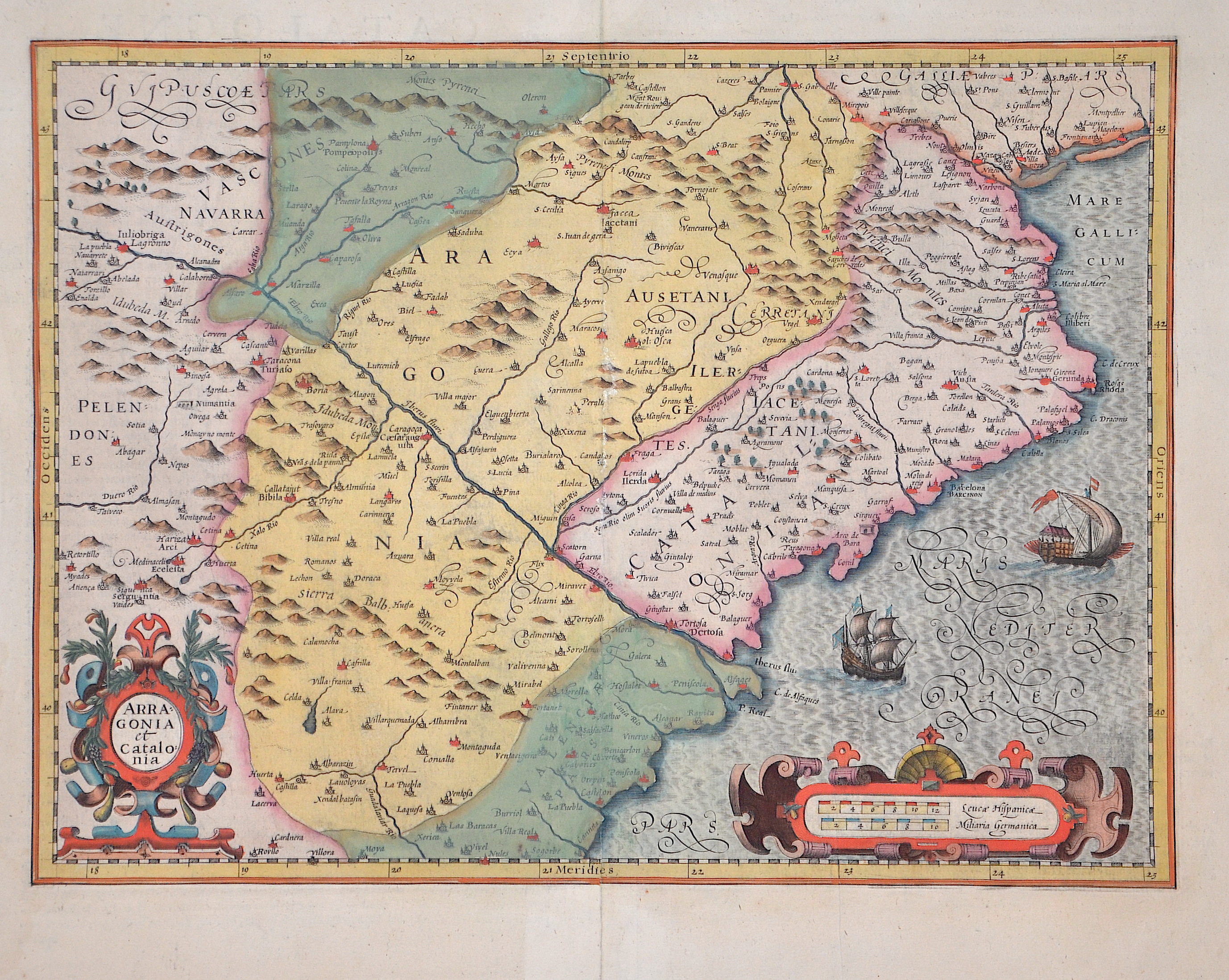
Arragonia et Catalonia

| Article ID | EUE1541 |
Title | Arragonia et Catalonia |
Description | Map shows Catalonia, Aronia, the northern part of Valencia, two sailing ship staffages and two cartouches. |
| Year | ca. 1606 |
Artist | Mercator (1512-1594) |
Gerardus Mercator (1512 - 1594). He was a cartographer, philosopher and mathematician. He is best known for his work in cartography, in particular the world map of 1569 based on a new projection which represented sailing courses of constant bearing as straight lines. He is renowned to the present day as the cartographer who created a world map based on a new projection which represented sailing courses of constant bearing as straight lines. In his own day he was the world's most famous geographer but in addition he had interests in theology, philosophy, history, mathematics and magnetism as well as being an accomplished engraver, calligrapher and maker of globes and scientific instruments. He wrote few books but much of his knowledge is to be found in the copious legends on his wall maps and the prefaces that he composed for his atlas ,the first in which the term "atlas" appears and the sections within it. | |
Historical Description | The Pyrenean region has always been a preferred transit area for culture and trade between the Near East and the British Isles. In the course of the wars between the Frankish Empire and the Arabs, several counties were created at the end of the 8th and beginning of the 9th century in the northern part of Catalonia, which today belongs to Spain, and in northern Catalonia, which today belongs to France. At first, these counties were under the control of the West Frankish or French king, but in the course of the following centuries they became increasingly independent. As a result of the marriage contract between Raimund Berengar IV, Count of Barcelona, and Petronila/Peronella, heiress to the Crown of Aragon, who was only one year old, a state community known as the Crown of Aragon was created in 1137 from Aragon and the lands of the Counts of Barcelona, which were largely identical to Catalonia in the 12th century. The Franco-Spanish War of 1635-1659 saw separatist movements in Spain. In 1640, Portugal successfully regained its independence. Catalonia also tried to regain its former independence, but was not successful in it. In the Peace of the Pyrenees, Spain had to cede the Catalan territories north of the Pyrenees to France, while the rest of Catalonia remained with Spain. In the War of the Spanish Succession (1700-1713), which was about the succession to the throne after the death of Charles II, who remained childless, most Catalans supported the Habsburg pretender to the throne, Archduke Charles, against the Bourbon Philip of Anjou. Between 1812 and 1814, Catalonia was part of the French Empire and was divided first into four and later into two French départements. In the Second Republic, Catalonia was initially granted provisional autonomy in 1931 with the re-establishment of the Generalitat; this was codified in the Statute of Autonomy of 1932. Because of its historical, linguistic and cultural differences from the rest of Spain, Catalonia sees itself as a separate nation. The term nation is understood in the sense of a cultural nation and is not defined by ethnic affiliation. |
| Place of Publication | Amsterdam |
| Dimensions (cm) | 34,5 x 46 cm |
| Condition | Some restoration at centerfold |
| Coloring | original colored |
| Technique | Copper print |