

Adina Sommer
Antique and Contemporary Art
Winzerer Str. 154
80797 München
telephone
+49 89 304714
business hours:
by appointment
Email
![]()


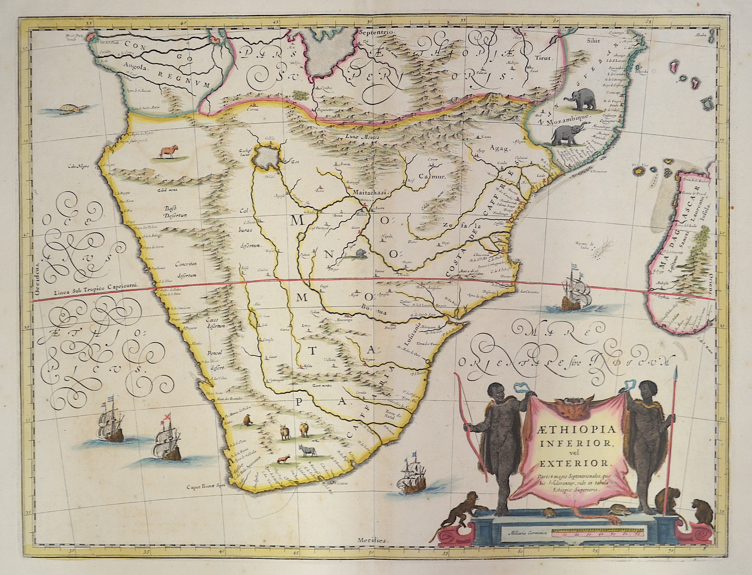
Aethiopia inferior, vel exterior

| Article ID | AF0108 |
Title | Aethiopia inferior, vel exterior |
Description | Map shows Southern Africa up to the equator with Botswana, Rhodesia, partly Mozambique and Madagascar. Furthermore a magnificent title cartouche. |
| Year | ca. 1661 |
Artist | Janssonius/Mercator-Hondius, H. (1588-1664) |
Johannes Janssonius (Jansson),( 1588- 1664) Amsterdam was born in Arnhem, the son of Jan Janszoon the Elder,a publisher and bookseller. In 1612 he married Elisabeth de Hondt, the daughter of Jodocus Hondius. He produced his first maps in 1616 of France and Italy. In 1623 Janssonius owned a bookstore in Frankfurt am Main, later also in Danzig, Stockholm, Copenhagen, Berlin, Königsberg, Geneva and Lyon. In the 1630s he formed a partnership with his brother in law Henricus Hondius, and together they published atlases as Mercator/Hondius/Janssonius. Under the leadership of Janssonius the Hondius Atlas was steadily enlarged. Renamed Atlas Novus, it had three volumes in 1638, one fully dedicated to Italy. 1646 a fourth volume came out with English County Maps, a year after a similar issue by Willem Blaeu. Janssonius' maps are similar to those of Blaeu, and he is often accused of copying from his rival, but many of his maps predate those of Blaeu and/or covered different regions. By 1660, at which point the atlas bore the appropriate name Atlas Major, there were 11 volumes, containing the work of about a hundred credited authors and engravers. It included a description of most of the cities of the world (Townatlas), of the waterworld (Atlas Maritimus in 33 maps), and of the Ancient World (60 maps). The eleventh volume was the Atlas of the Heavens by Andreas Cellarius. Editions were printed in Dutch, Latin, French, and a few times in German. | |
Historical Description | Some of the world's oldest paleoanthropological fossils have been unearthed in South Africa. After these pre-humans, various species of the Homo genus such as Homo habilis, Homo naledi, Homo erectus and finally modern man, Homo sapiens, lived here. The beginning of modern historiography in South Africa is set on April 6, 1652, when the Dutchman Jan van Riebeeck built a supply station on the Cape of Good Hope on behalf of the Dutch East India Company (Dutch Vereenigde Oostindische Compagnie, VOC). Due to its strategically favorable location, it was supposed to be a rest stop for merchant ships traveling between Europe and Southeast Asia. During the 17th and 18th centuries, the settlement, which slowly but steadily expanded, was owned by the Netherlands. The settlers initially spread to the western Cape region, which at that time was a retreat for the Khoisan. Several hundred French Huguenots, after being persecuted in France from 1686, came into the country via the Netherlands from 1688 and brought the viticulture culture with them. The French-speaking names of wineries and fruit-growing farms in the western Cape can be traced back to them. After reaching the Bantu settlement border eastwards in 1770, they waged a series of wars - the border wars - against the Xhosa people. The Cape Dutch brought numerous slaves into the country from Indonesia, Madagascar and India. |
| Dimensions (cm) | 38 x 50 |
| Condition | Very good |
| Coloring | original colored |
| Technique | Copper print |