

Adina Sommer
Antique and Contemporary Art
Winzerer Str. 154
80797 München
telephone
+49 89 304714
business hours:
by appointment
Email
![]()


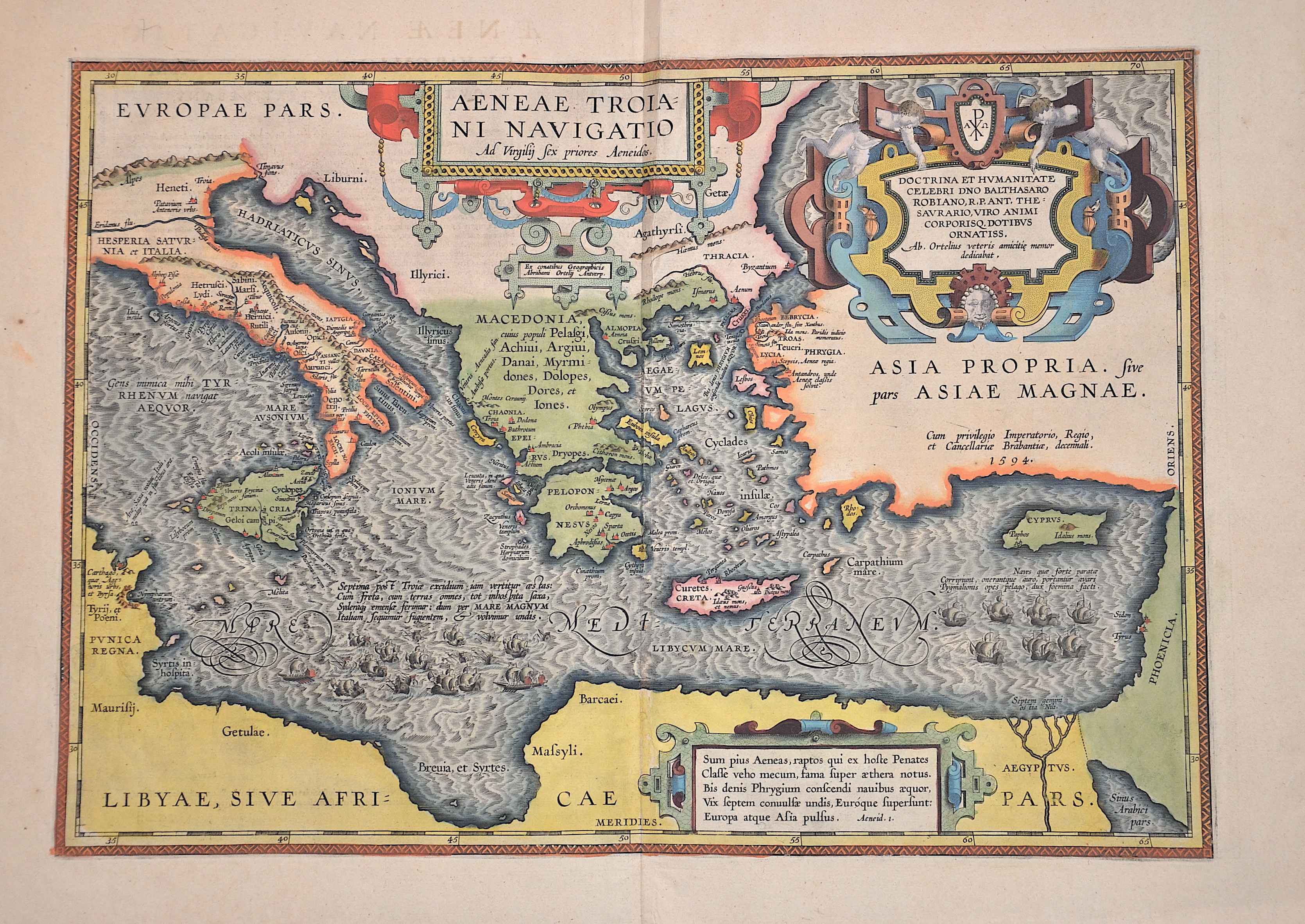
Aeneae Troiani Navigatio

| Article ID | EUX5305 |
Title | Aeneae Troiani Navigatio |
Description | Map shows the Mediterranean from Africa (from Cartago) via Italy, Greece, Crete, Türkiye, Cyprus to the Holy Land. Furthermore, three magnificent cartouches and many sailing ship. Title: The Navigation of Aeneas, by Virgil. |
| Year | ca. 1601 |
Artist | Ortelius (1527-1598) |
Abraham Ortelius (1527–1598) was a Flemish cartographer and publisher from Antwerp. Originally a map colorist, he became a major figure in cartography through his Theatrum Orbis Terrarum (1570), considered the first modern atlas—a uniform collection of reliable maps in book form. Influenced by Gerardus Mercator, Ortelius published several maps before compiling the Theatrum, which clearly showed America as a separate continent. The work was published in 42 editions and 7 languages by 1612. Unlike many of his peers, Ortelius cited his sources, and his atlas became a milestone in mapmaking and geographic knowledge. | |
Historical Description | Aeneas was a central figure in Roman mythology and the main character in Virgil's epic poem “Aeneid”. He was the son of the goddess of love Venus and the Trojan prince Anchises and was regarded as the founder of Rome. Mythological tales based on Homer tell of Aeneas' rescue from the sinking Troy and his journey to the west. According to legend, Aeneas' journeys from Troy ultimately led to the founding of the city of Alba Longa, from which Rome would one day emerge. |
| Place of Publication | Antwerp |
| Dimensions (cm) | 34,5 x 49 cm |
| Condition | Perfect condition |
| Coloring | original colored |
| Technique | Copper print |