

Adina Sommer
Antique and Contemporary Art
Winzerer Str. 154
80797 München
telephone
+49 89 304714
business hours:
by appointment
Email
![]()


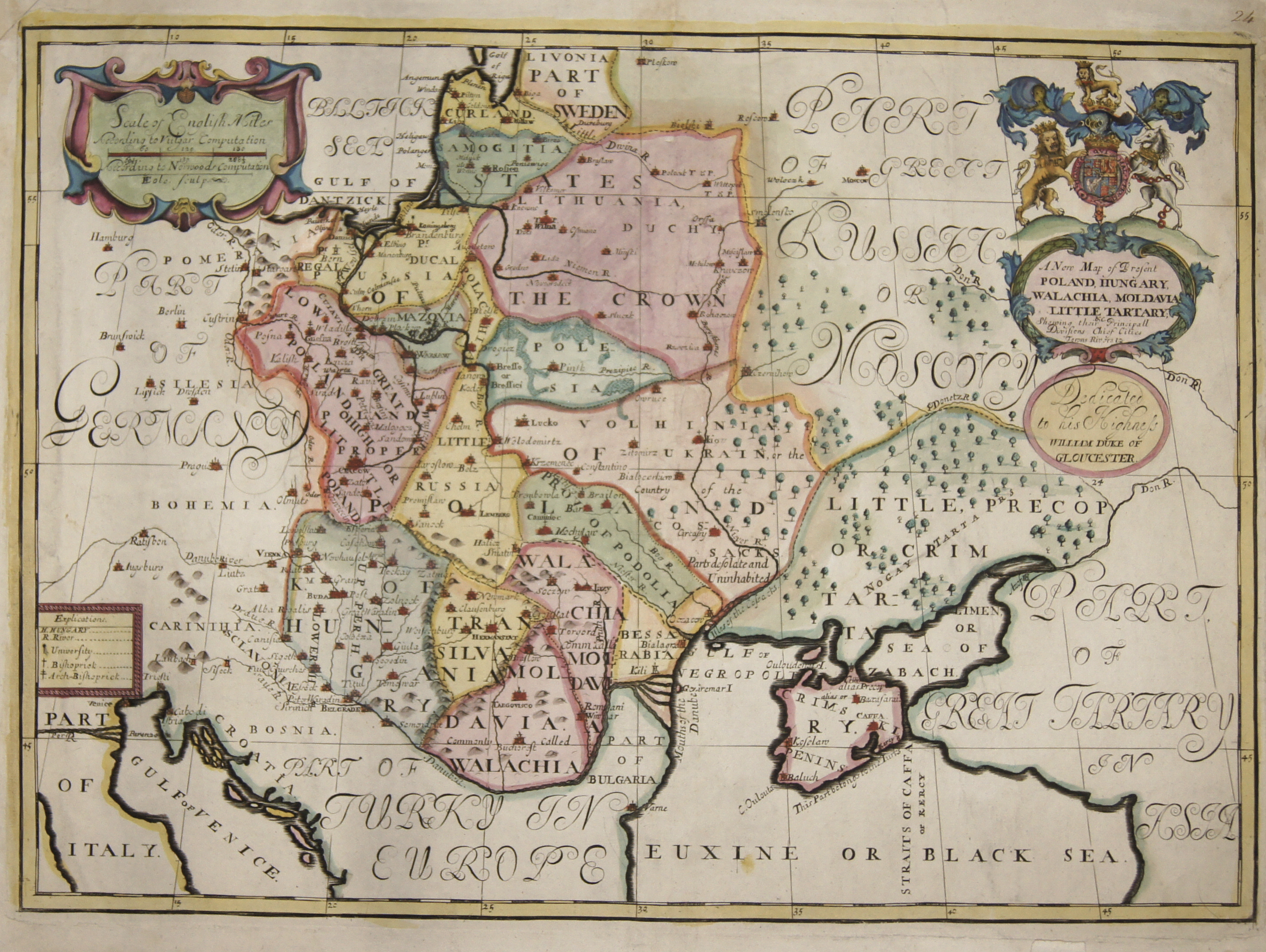
A New Map of Present Poland, Hungary, Walachia, Moldavia, Little Tartary
| Article ID | EUP3769 |
Title | A New Map of Present Poland, Hungary, Walachia, Moldavia, Little Tartary |
Map shows the whole of Poland, Hungary, Romania, Bulgaria, the Ukraine and two cartouches including the title cartouche with the English coat of arms. This map was part of an atlas dedicated to the Duke of Glocester, who went to school in Oxford at the time. The maps were highly regarded for their accuracy at the time. | |
| Year | ca. 1712 |
Artist | Wells |
| Place of Publication | Oxford |
| Dimensions (cm) | 36,5 x 51,5 cm |
| Condition | Very good |
| Coloring | original colored |
| Technique | Copper print |
:
61.50 €
( A reproduction can be ordered individually on request. )