

Adina Sommer
Antique and Contemporary Art
Winzerer Str. 154
80797 München
telephone
+49 89 304714
business hours:
by appointment
Email
![]()


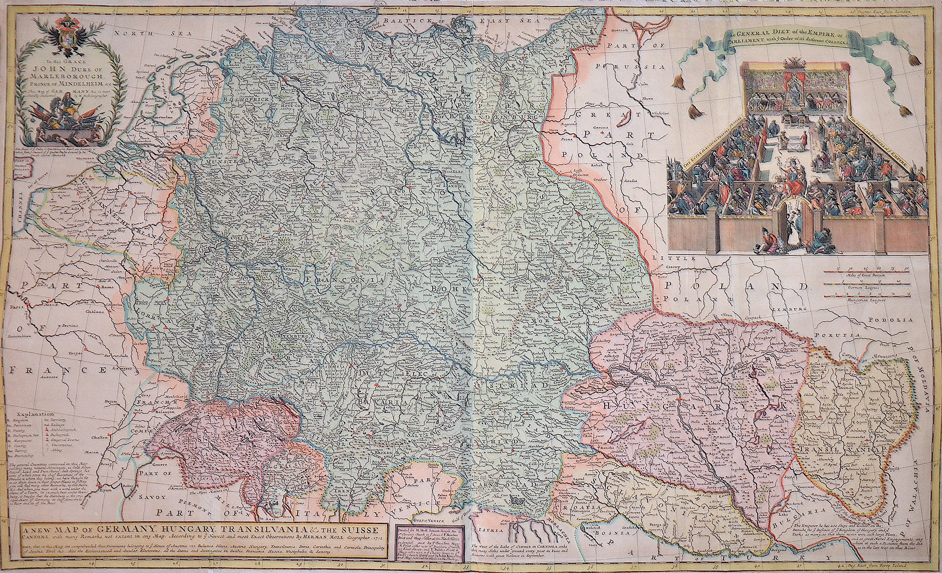
A new map of Germany. Hungary. Transivania and the Suisse Cantons……..

| Article ID | EUO1663 |
Title | A new map of Germany. Hungary. Transivania and the Suisse Cantons…….. |
Description | Map shows total Germany with Hungary, Transilvania, Slavonia and Suisse, representation of a court of law. |
| Year | ca. 1712 |
Artist | Moll (1654-1732) |
Hermann Moll (1654–1732) was a London-based engraver, cartographer, and publisher known for his detailed maps of Europe and the Americas. He also created maps for Defoe’s Robinson Crusoe and Swift’s Gulliver’s Travels. His major works include the Atlas Geographus (1711–1717) and Atlas Minor (1719), both published in multiple editions. Moll collaborated with explorer William Dampier, whose travel reports provided valuable geographic data for Moll’s maps. Dampier’s popularity and the public’s growing interest in travel literature helped boost Moll’s success, leading other authors like Defoe and Swift to use his illustrations. | |
Historical Description | In the historical sense, Eastern Europe refers to Ukraine, the European part of Russia, Belarus and the Republic of Moldova. Occasionally, the Caucasian countries of Georgia, Armenia and, conditionally, Azerbaijan are also seen as part of Eastern Europe. By Christian Giordano and other scholars, one of the six historical regions of Europe is called "Eastern Europe." The Eastern European countries are historically and culturally largely influenced by the Orthodox Church (Islamic Azerbaijan excepted) and were - in contrast to the Ottoman-dominated Balkans - under the rule of the Russian Empire. Like the Balkan countries, the countries of Eastern Europe were for a long time backward agricultural states (cf.: Intermediate Europe) and had no or only a limited share in the social developments of the Renaissance, Reformation and Enlightenment of the Western world. |
| Place of Publication | London |
| Dimensions (cm) | 60,50 x 99 cm |
| Condition | Some folds partly restored |
| Coloring | original colored |
| Technique | Copper print |