

Adina Sommer
Antique and Contemporary Art
Winzerer Str. 154
80797 München
telephone
+49 89 304714
business hours:
by appointment
Email
![]()


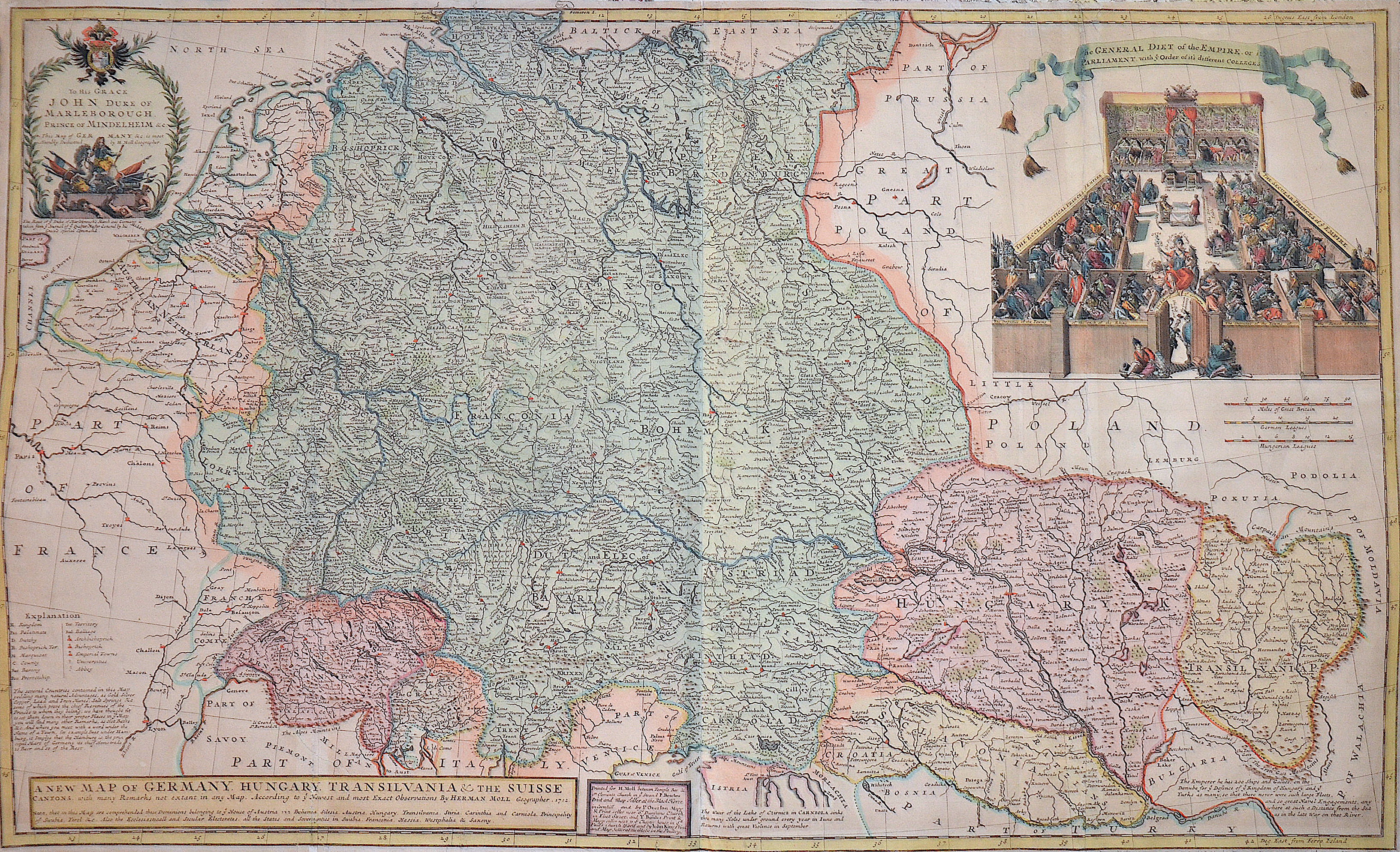
A new map of Germany. Hungary. Transivania and the Suisse Cantons……..

| Article ID | EUD1662 |
Title | A new map of Germany. Hungary. Transivania and the Suisse Cantons…….. |
Description | Map shows total Germany with Hungary, Transilvania, Slavonia and Suisse, representation of a court of law. |
| Year | dated 1712 |
Artist | Moll (1654-1732) |
Hermann Moll (1654–1732) was a London-based engraver, cartographer, and publisher known for his detailed maps of Europe and the Americas. He also created maps for Defoe’s Robinson Crusoe and Swift’s Gulliver’s Travels. His major works include the Atlas Geographus (1711–1717) and Atlas Minor (1719), both published in multiple editions. Moll collaborated with explorer William Dampier, whose travel reports provided valuable geographic data for Moll’s maps. Dampier’s popularity and the public’s growing interest in travel literature helped boost Moll’s success, leading other authors like Defoe and Swift to use his illustrations. | |
Historical Description | The concept of Germany as a distinct region in central Europe can be traced to Roman commander Julius Caesar, who referred to the unconquered area east of the Rhine as Germania, thus distinguishing it from Gaul (France), which he had conquered. In the High Middle Ages, the regional dukes, princes and bishops gained power at the expense of the emperors. Martin Luther led the Protestant Reformationagainst the Catholic Church after 1517, as the northern states became Protestant, while the southern states remained Catholic. The two parts of the Holy Roman Empire clashed in the Thirty Years' War (1618–1648). 1648 marked the effective end of the Holy Roman Empire and the beginning of the modern nation-state system, with Germany divided into numerous independent states, such as Prussia, Bavaria and Saxony. |
| Place of Publication | London |
| Dimensions (cm) | 60,5 x 99 cm |
| Condition | Some folds partly restored |
| Coloring | original colored |
| Technique | Copper print |