

Adina Sommer
Antique and Contemporary Art
Winzerer Str. 154
80797 München
telephone
+49 89 304714
business hours:
by appointment
Email
![]()


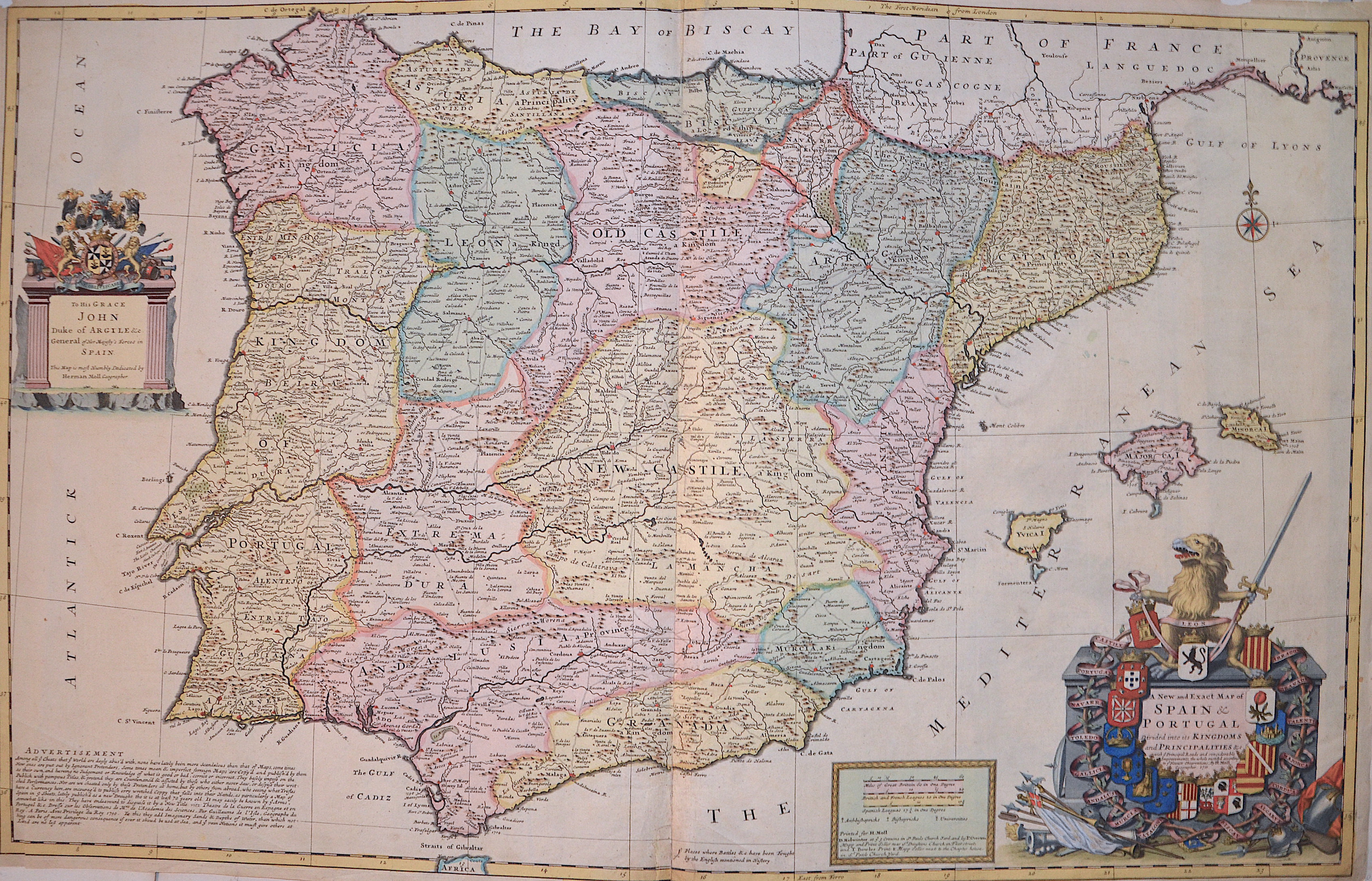
A new and exact map of Spain & Portugal

| Article ID | EUE1243 |
Title | A new and exact map of Spain & Portugal |
Description | Map shows the Iberian Peninsula with Spain, Portugal and the Balearic Islands. On the lower right a magnificent title cartouche with 16 coats of arms of the different provinces of Spain as well as Portugal. Above the coats of arms is the Spanish lion. Together with the bull it is a symbol of the Iberian country. Left side a cartouche - To His Grace John Duke of Argile & c. General of Her Majesty's Armed Forces in Spain - above a representation of the coat of arms held by two lions. |
| Year | dated 1711 |
Artist | Moll (1654-1732) |
Hermann Moll (1654–1732) was a London-based engraver, cartographer, and publisher known for his detailed maps of Europe and the Americas. He also created maps for Defoe’s Robinson Crusoe and Swift’s Gulliver’s Travels. His major works include the Atlas Geographus (1711–1717) and Atlas Minor (1719), both published in multiple editions. Moll collaborated with explorer William Dampier, whose travel reports provided valuable geographic data for Moll’s maps. Dampier’s popularity and the public’s growing interest in travel literature helped boost Moll’s success, leading other authors like Defoe and Swift to use his illustrations. | |
Historical Description | In prehistoric and prehistoric times, Iberians, Celts and Basques settled on the Iberian peninsula named after the former. In the 11th century BC The Phoenicians settled on the south coast; the most famous of their colonies was Cadiz. The name Spain is derived from the Roman name Hispania (from Phoenician ishapan "land of the rock hyrax". In the early 8th century, the Moors destroyed the Visigoth Empire and conquered the entire Iberian Peninsula. Their centuries of rule shaped the country. The Arabic heritage was reflected in both the architecture and the language. However, the Moors were unable to establish themselves permanently in the northern outskirts of the peninsula. From there the "Reconquest" (Reconquista) started. In this process, which spanned several centuries (722–1492) and was not continuous, the Muslim empires were gradually pushed back by the Christian empires until the fall of Granada in 1492, the last Moorish state structure on the peninsula also disappeared. In the 15th century, the kingdoms of Castile and Aragon were united. Aragon was an important maritime power in the Mediterranean at that time. The Spanish colonial empire extended around 1600 across large parts of South and Central America, the southern part of today's USA and the Philippines. As the English and French also intensified their colonial efforts, Spain gradually lost its supremacy. The liberation wars of the American states, particularly the Mexican and South American wars of independence in the early 19th century, brought independence to most of the colonies. In 1898, the last major properties were lost to the United States during the Spanish-American War, which meant the end of the colonial empire. The African colonies that followed later (Spanish-Morocco, Spanish-Sahara and Equatorial Guinea) finally became independent in the 20th century. |
| Place of Publication | London |
| Dimensions (cm) | 61 x 98 cm |
| Condition | Centerfold and tears perfetly restored |
| Coloring | original colored |
| Technique | Copper print |