

Adina Sommer
Antique and Contemporary Art
Winzerer Str. 154
80797 München
telephone
+49 89 304714
business hours:
by appointment
Email
![]()


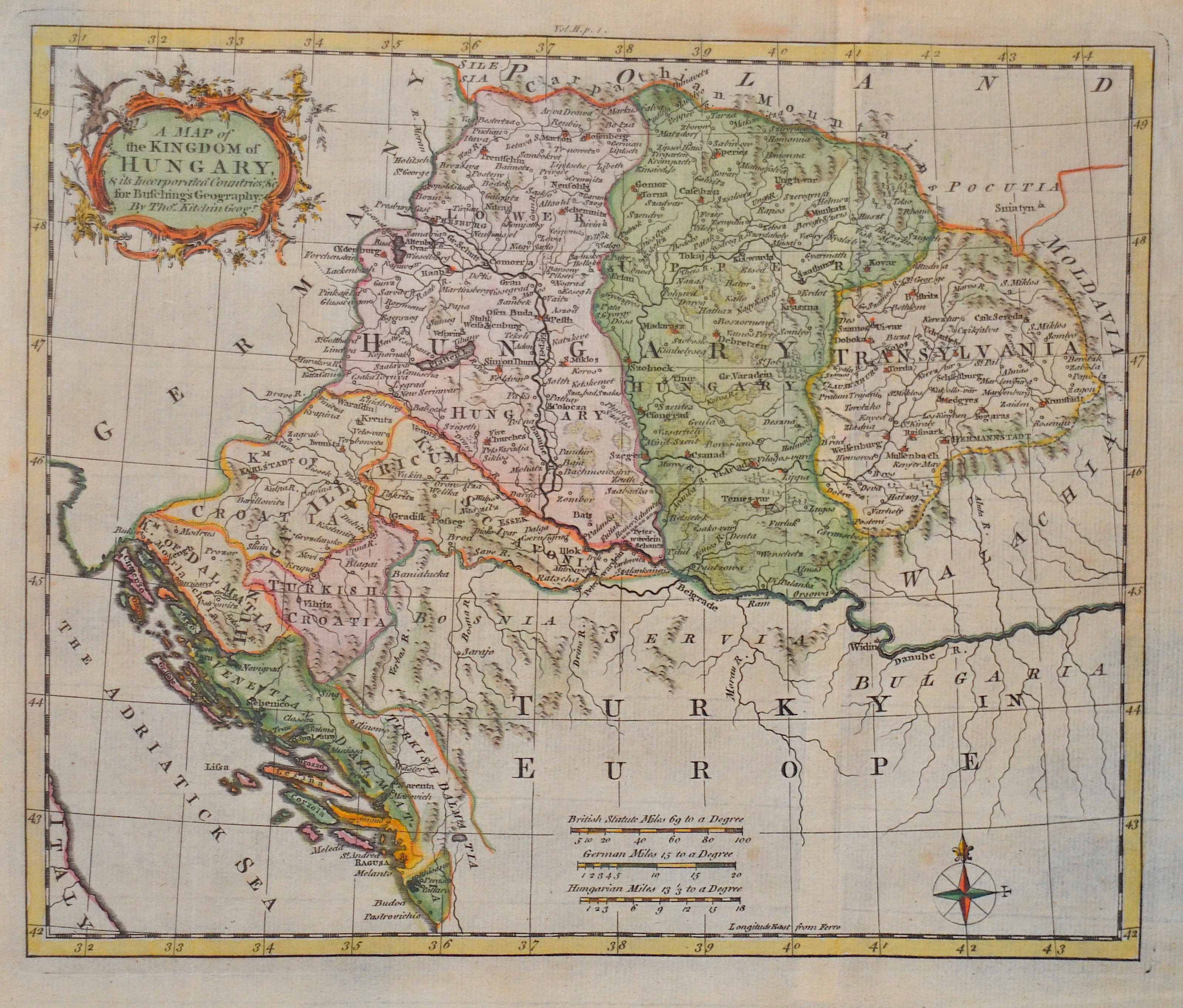
A Map of the Kingdom of Hungary.

| Article ID | EUH4231 |
Title | A Map of the Kingdom of Hungary. |
Description | Map shows Hungary, Transilvania, Slavonia, Bosnia, Croatia, Dalmatia and a titelcartouche. |
| Year | ca. 1770 |
Artist | Kitchin (Kitchen) (1718-1784) |
Thomas Kitchin (or Thomas Kitchen (1718–1784) was an English engraver and cartographer, who became hydrographer to the king. He was also an author, who wrote about the history of the West Indies. He produced John Elphinstone's map of Scotland (1746), Geographia Scotiae (1749), and The Small English Atlas (1749) with Thomas Jefferys. The Large English Atlas (with Bowen 1749–60) was a serious attempt to cover England at large scale. In 1755 Kitchin engraved the Mitchell Map map of North AmericaHe worked for London Magazine. He produced 170 maps for London Magazine (1747–83). Kitchin was the head hydrographer for the King of England. Kitchin frequently stole the works of other cartographers, which is one reason why he created so much work as a cartographer. His book, The Present State of the West-Indies: Containing an Accurate Description of What Parts Are Possessed by the Several Powers in Europe was published in 1778 by R. Baldwin in London. | |
Historical Description | In the historical sense, Eastern Europe refers to Ukraine, the European part of Russia, Belarus and the Republic of Moldova. Occasionally, the Caucasian countries of Georgia, Armenia and, conditionally, Azerbaijan are also seen as part of Eastern Europe. By Christian Giordano and other scholars, one of the six historical regions of Europe is called "Eastern Europe." The Eastern European countries are historically and culturally largely influenced by the Orthodox Church (Islamic Azerbaijan excepted) and were - in contrast to the Ottoman-dominated Balkans - under the rule of the Russian Empire. Like the Balkan countries, the countries of Eastern Europe were for a long time backward agricultural states (cf.: Intermediate Europe) and had no or only a limited share in the social developments of the Renaissance, Reformation and Enlightenment of the Western world. |
| Place of Publication | London |
| Dimensions (cm) | 22,5 x 27 cm |
| Condition | Perfect condition |
| Coloring | colored |
| Technique | Copper print |