

Adina Sommer
Antique and Contemporary Art
Winzerer Str. 154
80797 München
telephone
+49 89 304714
business hours:
by appointment
Email
![]()


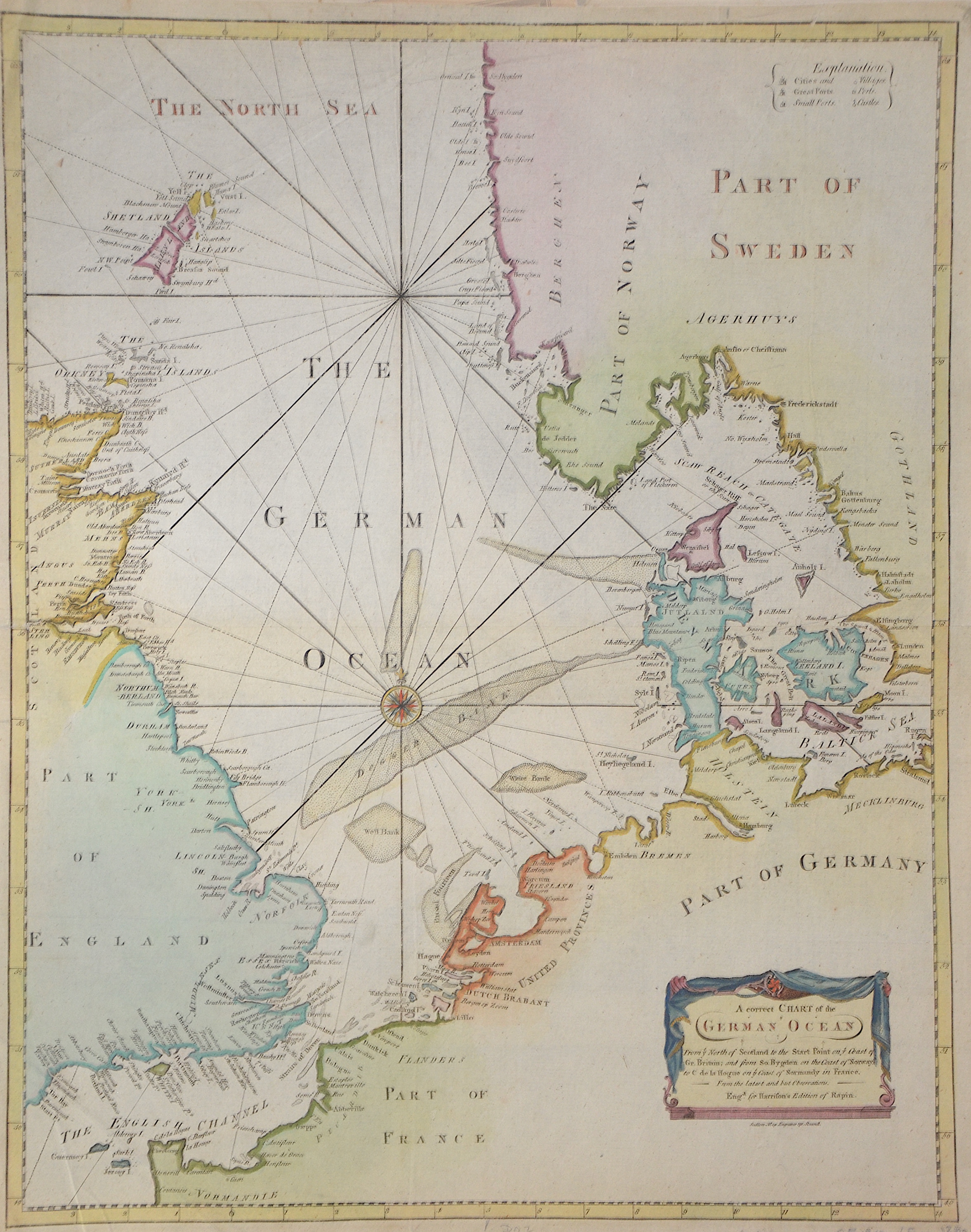
A correct Chart of the German Ocean
| Article ID | SE0318 |
Title | A correct Chart of the German Ocean |
Copper engraved map of the North Sea and the English Channel from the Channel Islands in the south to the Shetland Islands in the north with the east coast of Great Britain, Denmark, partly Norway, Sweden, France, the Netherlands, Germany and a title cartouche. Produced for Harrison's Edition of Rapin's. | |
| Year | ca. 1720 |
Artist | Rapin de Thoyras |
| Dimensions (cm) | 47 x 37 cm |
| Condition | Some folds |
| Coloring | colored |
| Technique | Copper print |
:
48.00 €
( A reproduction can be ordered individually on request. )