

Adina Sommer
Antique and Contemporary Art
Winzerer Str. 154
80797 München
telephone
+49 89 304714
business hours:
by appointment
Email
![]()


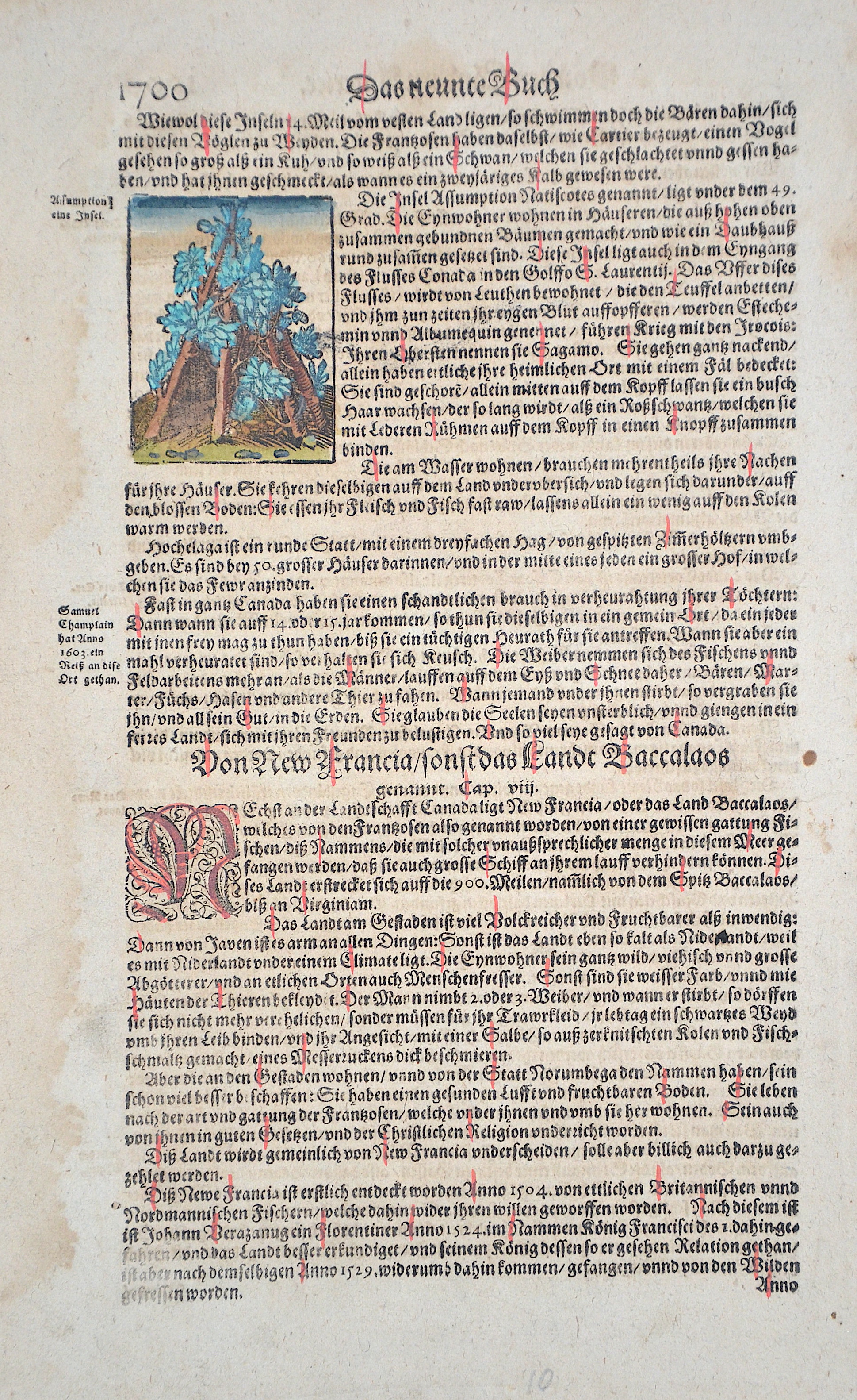
1699 Von den Ländern Americe. / 1700 Das neunte Buch / Assumption eine Insel.

| Article ID | AMC1627 |
Title | 1699 Von den Ländern Americe. / 1700 Das neunte Buch / Assumption eine Insel. |
Description | This illustration shows a local hut on the island of Assumption Natifcotes, located at latitude 49° in the Gulf of St. Lawrence at the entrance to the "Conata" River, Canada. It also includes a description in German, as well as information for the Canadian islands of "New Francia", "Terra Corteralis", and the "Island of the Birds". |
| Year | ca. 1610 |
Artist | Münster (1489-1552) |
Sebastian Münster (1489–1552) was a leading Renaissance cosmographer. His most famous work, the Cosmographia (1544), was a comprehensive description of the world with 24 maps, based on research dating back to 1528. Continuously revised, the 1550 edition already included many new maps. It was the first scientific yet accessible world description published in German, illustrated with numerous woodcuts by artists such as Hans Holbein the Younger. Between 1544 and 1650, the Cosmographia appeared in 46 editions (27 in German) and was translated into several languages. Münster’s work combined the knowledge of scholars, artists, and travelers and remained influential long after his death. | |
Historical Description | Various indigenous peoples have inhabited what is now Canada for thousands of years before European colonization. Beginning in the 16th century, British and French expeditions explored and later settled along the Atlantic coast. As a consequence of various armed conflicts, France ceded nearly all of its colonies in North America in 1763. In 1867, with the union of three British North American colonies through Confederation, Canada was formed as a federal dominion of four provinces. In 1583, Sir Humphrey Gilbert, by the royal prerogative of Queen Elizabeth I, founded St. John's, Newfoundland, as the first North American English colony. French explorer Samuel de Champlain arrived in 1603 and established the first permanent European settlements at Port Royal (in 1605) and Quebec City (in 1608). Among the colonists of New France, Canadiensextensively settled the Saint Lawrence River valley and Acadians settled the present-day Maritimes, while fur traders and Catholic missionaries explored the Great Lakes, Hudson Bay, and the Mississippi watershed to Louisiana. The Beaver Wars broke out in the mid-17th century over control of the North American fur trade. The Royal Proclamation of 1763 established First Nation treaty rights, created the Province of Quebec out of New France, and annexed Cape Breton Island to Nova Scotia. After the successful American War of Independence, The 1783 Treaty of Paris recognized the independence of the newly formed United States and set the terms of peace, ceding British North American territories south of the Great Lakes to the new country. the Constitutional Act of 1791 divided the province of Canada into French-speaking Lower Canada (later Quebec) and English-speaking Upper Canada (later Ontario), granting each its own elected legislative assembly. |
| Place of Publication | Basle |
| Dimensions (cm) | 29 x 17,5 cm |
| Condition | Left margin outside, slightly spotted |
| Coloring | original colored |
| Technique | Woodcut |