

- Alsace
- Aquitaine
- Auvergne
- Bourgogne
- Bourgogne-Franche-Comte
- Brittany
- Centre
- Champagne
- France Islands
- Gascogne
- Gironde
- Hauts-de-France
- Ile de France
- Languedoc
- Lothringen
- Midi-Pyrénées
- Nivernais
- Nord-Pas-de-Calais
- Normandie
- Occitanie
- Pas-de-Calais
- Pays de la Loire
- Picardie
- Poitou-Charentes
- Provence-Alpes-Cote d Azur
- Pyrénées
- Rhone- Alpes
- Saintonge
- Savoyen
- Tourain
- Westcoast
Adina Sommer
Antique and Contemporary Art
Winzerer Str. 154
80797 München
telephone
+49 89 304714
business hours:
by appointment
Email
![]()


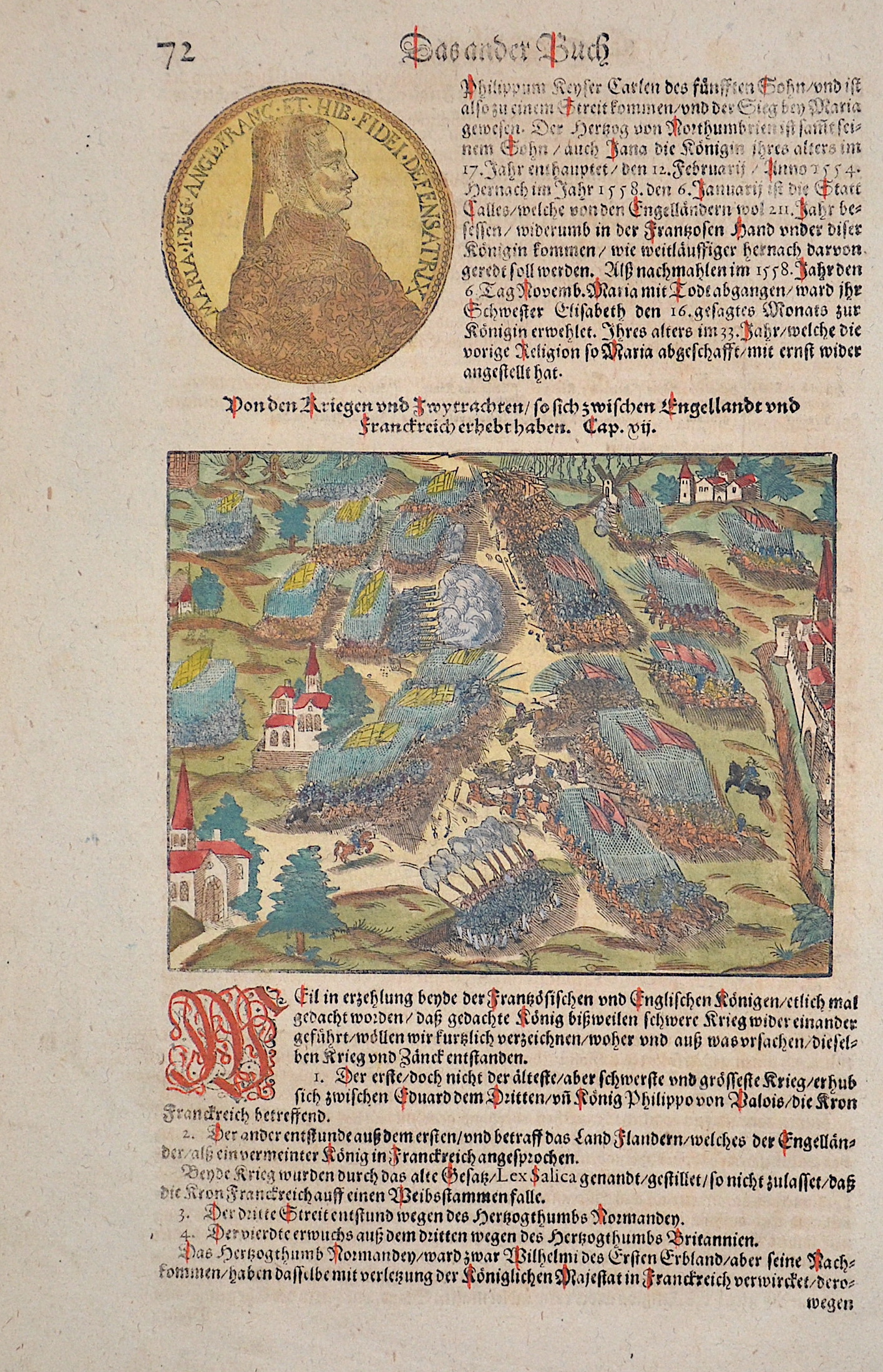
Von den Kriegen und zwytrachten so sich zwischen engelandt und frankreich erhebt haben

| Article ID | DK0060 |
Title | Von den Kriegen und zwytrachten so sich zwischen engelandt und frankreich erhebt haben |
Description | The map shows the Battle of Agincourt between England and France, in 1415. On one side were the troops of the English King Henry V, and on the other side were the French forces. The Battle of Agincourt was a decisive victory for the English army in the Hundred Years' War. Despite being outnumbered, Henry V was able to decisively defeat the French troops. This victory solidified Henry's claim to the French throne and was a turning point in the war. |
| Year | ca. 1550 |
Artist | Münster (1489-1552) |
Sebastian Münster (1489–1552) was a leading Renaissance cosmographer. His most famous work, the Cosmographia (1544), was a comprehensive description of the world with 24 maps, based on research dating back to 1528. Continuously revised, the 1550 edition already included many new maps. It was the first scientific yet accessible world description published in German, illustrated with numerous woodcuts by artists such as Hans Holbein the Younger. Between 1544 and 1650, the Cosmographia appeared in 46 editions (27 in German) and was translated into several languages. Münster’s work combined the knowledge of scholars, artists, and travelers and remained influential long after his death. | |
Historical Description | Hauts-de-France is the northernmost region of France, created only in 2016 through the merger of the former regions Nord–Pas-de-Calais and Picardy. The area has a long and rich history—ranging from medieval power struggles over Flanders and Artois, to the pivotal Battle of Bouvines (1214), and the administrative reorganization during the French Revolution, which led to the division into the departments of Nord and Pas-de-Calais. In the 20th century, the region became an industrial hub—dominated by mining and heavy industry—until parts of it shifted toward the service sector starting in the 1980s. Thanks to the Channel Tunnel (since 1994), along with TGV, Eurostar, and Thalys connections, the region is now a key logistical crossroads of Europe. |
| Place of Publication | Basle |
| Dimensions (cm) | 30 x 16 cm |
| Condition | Perfect condition |
| Coloring | original colored |
| Technique | Woodcut |