

Adina Sommer
Antique and Contemporary Art
Winzerer Str. 154
80797 München
telephone
+49 89 304714
business hours:
by appointment
Email
![]()


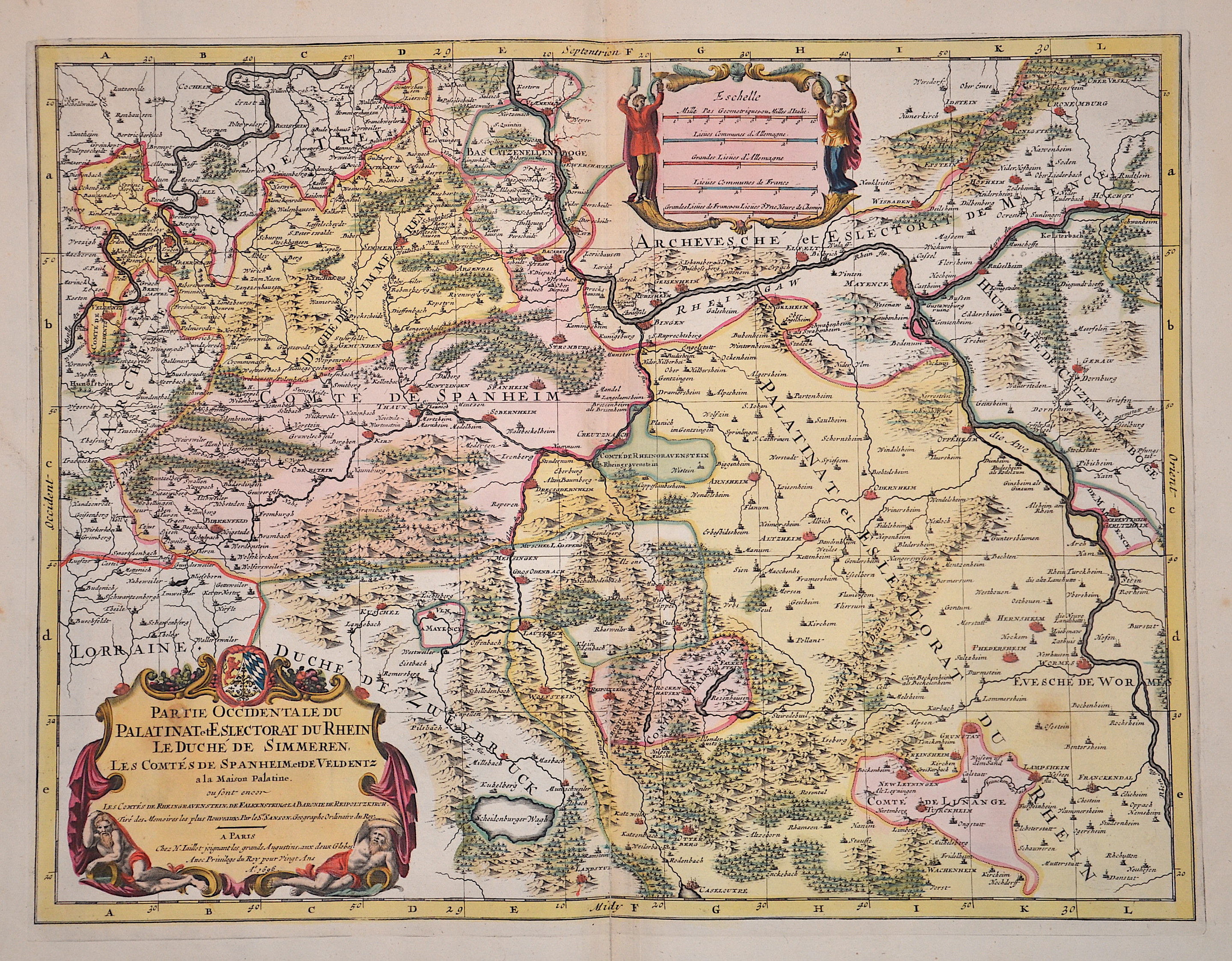
Partie Occidentale du Palatinat et Eslectorat du Rhein le Duche de Simmeren, Les Comtes de Spanheim, et De Veldentz a la Maison Palatine.
| Article ID | EUD5322 |
Title | Partie Occidentale du Palatinat et Eslectorat du Rhein le Duche de Simmeren, Les Comtes de Spanheim, et De Veldentz a la Maison Palatine. |
Map shows the course of the Rhine from St. Goar, Oberwesel, Kaub, Bacharach, Bingen, Mainz, Oppenheim, Worms to Frankenthal. The course of the Moselle with Cochem, Beilstein, Zell, Traben, Trabach, Bernkastel to Veldenz. The county of Spanheim (Sponheim) with the towns of Birkenfeld, Kirn, Thaun and Sobernheim. Furthermore, a splendid hand-colored title and mileage cartouche. | |
| Year | c. 1696 |
Artist | Jaillot/ Sanson (1632-1712) |
Alexis Hubert Jaillot (1632–1712) was a prominent French cartographer and publisher. In 1665, he married into the Berey family of map publishers. After the death of his brother-in-law Nicolas II Berey in 1667, Jaillot bought the Berey map collection from his sister-in-law, acquiring a valuable stock without having ever created a map himself. Jaillot entered the map business at a favorable time—after Louis XIV’s early victories in the Reunions Wars in 1668, France’s territory expanded rapidly, creating high demand for maps showing French triumphs, new borders, and expansion plans. His collection included plates originally made by Pierre Duval, who resisted Jaillot’s reissues. At the height of this conflict, Jaillot gained the support of Guillaume and Adrien Sanson, sons of Nicolas Sanson, as mapmakers and partners, enabling him to publish new maps under the prestigious Sanson name. His first atlas, Atlas Nouveau (1681), was a commercial success, leading to widespread piracy by other publishers. | |
Historical Description | Rhineland-Palatinate is surrounded by the states of North Rhine-Westphalia, Saarland, Baden-Württemberg and Hesse. It also borders three foreign countries: France, Luxembourg and Belgium. Rhineland-Palatinate was established in 1946 after World War II, from territory of the historically separate regions of the Free State of Prussia, the People's State of Hesse and Bavaria, by the French military administration in Allied-occupied Germany. Rhineland-Palatinate became part of the Federal Republic of Germany in 1949 and shared the country's only border with the Saar Protectorate until it was returned to German control in 1957. Rhineland-Palatinate has since developed its own identity built on its natural and cultural heritage, including the extensive Palatinate winegrowing region, its picturesque landscapes, and its many castles and palaces. |
| Place of Publication | Paris |
| Dimensions (cm) | 41,5 x 54,5 cm |
| Condition | Some restoration at lower centerfold, missing part on the left replaced |
| Coloring | original colored |
| Technique | Copper print |